
Images


April 16, 2021 - Tropical Cyclone Surigae north of Babelthuap, Palau
 Tweet
Tweet
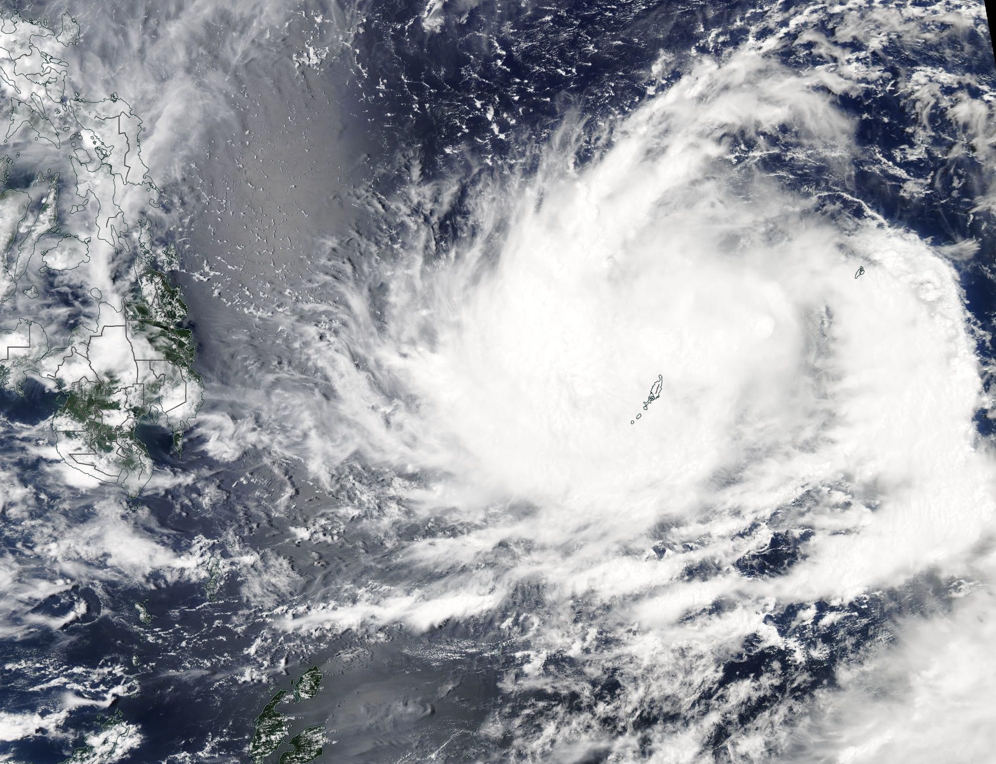
On April 15, 2021, the Moderate Resolution Imaging Spectroradiometer (MODIS) on board NASA’s Aqua satellite acquired a true-color image of strengthening Tropical Cyclone Surigae brushing the Republic of Palau. At the time the image was acquired, the storm’s large, cloud-filled eye was northeast of Babelthuap, the largest island in Palau. While the island archipelago of Palau will see heavy rain and storm surge, the center of Surigae is expected to pass north of Palau.
Tropical Cyclone Surigae (also known as Bising in the Philippines) formed in the West Pacific Ocean south of the island of Woleai, Micronesia on April 12. At 11:00 p.m. EST April 15 (0300 UTC April 16), the Joint Typhoon Warning Center reported that the storm was located about 48 miles (77 km) north of Kayangel, the northernmost state in Palau and was tracking west-northwestward. Surigae was carrying one-minute sustained winds of 86 mph (138 km/h), raising it to typhoon status (Philippines) and placing it as equivalent to a Category 1 storm on the Saffir-Simpson Hurricane Wind Scale.
Typhoon Surigae is expected to make a strong run towards the Philippines as it continues to strengthen, eventually peaking at about 138 mph (206 km/h) or the equivalent of a Category 4 storm on the Saffir-Simpson Hurricane Wind Scale. This peak is likely to occur on April 19, near the time Typhoon Surigae makes its closest approach to the Philippines. On or near that day, the storm is forecast to recurve and move away from the Philippines and towards open ocean.
Image Facts
Satellite:
Aqua
Date Acquired: 4/15/2021
Resolutions:
1km (488.3 KB), 500m (1.5 MB), 250m (4.4 MB)
Bands Used: 1,4,3
Image Credit:
MODIS Land Rapid Response Team, NASA GSFC
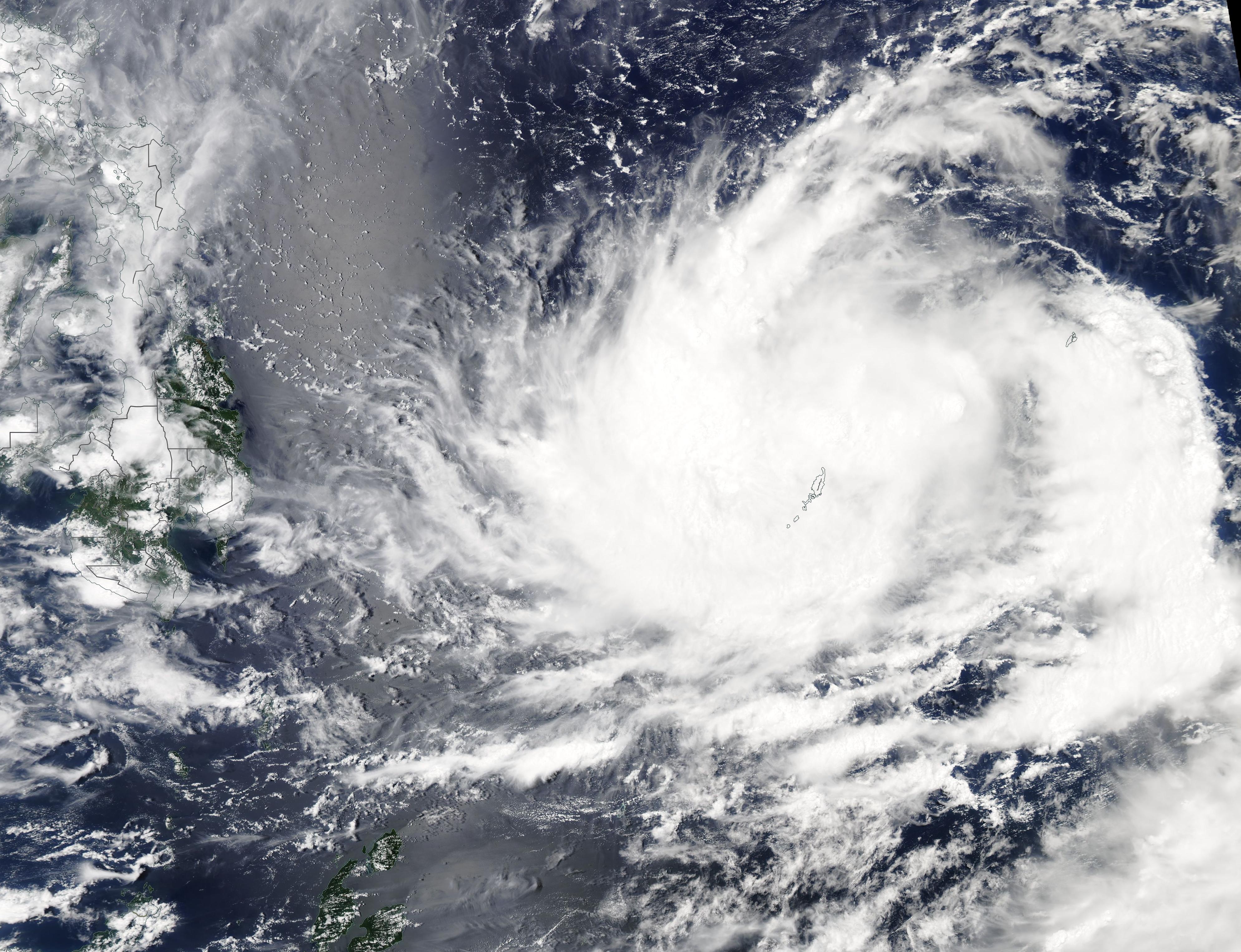
