
Images


July 17, 2021 - Hurricane Felicia
 Tweet
Tweet
On July 16, the Eastern Pacific Ocean saw its first major hurricane of the season as Hurricane Felicia strengthened to Category 3 strength. Less than twelve hours later, at 1200 UTC on July 16 (8:00 a.m. EDT), Felicia had further strengthened, carrying maximum sustained winds of 130 mph (215 km/h), placing it as a Category 4 storm on the Saffir-Simpson Hurricane Wind Scale. At that time the strong hurricane was located over the open ocean about 985 miles (1,585 km) west southwest of the southern tip of Baja California and was moving westward at 9 mph (15 km/h).
According to the National Hurricane Center, Felicia remains a small tropical cyclone, with hurricane-force winds extending outward up to 25 miles (35 km) from the center and tropical-storm-force winds extending outward up to 70 miles (110 km) from the center. The storm is expected to begin a cycle of slow weakening by early on July 17. It is not expected that Hurricane Felicia will present hazards to land.
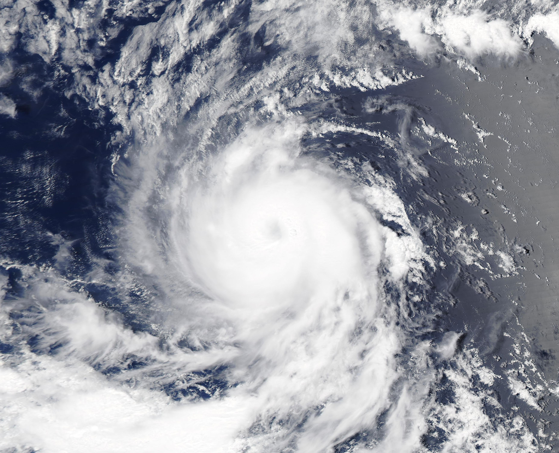
The Moderate Resolution Imaging Spectroradiometer (MODIS) on board the Aqua satellite acquired a true-color image of newly-formed Hurricane Felicia on July 15 as it was strengthening. The compact storm sported a distinct but partially cloud-filled eye, with convective banding spiraling into the center at the time the image was captured.
Image Facts
Satellite:
Aqua
Date Acquired: 7/15/2021
Resolutions:
1km (602.7 KB), 500m (1.5 MB), 250m (1 MB)
Bands Used: 1,4,3
Image Credit:
MODIS Land Rapid Response Team, NASA GSFC
On July 16, the Eastern Pacific Ocean saw its first major hurricane of the season as Hurricane Felicia strengthened to Category 3 strength. Less than twelve hours later, at 1200 UTC on July 16 (8:00 a.m. EDT), Felicia had further strengthened, carrying maximum sustained winds of 130 mph (215 km/h), placing it as a Category 4 storm on the Saffir-Simpson Hurricane Wind Scale. At that time the strong hurricane was located over the open ocean about 985 miles (1,585 km) west southwest of the southern tip of Baja California and was moving westward at 9 mph (15 km/h).
According to the National Hurricane Center, Felicia remains a small tropical cyclone, with hurricane-force winds extending outward up to 25 miles (35 km) from the center and tropical-storm-force winds extending outward up to 70 miles (110 km) from the center. The storm is expected to begin a cycle of slow weakening by early on July 17. It is not expected that Hurricane Felicia will present hazards to land.
The Moderate Resolution Imaging Spectroradiometer (MODIS) on board the Aqua satellite acquired a true-color image of newly-formed Hurricane Felicia on July 15 as it was strengthening. The compact storm sported a distinct but partially cloud-filled eye, with convective banding spiraling into the center at the time the image was captured.
Image Facts
Satellite:
Aqua
Date Acquired: 7/15/2021
Resolutions:
1km (602.7 KB), 500m (1.5 MB), 250m (1 MB)
Bands Used: 1,4,3
Image Credit:
MODIS Land Rapid Response Team, NASA GSFC
