
Images


July 24, 2021 - Fires in Oregon and Northern California
 Tweet
Tweet
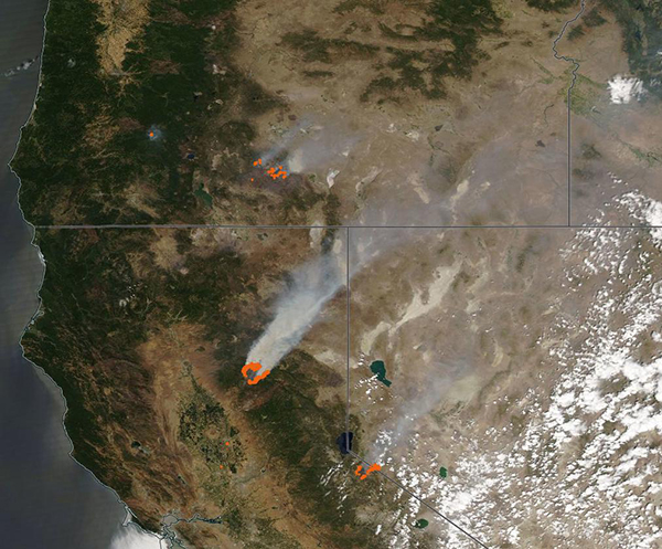
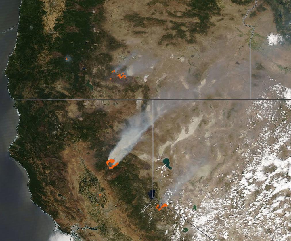
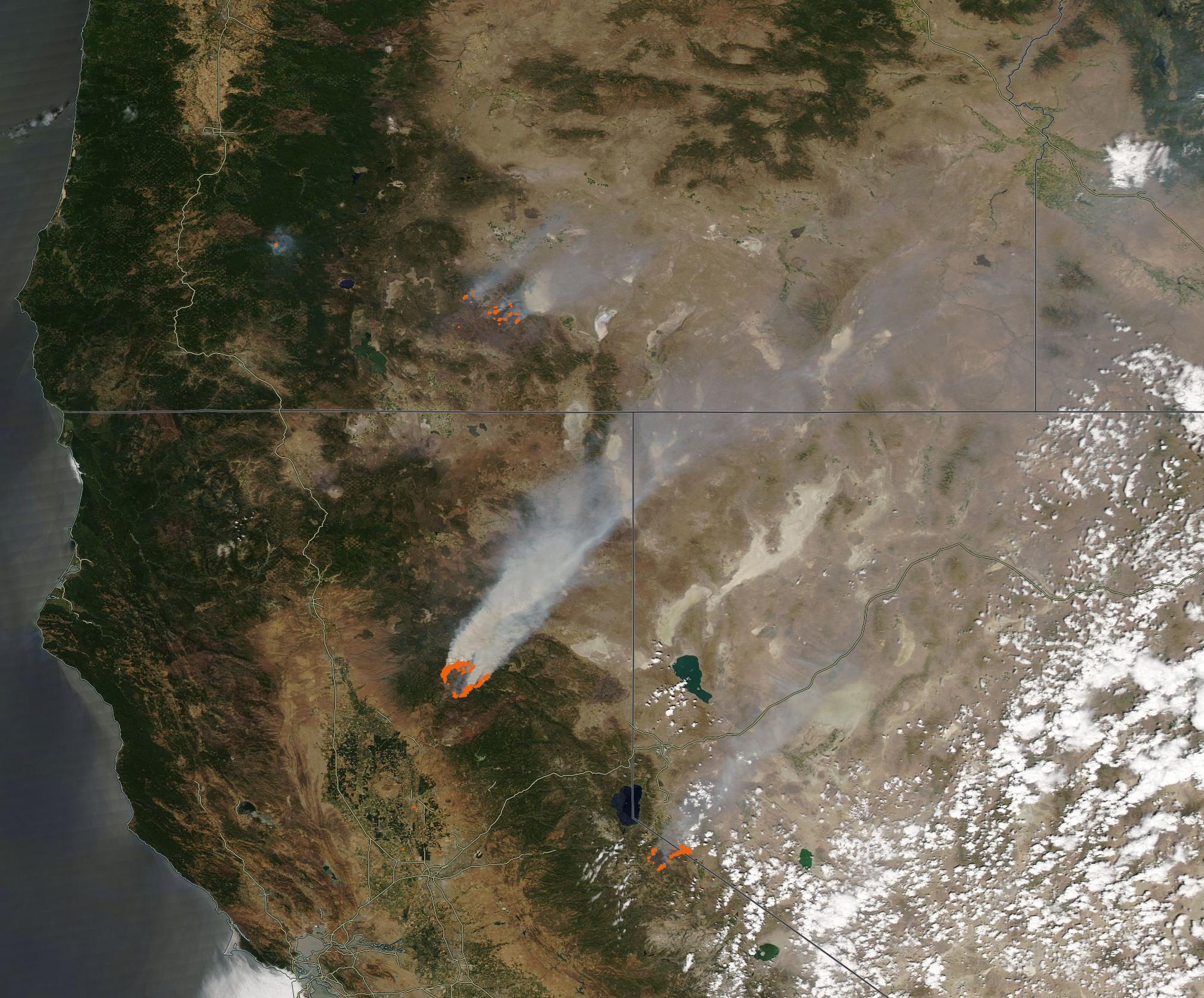
On July 22, 2021, the Moderate Resolution Imaging Spectroradiometer (MODIS) on board NASA’s Aqua satellite acquired a true-color image focused on several large blazes across Northern California and Oregon. Each red “hot spot” marks an area where the thermal bands on the MODIS instrument detected high temperatures. When combined with typical smoke, as in this image, such hot spots are diagnostic for actively burning fire.
The large cluster of hot spots in Oregon (north) marks the Bootleg Fire. Ignited on July 6 by lightning, the fire grew rapidly in the parched grass, shrub, and forest northwest of Beatty. As of July 23, the fire is burning in the Fremont-Winema National Forest northeast of the town of Sprague River and has consumed 400,289 acres and is the third-largest in Oregon’s history. A large stand of beetle-killed lodgepole pine in the vicinity provides excellent fuel. With more than 2,300 personnel working the fire, it has reached 40 percent containment.
An exceptionally large blaze located south of the Bootleg Fire in Northern California is the Dixie Fire. It ignited on July 13 in Feather River Canyon near Cresta Powerhouse. The fire has exhibited extreme behavior, forcing new evacuation orders that affect several local counties. As of July 23, it has burned 142,940 acres. With more than 4,000 personnel active, the fire perimeter is 18 percent contained. Full containment is expected by July 31.
Several fires burn in close proximity south of the Dixie Fire and close to the border with Nevada. The Henry Fire ignited from a lightning strike on June 24 and has burned 1,316 acres. It is 52 percent contained. The Summit Fire was also ignited by a lightning strike on July 20. Only 22 acres in size, a fireline has encircled the entire perimeter and crews have substantially reduced the heat in the burn area. The largest fire in this area, the Tamarack Fire, started on July 4 as a lightning strike in the Mokelumne Wilderness on a rocky ridgetop with sparse fuels and natural barriers to fire spread. Unfortunately, on July 16 high winds caused rapid downslope fire spread. As of July 23, the fire has burnt 59,112 acres and destroyed at least six structures. With 1,425 personnel active, the fire is reported to be 4 percent contained.
Image Facts
Satellite:
Aqua
Date Acquired: 7/22/2021
Resolutions:
1km (145.8 KB), 500m (531.8 KB), 250m (1.7 MB)
Bands Used: 1,4,3
Image Credit:
MODIS Land Rapid Response Team, NASA GSFC
