
Images


October 9, 2021 - Tropical Storm Lionrock
 Tweet
Tweet
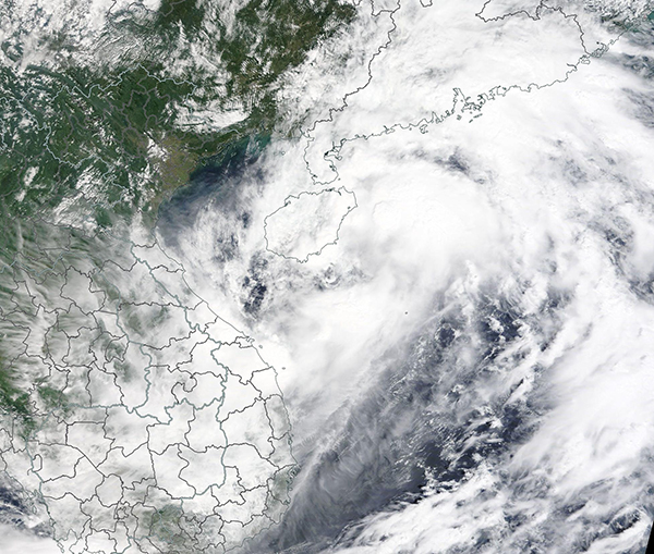
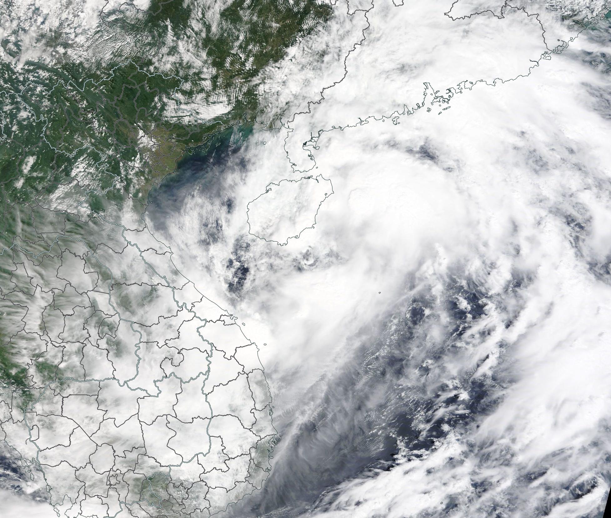
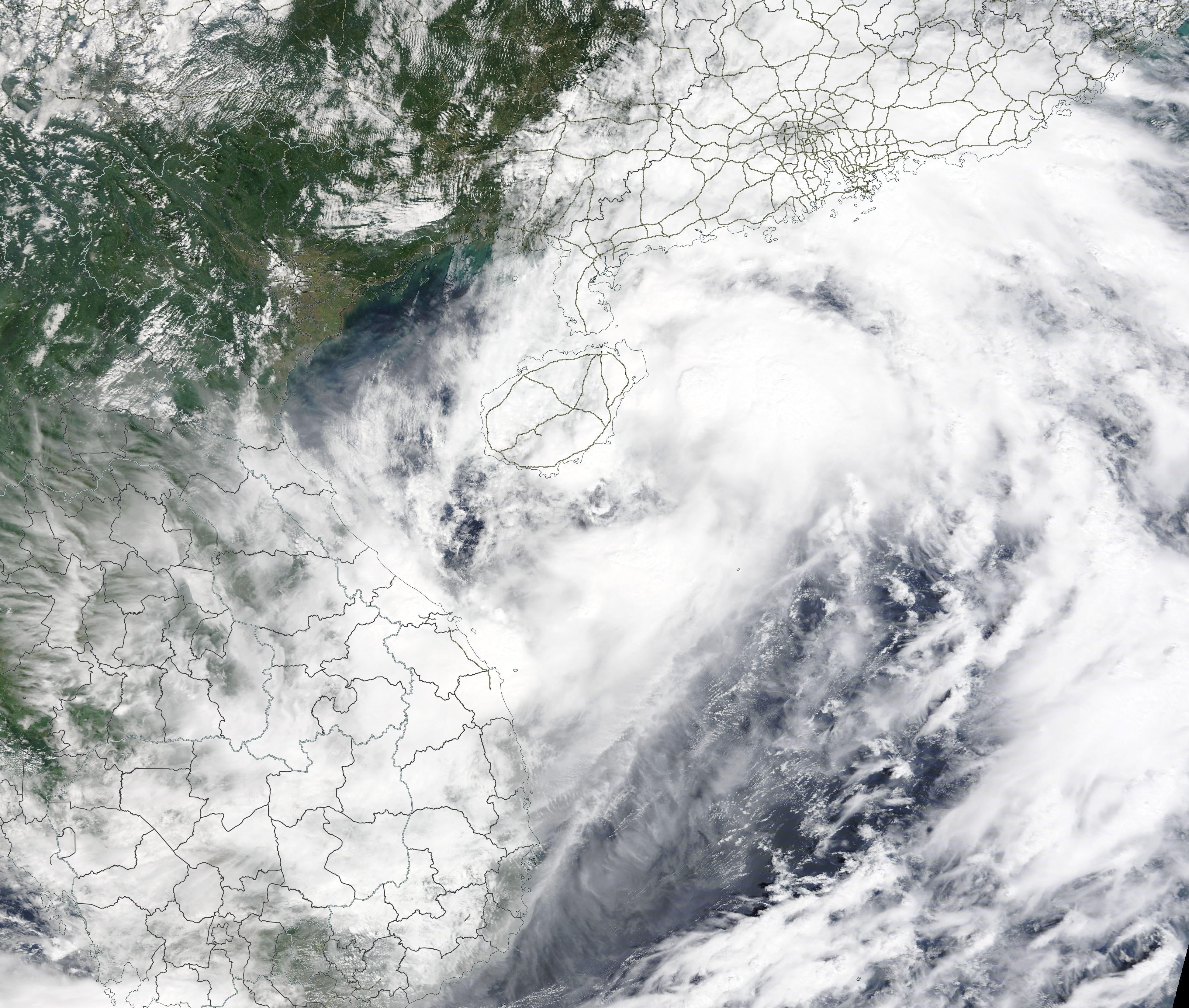
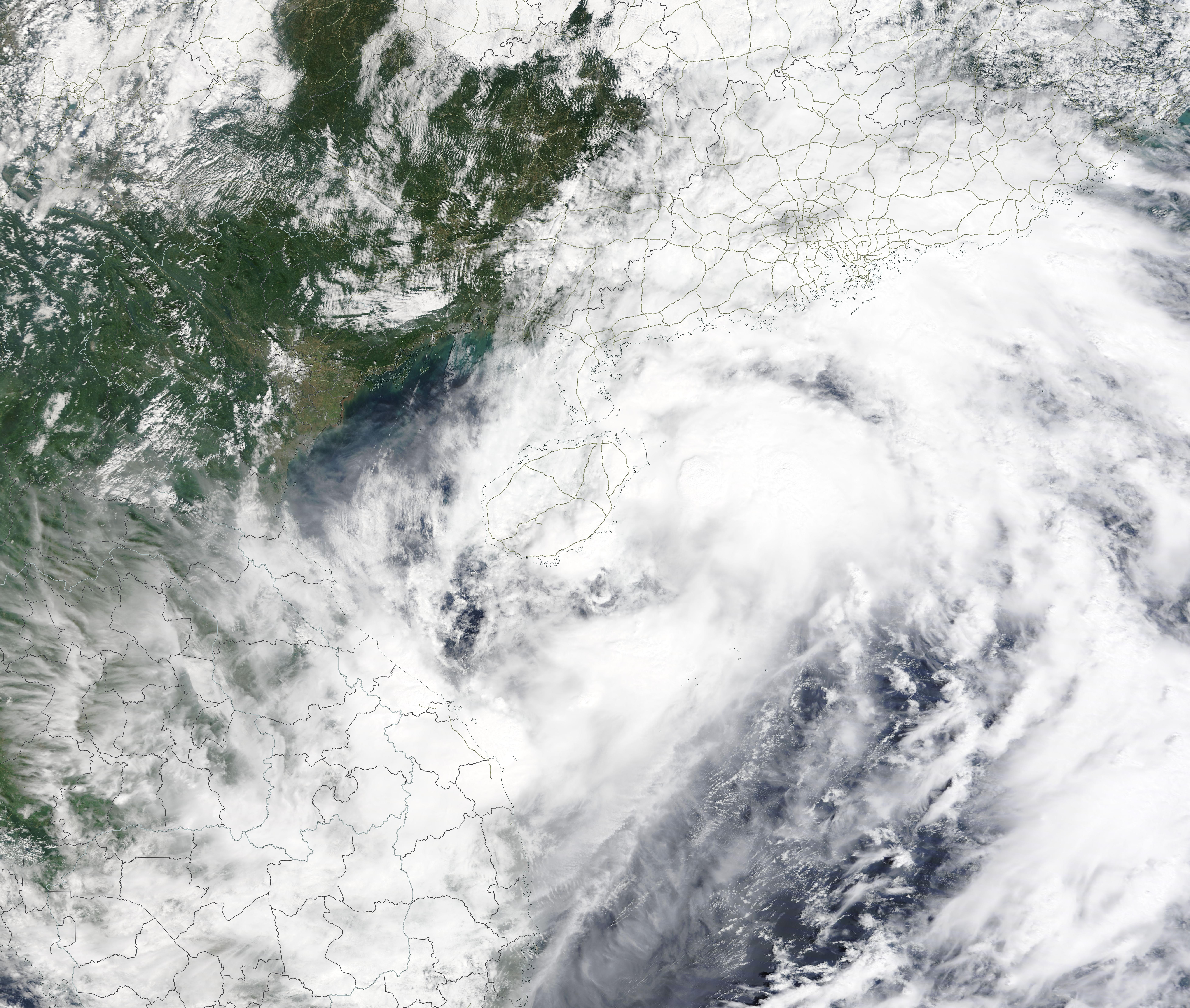
Tropical Storm Lionrock crossed Hainan Island on October 8, 2021, carrying maximum sustained winds of about 40 mph (64 km/h). At 2100 UTC (5:00 p.m. EDT), the Joint Typhoon Warning Center (JTWC) advised that Lionrock was located about 269 mi (433 km) north-northeast of Da Nang, Vietnam and was tracking northwestward. The storm was lashing Hainan Island as well as Guangdong Province with very heavy rains. Guangdong Province sits on the southern coast of mainland China.
Hong Kong has issued its third-highest storm warning due to Lionrock’s approach. This prompted closures of airports, schools, and businesses. One person has been reported killed in China due to the storm as of the evening of October 8.
Tropical Storm Lionrock is expected to intensify as it moves off of Hainan Island and over the warm waters of the Gulf of Tonkin. Increasing vertical wind shear is expected to prevent the storm from gathering too much strength before it makes landfall over northern Vietnam. Once over Vietnam and Laos, Lionrock should dissipate quickly.
The Moderate Resolution Imaging Spectroradiometer (MODIS) on board NASA’s Terra satellite acquired a true-color image of Tropical Storm Lionrock as it crept towards Hainan on October 8. At that time, the storm sported a large cloud-filled eye. Convective bands reached over Hainan, mainland China (north), and Vietnam (southwest).
Image Facts
Satellite:
Terra
Date Acquired: 10/8/2021
Resolutions:
1km (499.9 KB), 500m (1.6 MB), 250m (4.8 MB)
Bands Used: 1,4,3
Image Credit:
MODIS Land Rapid Response Team, NASA GSFC
