
Images


October 13, 2021 - Tropical Storm Kompasu
 Tweet
Tweet
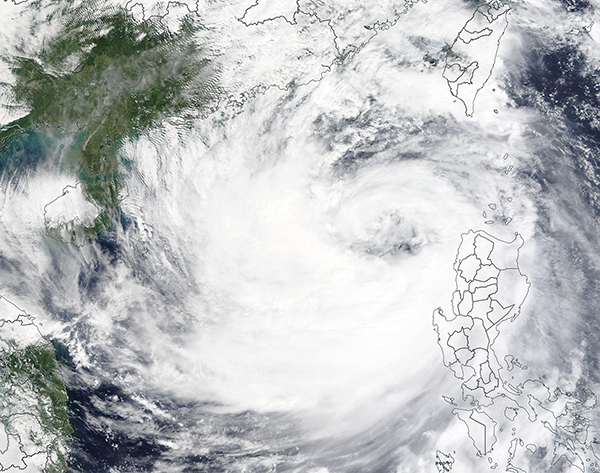
Tropical Storm Kompasu made landfall on the Babuyan Islands, Philippines on October 11, 2021, bringing heavy rain, strong winds, and substantial storm surge that triggered flooding and landslides. According to the Philippine News Agency (PNA), nine people have died and 11 remain missing on Luzon and Palawan Islands as of early October 12. Additional news reports have increased that number as high as 11 dead and 16 missing, although there remains some uncertainty in final numbers. More than 1,500 people had been evacuated ahead of the storm in the Philippines.
The Moderate Resolution Imaging Spectroradiometer (MODIS) on board NASA’s Terra satellite acquired a true-color image of Tropical Storm Kompasu after the storm emerged over the South China Sea on the morning of October 12. The large island of Luzon, Philippines remains under the eastern convective (rain) bands of the storm. Babuyan Islands sit to the north of Luzon and appear to be under cloudy skies, but out of the worst of the storm. Kompasu sports a large eye, and the asymmetrical shape suggests the storm is fighting easterly wind shear.
At 2100 UTC (5:00 p.m. EDT) on October 12, the Joint Typhoon Warning Center (JTWC) advised that Tropical Storm Kompasu was carrying maximum sustained winds of 63 mph (101 km/h) with gusts to 80 mph (129 km/h). It was located about 222 miles (357 km) south of Hong Kong and was tracking to the west at 18 mph (29 km/h). Gale- to storm-force winds extend outwards to the southern coast of China and approximately 288 mi (463 km) to the south and southeast.
Tropical Storm Kompasu is forecast to continue on a westward track, bringing it over the east coast of Hainan Island by October 13. A second landfall is expected along the coast of North Vietnam on October 14-15. The storm is currently gaining some intensity, but is not expected to continue that trend, given the wind shear.
Image Facts
Satellite:
Terra
Date Acquired: 10/12/2021
Resolutions:
1km (426 KB), 500m (1.4 MB), 250m (3.8 MB)
Bands Used: 1,4,3
Image Credit:
MODIS Land Rapid Response Team, NASA GSFC
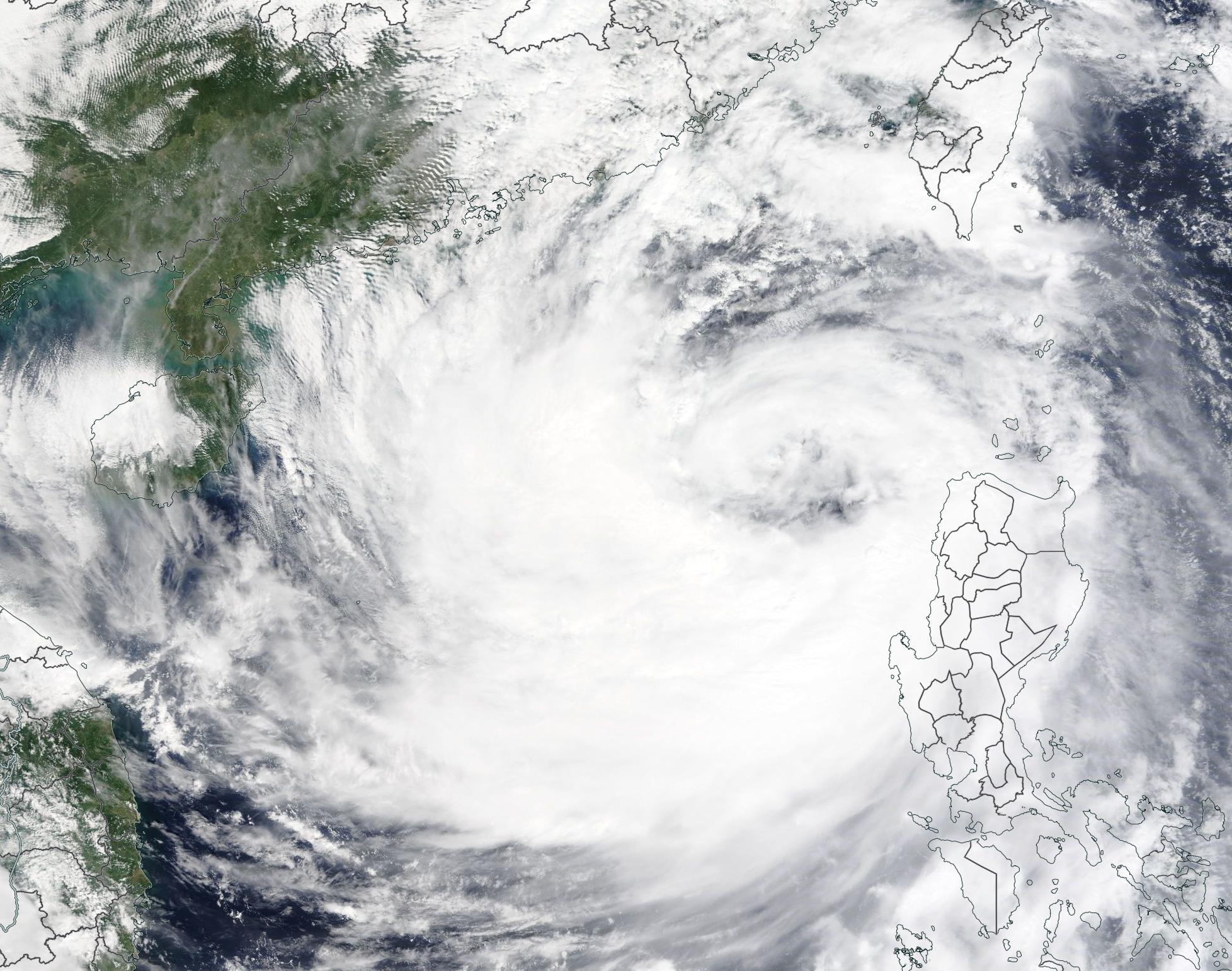
