
Images


January 9, 2022 - Thailand
 Tweet
Tweet
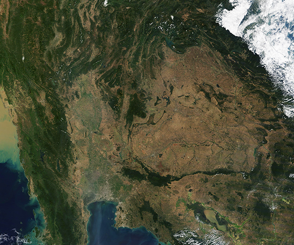
Thailand is known for lush rainforests, stunning waterfalls, vast fields of rice, long coastlines, glittering cities, sacred spaces, and warm hospitality. Sitting in the center of the Indochinese Peninsula of Southeast Asia, the country is made up of 76 provinces and borders Myanmar (Burma) on the west, Laos in the east, Cambodia in the southeast, and Malaysia in the far south on the Malay Peninsula. The Gulf of Thailand washes the southern coastline, with the western coast of Thailand’s portion of the Malay Peninsula sitting on the Andaman Sea.
On January 6, 2022, the Moderate Resolution Imaging Spectroradiometer (MODIS) on board NASA’s Terra satellite acquired a true-color image of Thailand on a cloud-free day. The four natural regions of the country are clearly visible. The northern portion of Thailand are covered in mountains and spectacular forests, many of which are popular treks for residents and tourists alike. The Central Plains contain seemingly endless fields of rice and copious lakes and rivers. In the northeast, the land rises to a semi-arid plateau, which appears tan in this image. This is primarily agricultural land. The fourth natural region (which is not seen in this image) is the peninsular south, lined with beaches and off-shore islands. Also visible in this image is Bangkok, the most populous and capital city in Thailand. It can be seen as a large area of gray pixels sitting just inland of the northern shore of the Gulf of Thailand.
Image Facts
Satellite:
Terra
Date Acquired: 1/6/2022
Resolutions:
1km (1.1 MB), 500m (3.2 MB), 250m (7.5 MB)
Bands Used: 1,4,3
Image Credit:
MODIS Land Rapid Response Team, NASA GSFC
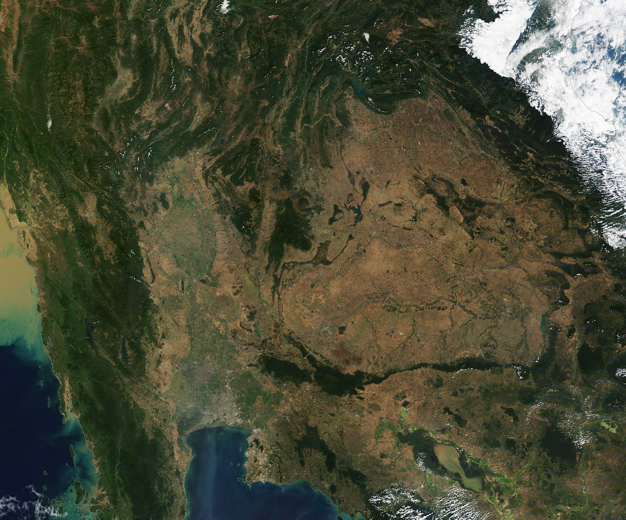
