
Images


January 11, 2022 - Streaks of Sediment in the Gulf of Khambhat
 Tweet
Tweet
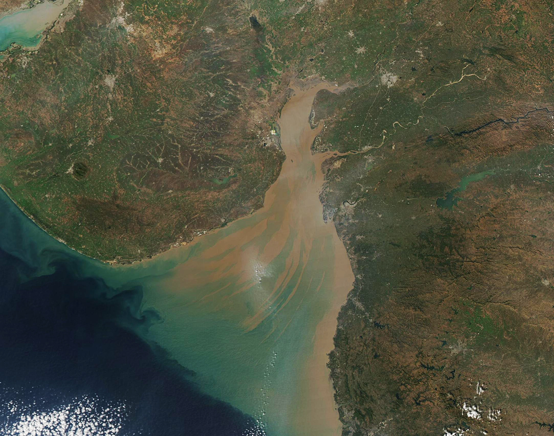
This gorgeous true-color image of sediment-laden water coloring the Gulf of Khambhat was acquired by the Moderate Resolution Imaging Spectroradiometer (MODIS) on board NASA’s Aqua satellite on January 10, 2022. The mud-brown sediment is thickest and nearest the surface in the northern section of the Gulf. As sediment begins to disperse and sink, the reflectivity changes and so it is seen as greenish in color. Currents leave streaks of sediment near the surface, creating a beautiful tan-and-green pattern as the waters open into the deep blue of the Arabian Sea.
The Gulf of Khambhat, which was once called the Gulf of Cambay, is a funnel-shaped indentation of the Arabian Sea that separates the large Saurashtra Peninsula and the mainland of Gujarat state, India. About 50 miles (80 km) wide at the mouth, the Gulf squeeze to a narrow 15 miles (25 km) as it courses northward. The mouth is also deeper than the northern area, with maximum water depth ranging from 98 feet (30 m) close to the Arabian Sea to 33 feet (10 m) in the north.
Waters of the Gulf of Khambhat are often turbid, with sediment suspended both from the action of the tides over the shallow northern waters and from the inflow of several rivers. The Narmada, Tapi, Mahi, and Sabarmati Rivers spill into the Gulf of Khambhat, carrying both freshwater and heavy loads of suspended sediment.
Image Facts
Satellite:
Aqua
Date Acquired: 1/10/2022
Resolutions:
1km (257.8 KB), 500m (738.9 KB), 250m (1.6 MB)
Bands Used: 1,4,3
Image Credit:
MODIS Land Rapid Response Team, NASA GSFC
