
Images


January 17, 2022 - Western Europe
 Tweet
Tweet
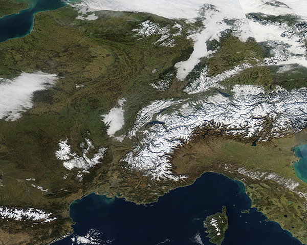
On January 13, 2022, the Moderate Resolution Imaging Spectroradiometer (MODIS) on board NASA’s Aqua satellite captured a gorgeous true-color image of a winter day across Western Europe. The view stretches for almost 600 miles (965 km) from west to east (western France to Austria) and from Belgium (north) to Corsica in the south.
Snow tops the high elevations of the Pyrenees Mountains, which lie in the south between France and Spain, the Alps as they course across the southeast section of the image, and the Central Massif in France. Large banks of fog cover low-lying land, particularly in France. Most of the landscape remains verdant green and free from snow.
Image Facts
Satellite:
Aqua
Date Acquired: 1/13/2022
Resolutions:
1km (321.4 KB), 500m (3.3 MB), 250m (3.5 MB)
Bands Used: 1,4,3
Image Credit:
MODIS Land Rapid Response Team, NASA GSFC
