
Images


August 8, 2022 - Fire and Burn Scars near Lake Upemba
 Tweet
Tweet
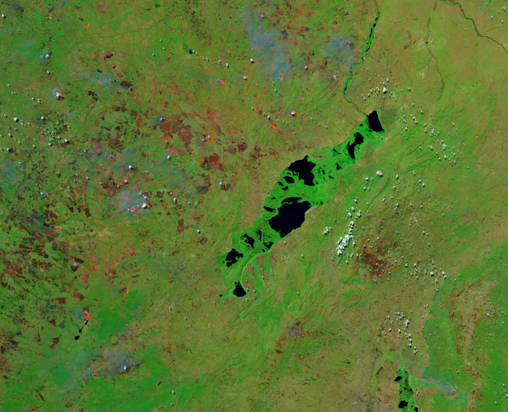
The Upemba Depression sits in Katanga Province of southern Democratic Republic of Congo. In this low-lying land, the Lualaba River widens to create many marshy lakes in the midst of scrubby savannah. There are about fifty lakes, most of them small, in the Upemba Depression. The largest of these is Lake Upemba, with a surface area measuring about 200 square miles (500 square kilometers).
On August 5, 2022, the Moderate Resolution Imaging Spectroradiometer (MODIS) on board NASA’s Aqua satellite acquired a false-colored image centered on Lake Upemba. This type of image combines infrared and visible light to help highlight features such as water and burn scars. Here, vegetation appears bright green, open land is colored in a variety of tans, while water looks deep blue or black. The color of burn scars—areas recently charred by fire—varies from bright brick-red or brown in fresh scars, depending on soil color and fire characteristics. Older burn scars fade as vegetation grows into the previously-charred area.
The dark water of Lake Upemba contrasts sharply with the floating islands of papyrus and other dense wetland vegetation typical of lakes in the Depression. Other small lakes are dotted over the landscape, especially to the west and southwest of Lake Upemba.
The wet savannah, west of Lake Upemba, is covered with burn scars as well as actively burning fires. Deep brick-red and brown burn scars are so dense and dark that, in some areas, it is difficult to discern where burnt grassland separates from small black lakes. Several actively burning fires, marked by red hot spots, and gray smoke are also scattered over this region. While it is not possible to discern why fires are burning from just a satellite image, given the location and time of year, most of these fires and burn scars are likely from fires that have been deliberately set for agricultural purposes—such as preparing soils for planting, clearing stubble from old fields, opening new areas for cropping, or renewing pastures.
The Upemba Depression has been home to humans since at least 700 A.D., providing fish, wild meat, and rich soils for agriculture. Human needs, including pressure from poaching, fishing, farming, and pasture, increasingly impacts the local wildlands, and the more than 1,800 species that live in the region. In 1939, the Democratic Republic of Congo set aside about 1.7 million hectares of land, including Lake Upemba and land to the south and east of it, as one of the country’s first National Parks. It is an extremely diverse and important ecosystem and has been recognized as and Important Bird and Biodiversity Area (IBA) by Birdlife International. Agriculture continues outside of the park, as the burn scars clearly show. Unfortunately, many burn scars—including one very large burn scar east of the lake—and at least 2 active fires can be seen within the borders of Upemba National Park.
Image Facts
Satellite:
Aqua
Date Acquired: 8/5/2022
Resolutions:
1km (246.2 KB), 500m (643.8 KB), 250m (352.3 KB)
Bands Used: 7,2,1
Image Credit:
MODIS Land Rapid Response Team, NASA GSFC
