
Images


August 14, 2022 - Southwest Egypt
 Tweet
Tweet
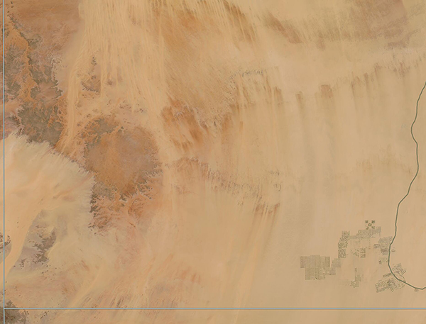
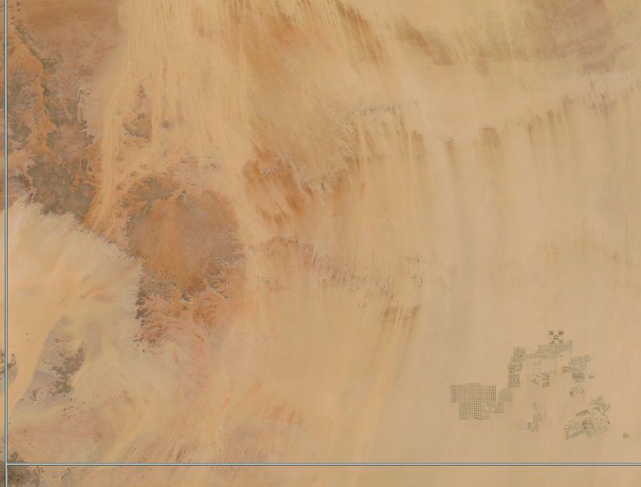
Southwest Egypt, tucked along the border of Sudan (south) and Libya (west), is a harsh land of sweeping sand and rugged mountains. On August 4, 2022, the Moderate Resolution Imaging Spectroradiometer (MODIS) on board NASA’s Aqua satellite acquired a true-color image of the spectacularly arid region.
Orange-tinted swaths are large deposits of sands and linear dunes, which line up parallel to the path of the prevailing wind. Darker colors are rocky outcroppings which rise above the Saharan sands. At the point where the corners of Egypt, Sudan, and Libya meet (lower left corner of the image) a tall, dark formation rises to about 2,000 meters (7,000 feet) above sea level. The rocks in this region have been estimated to be hundreds of millions of years old.
Just north of the border with Sudan, patches of green lie along a long, lonely roadway that cuts through the desert. This is the remote agricultural effort of Sharq El Owainat. It sits about 180 miles (290 km) from the nearest city and 130 miles (210 km) from evidence of surface water, the Toshka lakes. Water to run this extensive cropland comes from the Nubian Sandstone Aquifer, which is buried beneath the sand. It is drawn to the surface and piped to crops via center-pivot irrigation, which is a method of watering crops that minimizes loss of water. Viewed at high resolution (250m), the cropped areas can be seen to consist of round circles, evidence of the center-pivot method, where water is drawn upward into a well at the center of the circle, then is sprayed or dripped from long arms that rotate around the center.
Image Facts
Satellite:
Aqua
Date Acquired: 8/4/2022
Resolutions:
1km (95.9 KB), 500m (43.6 KB), 250m (135.5 KB)
Bands Used: 1,4,3
Image Credit:
MODIS Land Rapid Response Team, NASA GSFC
