
Images


December 6, 2022 - Dust Shrouds the Taklamakan Desert
 Tweet
Tweet
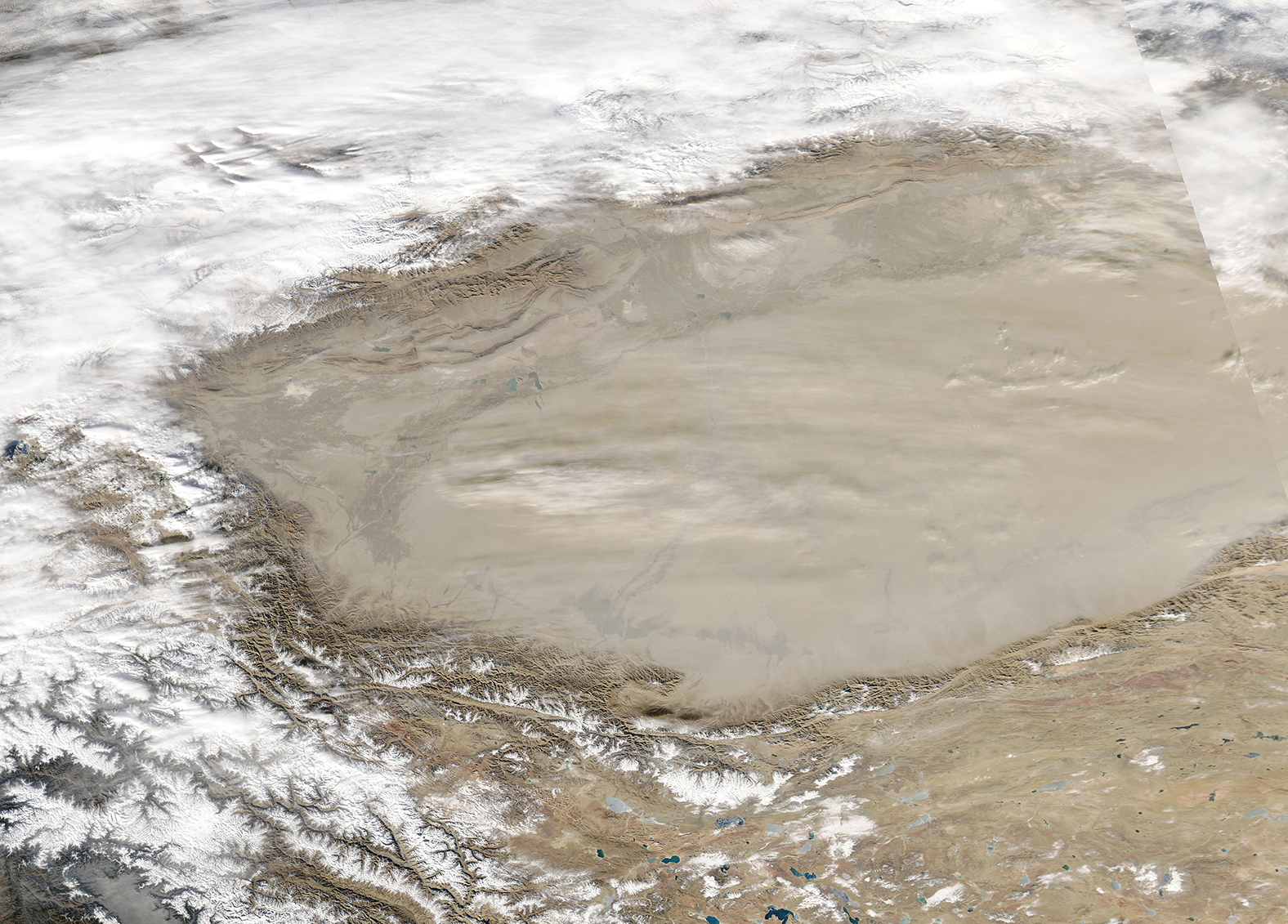
On December 4, 2022, a massive dust storm obscured almost all of the Taklimakan Desert from view as a thick layer of pale dust stretched across not only the desert but the entirety of the Tarim Basin itself. The Moderate Resolution Imaging Spectroradiometer (MODIS) acquired a true-color image of the dust-laden skies over the Taklimakan on that same day.
The Tarim Basin sits in western China and is enclosed on three sides by three major mountain ranges, with a narrow opening in the east. Parched by sitting in the rain shadow (an area devoid of rain) behind the tall mountains, the Tarim Basin receives nor more than 10 mm (0.4 inches) of rain per year. The Taklimakan Desert sits within the Tarim Basin and it is one of the driest and most barren expanses found on Earth. The name is said to mean “place of no return” in Turkish, due to the extreme lack of water, high daytime temperatures, the presence of vast fields of shifting sand dunes, and fierce dust storms that can destroy property as well as sicken people and livestock. A detailed account of a ferocious dust storm that destroyed a stagecoach was written on bamboo strips in China’s Han Dynasty, dating to more than 2,000 years ago, and still exists today. It is the earliest description of the effects of the desert’s most frequent natural hazard.
Image Facts
Satellite:
Aqua
Date Acquired: 12/4/2022
Resolutions:
1km (1.3 MB), 500m (3.7 MB), 250m (2.6 MB)
Bands Used: 1,4,3
Image Credit:
MODIS Land Rapid Response Team, NASA GSFC
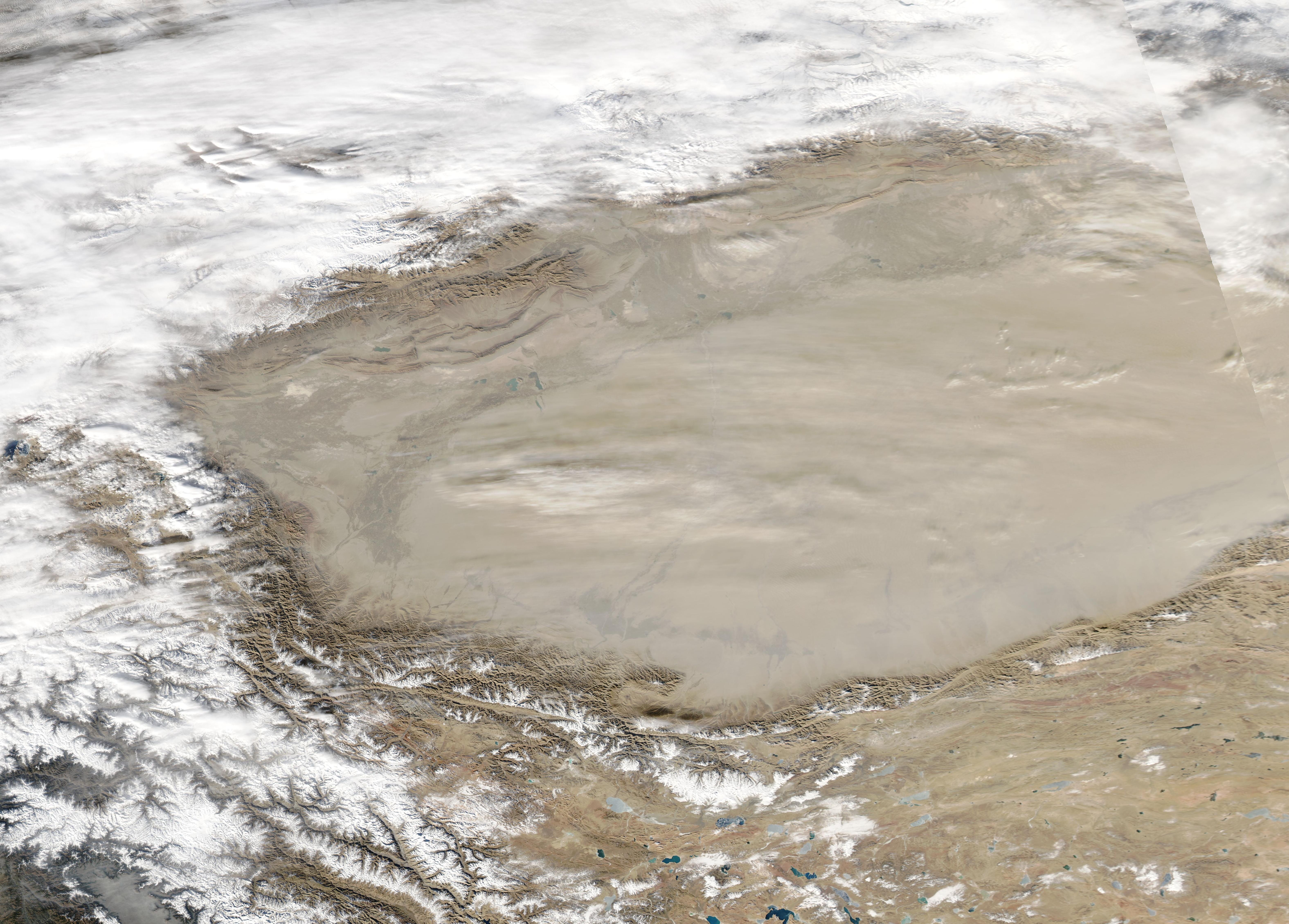
