
Images


March 25, 2023 - Fires and Smoke in Southeast Asia
 Tweet
Tweet
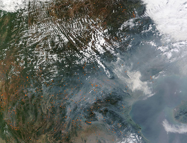
Dozens of fires, each marked in red, speckled the landscape of Southeast Asia on March 23, 2023, when the Moderate Resolution Imaging Spectroradiometer (MODIS) on board NASA’s Terra satellite acquired a true-color image of the region.
The image is centered on Laos (south) and Vietnam (north), with fires also seen in southern China, Thailand, and Myanmar (Burma). A thick pall of smoke obscures most of the coastal region of the South China Sea from view, with smoke also settling into the low valleys inland. Hanoi, Vietnam, sits under both a gray haze and a dingy-appearing cloud.
March is the end of the dry season across Southeast Asia, and this is the time of year when fires become widespread as people use burning to clear and maintain agricultural fields and pastures. In permanently cultivated (usually lowland) areas, fires are used to burn crop residues and get the land ready for the growing season. In urban and residential areas, people burn leaves, trash, and brush. In the mountains, fires may indicate permanent conversion of forest to agricultural land, or they may be associated with shifting cultivation, also known as swidden farming. In this system, patches of forest are cyclically cut down, burned, cultivated, and then left fallow for a time. Secondary forest or other vegetation reclaims the clearing during the fallow period.
While smoke is undoubtedly a primary source of the thick aerosol haze, it is likely so thick due to a temperature inversion. Air normally cools with altitude, but during an inversion warm air settles above a layer of cool air near the surface. The warm air acts like a lid and traps pollutants near the surface, especially in basins and valleys. In addition to smoke from the widespread fires, other sources of aerosols that may contribute to the haze include coal and wood burning for heat, industrial activity, dust storms, and vehicle emissions.
Image Facts
Satellite:
Terra
Date Acquired: 3/23/2023
Resolutions:
1km (312.4 KB), 500m (1.1 MB), 250m (3.3 MB)
Bands Used: 1,4,3
Image Credit:
MODIS Land Rapid Response Team, NASA GSFC
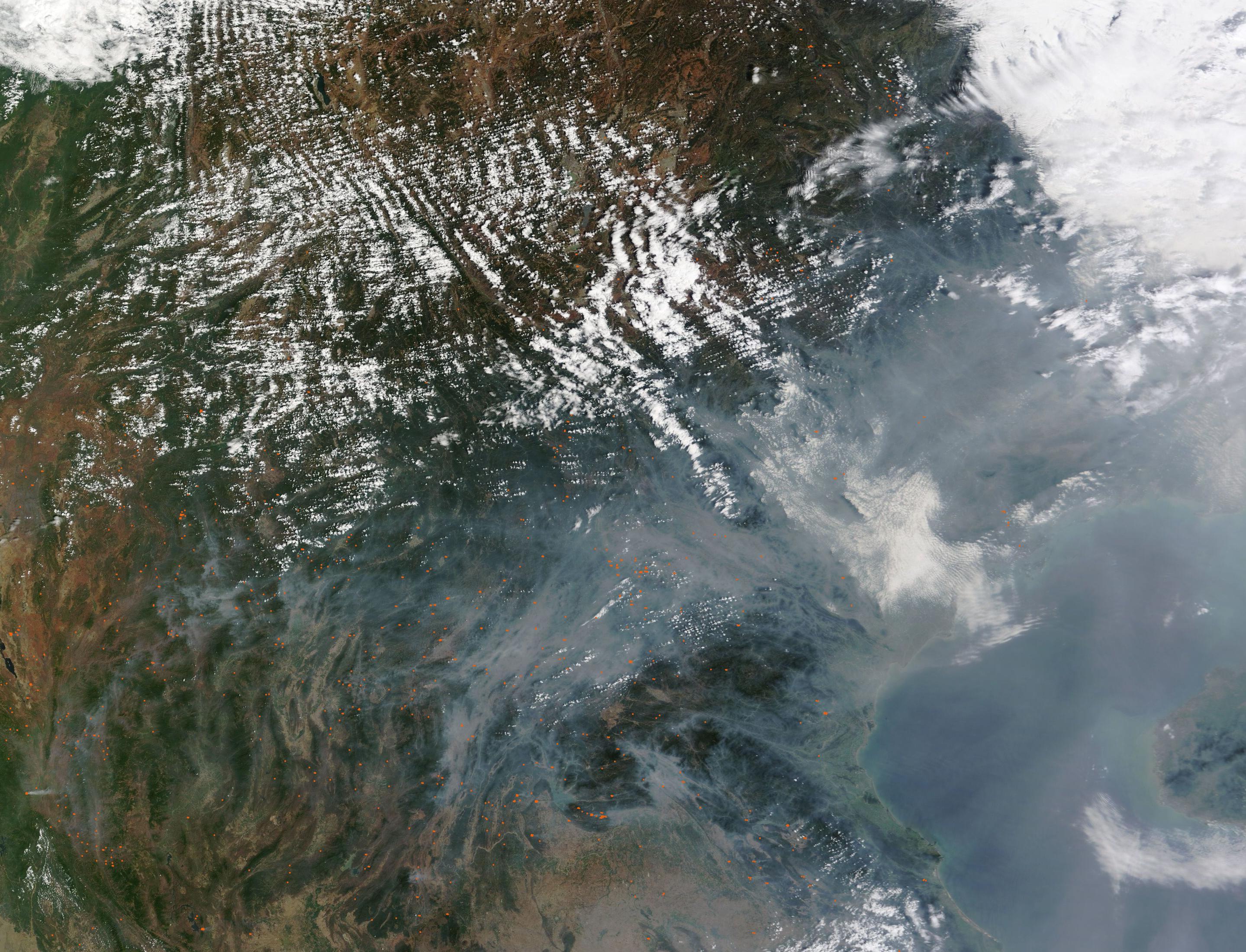
