
Images


March 6, 2017 - Central Europe
 Tweet
Tweet
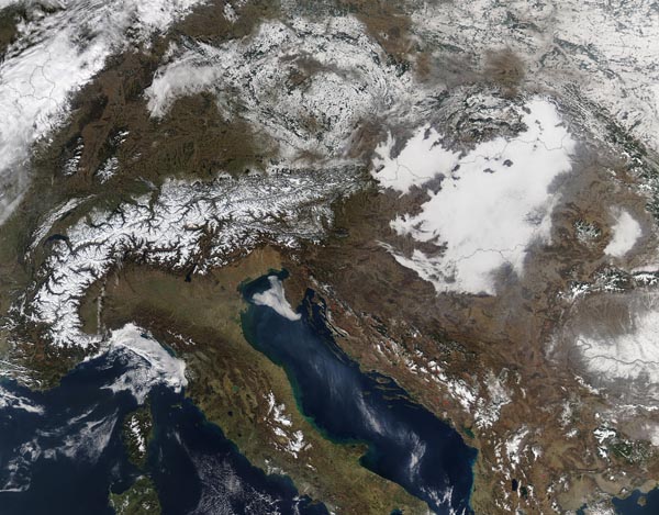
On February 16, 2017, NASA’s Aqua satellite flew over central Europe, allowing the Moderate Resolution Imaging Spectroradiometer (MODIS) aboard to acquire a true-color image of the wintery scene.
Snow caps the sinuous curves of the Alps as well as spread over parts of Germany, the Czech Republic (Czechia) (center), and Poland and Ukraine (northeast). In the northwest, streaks of white cloud cover snow in Germany, Belgium, Luxenberg, and France. Clouds also cover the Adriatic Sea (south central) and the Mediterranean Sea.
A white area with a dense texture marks a large bank of low cloud (fog) that has settled over Hungary and parts of Slovakia. Unlike snow, which dusts landforms and thus shows topography, fog settles into low-lying areas while the top of the bank of cloud forms a flat layer, without reference to the topography below. Fog creeps into valleys, creating finger-like projections along the edges where the fog bank meets mountainous ridges.
Image Facts
Satellite:
Aqua
Date Acquired: 2/16/2017
Resolutions:
1km (753.2 KB), 500m (2.6 MB), 250m (6.8 MB)
Bands Used: 1,4,3
Image Credit:
Jeff Schmaltz, MODIS Land Rapid Response Team, NASA GSFC
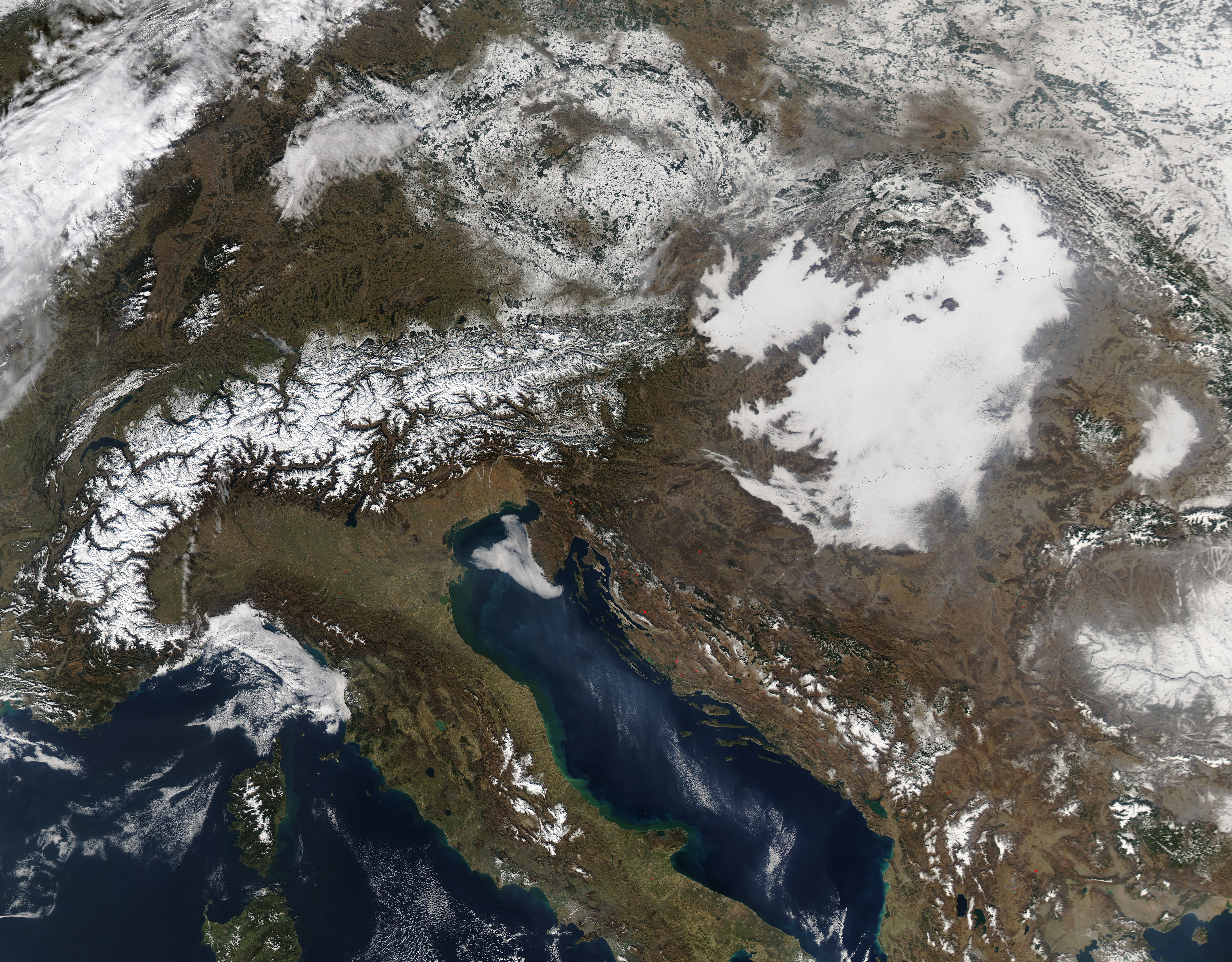
