
Images


December 9, 2017 - Fires in southern California (afternoon overpass)
 Tweet
Tweet
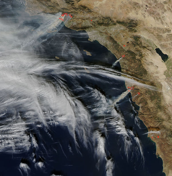
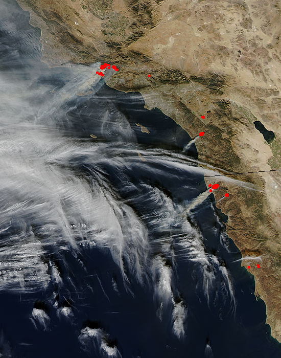
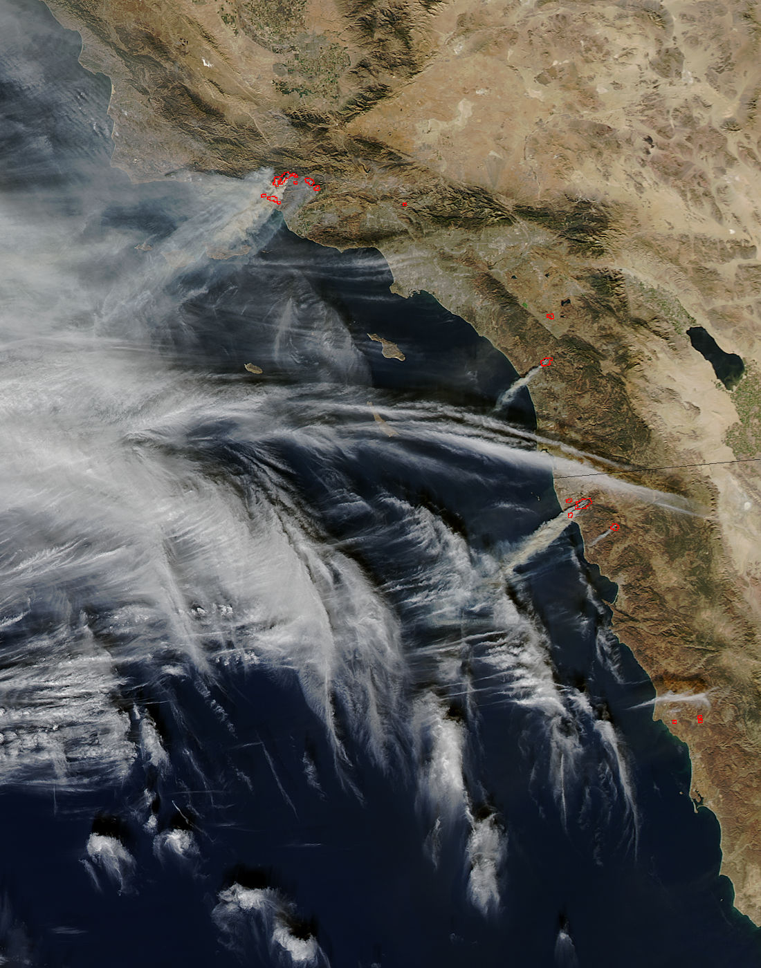
Intense wildfires have been scorching several communities in Southern California since early December, 2017. A deadly inferno, the Thomas Fire, ignited on December 6. As of December 8, this single fire consumed 132,000 acres (53,000 hectares or 200 square miles), destroyed 439 structures and damaged 85 more structures. With over 3,500 personnel deployed to fight the fire, containment reached 10% while 15,000 structures remain threatened by the flames. Meanwhile, additional fires to the south, including the Rye, Skirball, and Creek fires in Los Angeles County had charred roughly an additional 20,000 acres combined.
Fierce Santa Ana winds and extremely dry air drove the rapid expansion of the fires, and also made fighting the flames both difficult and dangerous. As of the afternoon of December 8, Cal Fire reported they were managing or assisting with the management of 10 fires across Southern California.
On December 7, 2017, the Moderate Resolution Imaging Spectroradiometer (MODIS) aboard NASA’s Aqua satellite acquired a true-color image of intense smoke blowing across the Pacific Ocean from a number of fires in Southern California and also in Mexico. The Thomas Fire sits the furthest to the north.
Image Facts
Satellite:
Aqua
Date Acquired: 12/7/2017
Resolutions:
1km (100.4 KB), 500m (317.9 KB), 250m (794.6 KB)
Bands Used: 1,4,3
Image Credit:
Jeff Schmaltz, MODIS Land Rapid Response Team, NASA GSFC
