
Images


September 3, 2015 - Tropical Storm Erika (05L) over the Lesser Antilles (afternoon overpass)
 Tweet
Tweet
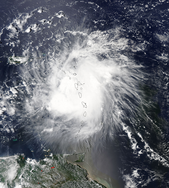
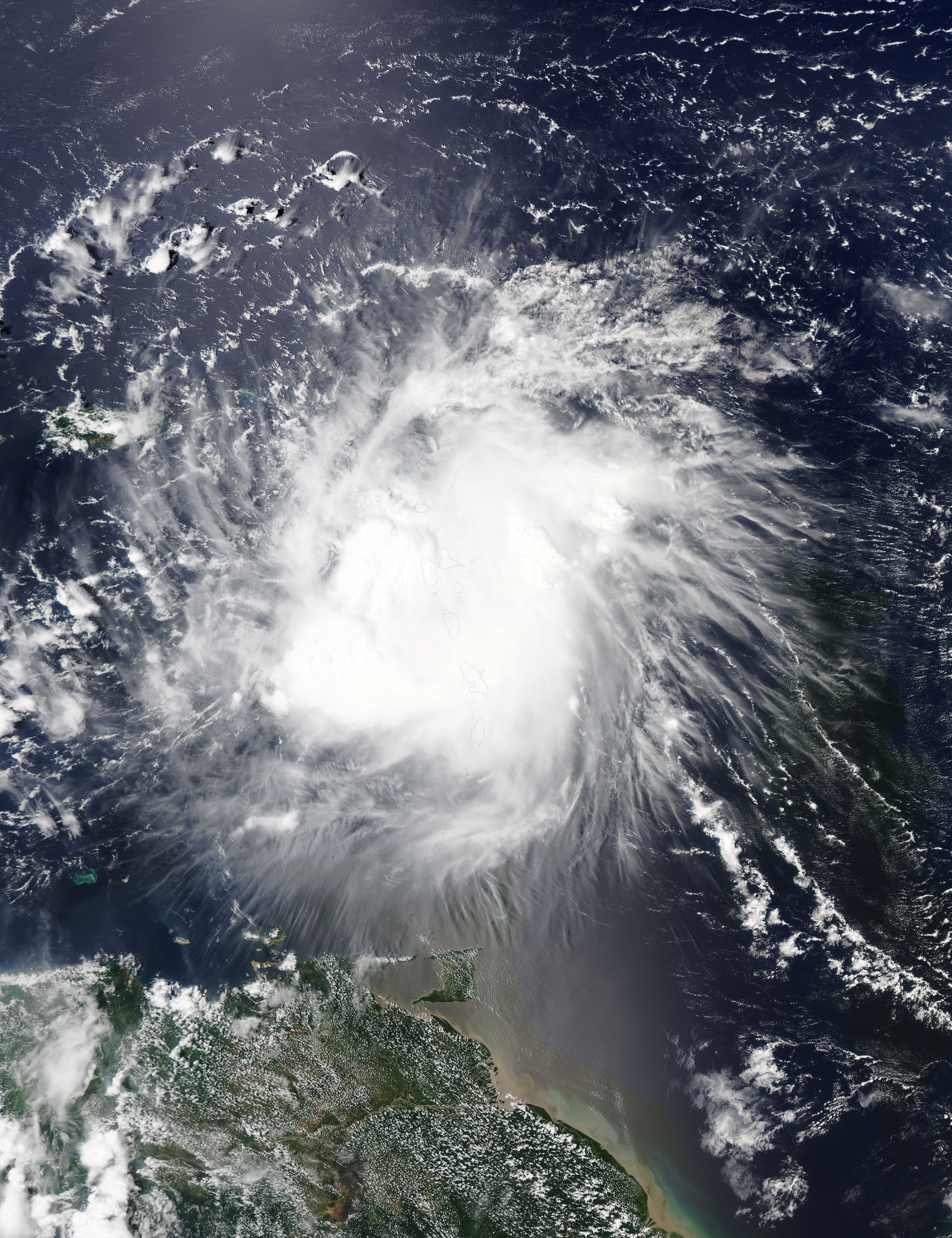
Tropical Storm Erika, the fifth named storm of the season, entered the northeast Caribbean early on the morning of August 27, 2015, as it passed through the Leeward Islands between Guadeloupe and Antigua. The Moderate Resolution Imaging Spectroradiometer (MODIS) aboard the Aqua satellite captured this true-color image on that same afternoon. At that time, the leading edge of convection had reached the island of Hispaniola.
Erika originated as a wave of low pressure that was first detected on Friday, August 21 midway between the West Coast of Africa and the Cape Verde Islands. The wave then tracked westward across the tropical mid-Atlantic where it eventually intensified enough to become a tropical storm, Tropical Storm Erika, about three days later on the evening of August 24 (local time, EDT).
At this point, Erika was located about 955 miles due east of the Leeward Islands. However, despite being over warm water, Erika struggled to intensify as it approached the Leeward Islands over the next few days thanks to an upper-level trough of low pressure near Hispaniola in the north central Caribbean, which created westerly wind shear that disrupted the storm's circulation.
From August 27 through 29 Tropical Storm Ericka moved through the Leeward islands and into the Eastern Caribbean Sea as its center passed just south of Puerto Rico, then crossed over the Island of Hispaniola, where the storm weakened. Erika then moved in a westerly direction where it dissipated near eastern Cuba.
By August 31, the remnants of Erika were causing rain and flooding in the southern United States. Meanwhile, the island of Dominica had declared disaster status due to damage caused by tropical-storm-force winds and flooding. At least twenty people were reported killed, and as many as another 50 people were missing.
Image Facts
Satellite:
Aqua
Date Acquired: 8/27/2015
Resolutions:
1km (976 KB), 500m (3.3 MB), 250m (7.8 MB)
Bands Used: 1,4,3
Image Credit:
Jeff Schmaltz, MODIS Land Rapid Response Team, NASA GSFC
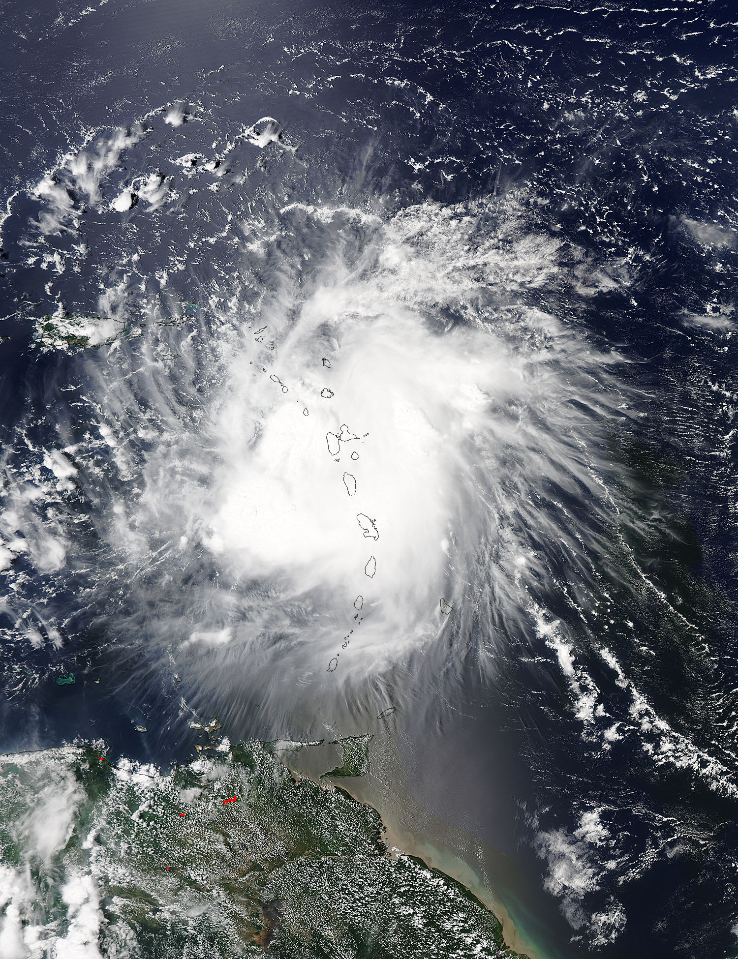
