
Images


September 19, 2017 - Hurricane Jose (12L) in the Atlantic Ocean
 Tweet
Tweet
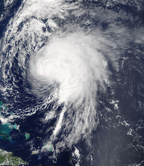
On September 16, 2017, the Moderate Resolution Imaging Spectroradiometer (MODIS) aboard NASA’s Terra satellite acquired a true-color image of Hurricane Jose spinning over the Atlantic Ocean.
The National Hurricane Center (NHC) issued its first advisory on Jose on September 5 when it became the 10th tropical storm of the Atlantic hurricane season. At that time, Tropical Storm Jose was carrying maximum sustained winds of 40 mph (65 km/h). It was located about 1505 miles (2,420 km) east of the Lesser Antilles and was moving west northwest. It became a hurricane later that same day.
Hurricane Jose meandered across the Atlantic, staying away from land and causing no or minimal damage, despite achieving Category 4 status on the Saffir-Simpson Hurricane Wind Scale, with peak winds of 155 mph (250 km/h) on September 9.
By September 16, Hurricane Jose’s winds had dropped to 80 mph (130 km/h), making it a Category 1 storm as it approached the East Coast of the United States. At 11:00 p.m. EDT on September 16, the NHC reported that Jose was located about 465 miles (750 km) south southeast of Cape Hatteras, North Carolina and about 465 miles (750 km) west southwest of Bermuda. It was creating large swells in the ocean, and dangerous surf and rip currents were expected along parts of the East Coast.
Hurricane Jose has stayed out to sea while running northward, roughly parallel to the East Coast. At 8:00 p.m. on September 18, Jose was reported to be located about 230 mi (370 km) east of Cape Hatteras and about 445 mi (720 km) south of Nantucket and was carrying maximum sustained winds of 75 mph (120 km/h). A Tropical Storm Watch was in effect for the coast of Long Island from Fire Island Inlet to Port Jefferson, NY and New Haven to Watch Hill, CT. Tropical Storm Warnings were in effect from Watch Hill to Hull, Block Island, CT, and Martha’s Vineyard and Nantucket, MA. Direct landfall is not expected.
Image Facts
Satellite:
Terra
Date Acquired: 9/16/2017
Resolutions:
1km (701.8 KB), 500m (2.2 MB), 250m (5.5 MB)
Bands Used: 1,4,3
Image Credit:
Jeff Schmaltz, MODIS Land Rapid Response Team, NASA GSFC
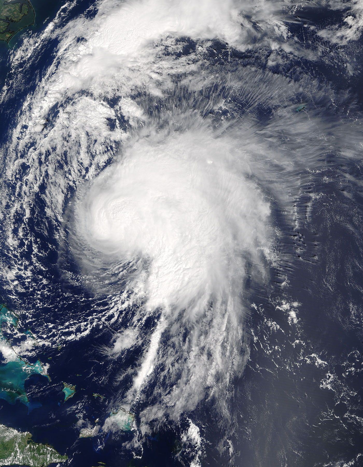
