
Images


August 6, 2018 - Europe
 Tweet
Tweet
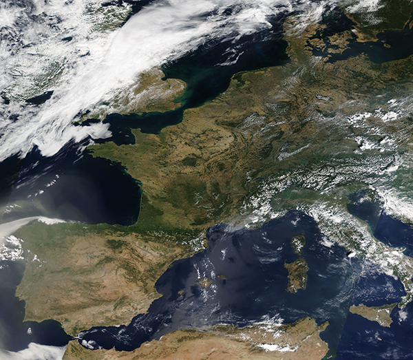
On August 3, 2018, the Moderate Resolution Imaging Spectroradiometer (MODIS) on board NASA’s Terra satellite acquired a true-color image of a relatively cloud-free day over Western Europe. The scene stretches from the Arctic Ocean in the north to the Mediterranean and captures a bit of north-western Africa in the south and the Atlantic Ocean in the west. Parts of Italy, Croatia, Hungary, Austria, Czechia, and Poland can be seen in the east.
While popcorn clouds cover much of the land to the east and a bank of white cloud covers the British Isles, the skies over the western continent are cloud-free. Dust pours from Africa to cover much of the southern and western Iberian Peninsula and a thinner veil reaches Greece and parts of Italy. The region, especially Spain and Portugal, have been suffering from a vicious heat wave for several weeks, with peak temperatures on August 4 reaching more than 45 °C (113 °F) in parts of Portugal and Spain. Two deaths have been linked to the heat in Spain.
Image Facts
Satellite:
Terra
Date Acquired: 8/3/2018
Resolutions:
1km (5.3 MB), 500m (5.1 MB),
Bands Used: 1,4,3
Image Credit:
MODIS Land Rapid Response Team, NASA GSFC
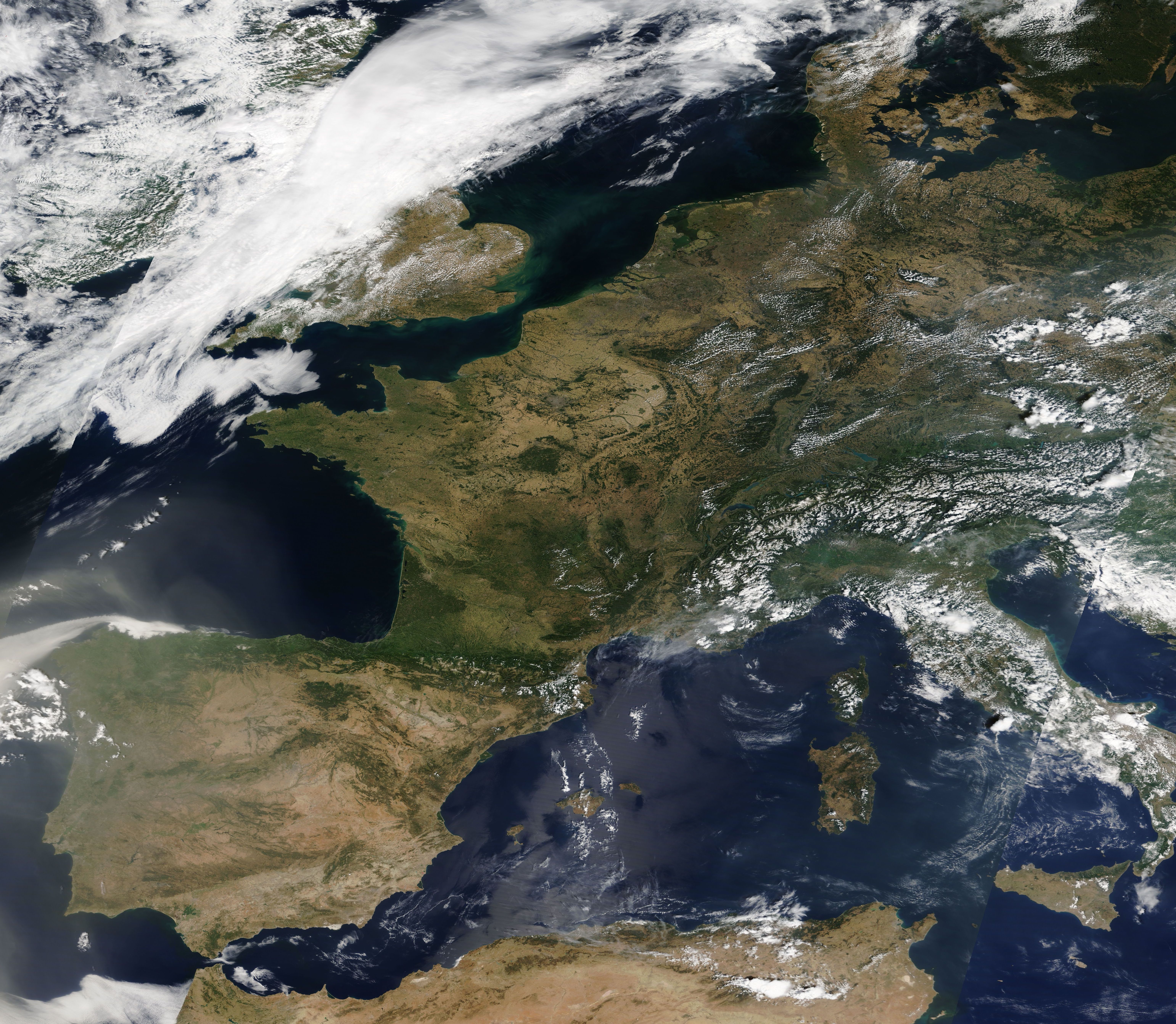
