
Images


February 1, 2019 - Polar vortex takes hold in North America
 Tweet
Tweet
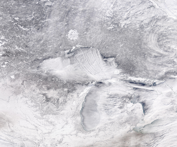
Desperately cold weather set record lows for much of the Midwest and Northern Plains of the United States, as well as interior Canada in late January 2019. The culprit is a familiar one: the polar vortex.
A large area of low pressure and extremely cold air usually swirls over the Arctic, with strong counter-clockwise winds that trap the cold around the Pole. But disturbances in the jet stream and the intrusion of warmer mid-latitude air masses can disturb this polar vortex and make it unstable, sending Arctic air south into middle latitudes.
According to the National Weather Service and media reports, the dipping polar vortex brought record low temperatures to a wide swath of the Midwest and Canada. At least four cities reported the lowest temperatures ever on record: Moline, Illinois reached -33°F (-36.1°C); Rockford, Illinois shivered at -31°F (-35°C); Cedar Rapids, Iowa noted -30°F (-34.4°C); while north of Mather, Wisconsin temperatures dipped to -43°F (-41.7°C). Wind chills as low as -60 or -65 were felt across much of Minnesota and a whopping -82 degree wind chill was reported in northern Manitoba and southern Nunavut, Canada on January 28.
On January 30 the Moderate Resolution Imaging Spectroradiometer (MODIS) on NASA’s Aqua satellite acquired a true-color image as the frigid air blew across the Ontario and the Midwest. Cloud streets and lake-effect snow stretch across the scene, as frigid Arctic winds blew over the Great Lakes.
Image Facts
Satellite:
Aqua
Date Acquired: 1/30/2019
Resolutions:
1km (1.8 MB), 500m (5.9 MB), 250m (5.5 MB)
Bands Used: 1,4,3
Image Credit:
MODIS Land Rapid Response Team, NASA GSFC
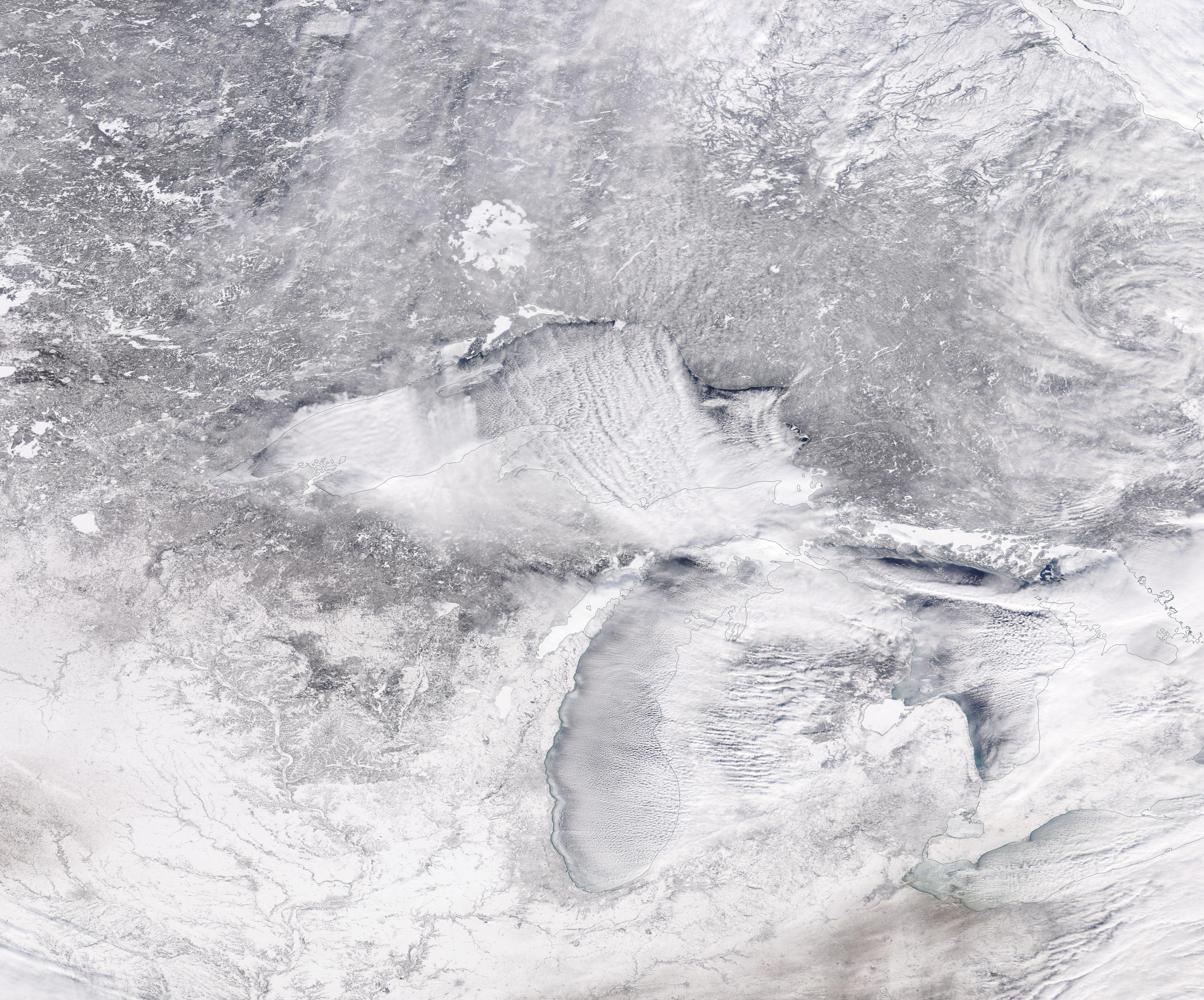
