
Images


September 6, 2019 - Pulau Yos Sudarso Island and the Arafura Sea
 Tweet
Tweet
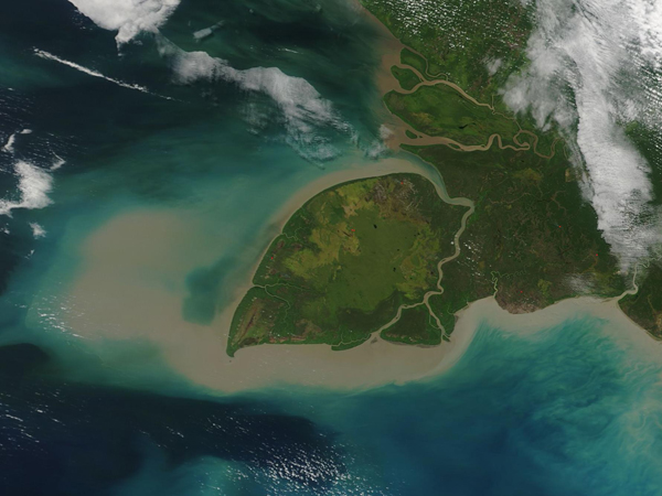
The large, leaf-shaped Pulau Yos Sudarso Island sits off the southwestern coast of New Guinea, separated from it by a narrow channel. The western half of New Guinea, including Pulau Yos Sudarso, has been administered by Indonesia since 1963 and is known as Western New Guinea or West Papua. Also known as Pulau Dolok or Pulau Kimaam, the unique island covers an area of about 11,600 square kilometers (4,480 square miles).
The blue waters of the Arafura Sea are stained brown with heavy sediment. The island is surrounded with a broad continental shelf which lies only about 50-80 meters (164 - 263 feet). West Papua is well-known for a number of well-developed coral reefs, but none are found around Pulau Yos Sudarso, in part because of the heavy sediment load. The island coastline, however, provides excellent habitat for mangroves, which grow in some of the largest mangrove forests on Earth.
The Moderate Resolution Imaging Spectroradiometer (MODIS) on board NASA’s Terra satellite acquired this true-color image of Pulau Yos Sudarso Island on September 2, 2019.
Image Facts
Satellite:
Terra
Date Acquired: 9/2/2019
Resolutions:
1km (115.3 KB), 500m (298.9 KB), 250m (182.1 KB)
Bands Used: 1,4,3
Image Credit:
MODIS Land Rapid Response Team, NASA GSFC
