
Images


September 8, 2019 - Typhoon Lingling
 Tweet
Tweet
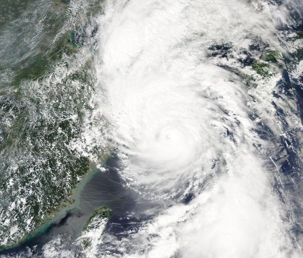
Typhoon LingLing formed in the Western Pacific Ocean on August 29, 2019. It swept over Japan’s Miyako-jima Island on September 5 with maximum sustained winds of about 100 mph (162 km/h). A gust of 136 mph (220 km/h) was recorded at Miyako-jima’s airport. Lingling then headed towards South Korea, where it struck the island of Jeju and the southern port cities on the night of September 6, reportedly killing three people and knocking out power to more than 120,000 homes. The storm then took aim at North Korea, striking that country in the afternoon of September 7, carrying maximum sustained winds of about 86 mph (138 km/h). Forecasters predict around 75 to 150 millimeters (3 to 6 inches) of rainfall and a storm surge, both of which may cause flooding and landslides.
The Moderate Resolution Imaging Spectroradiometer(MODIS) on NASA’s Aqua satellite acquired this true-color image of Typhoon LingLing on September 6, 2019. The well-formed eye of the storm was nearly due south of Jeju Island, South Korea, while rain bands stretched far to the north, already bringing rain to North Korea.
Typhoon Lingling is the thirteenth tropical cyclone (typhoon or tropical storm) in the North Pacific this year. However, the Korean Peninsula typically sees just one landfalling storm per year.
Image Facts
Satellite:
Aqua
Date Acquired: 9/6/2019
Resolutions:
1km (2.4 MB), 500m (7 MB), 250m (6 MB)
Bands Used: 1,4,3
Image Credit:
MODIS Land Rapid Response Team, NASA GSFC
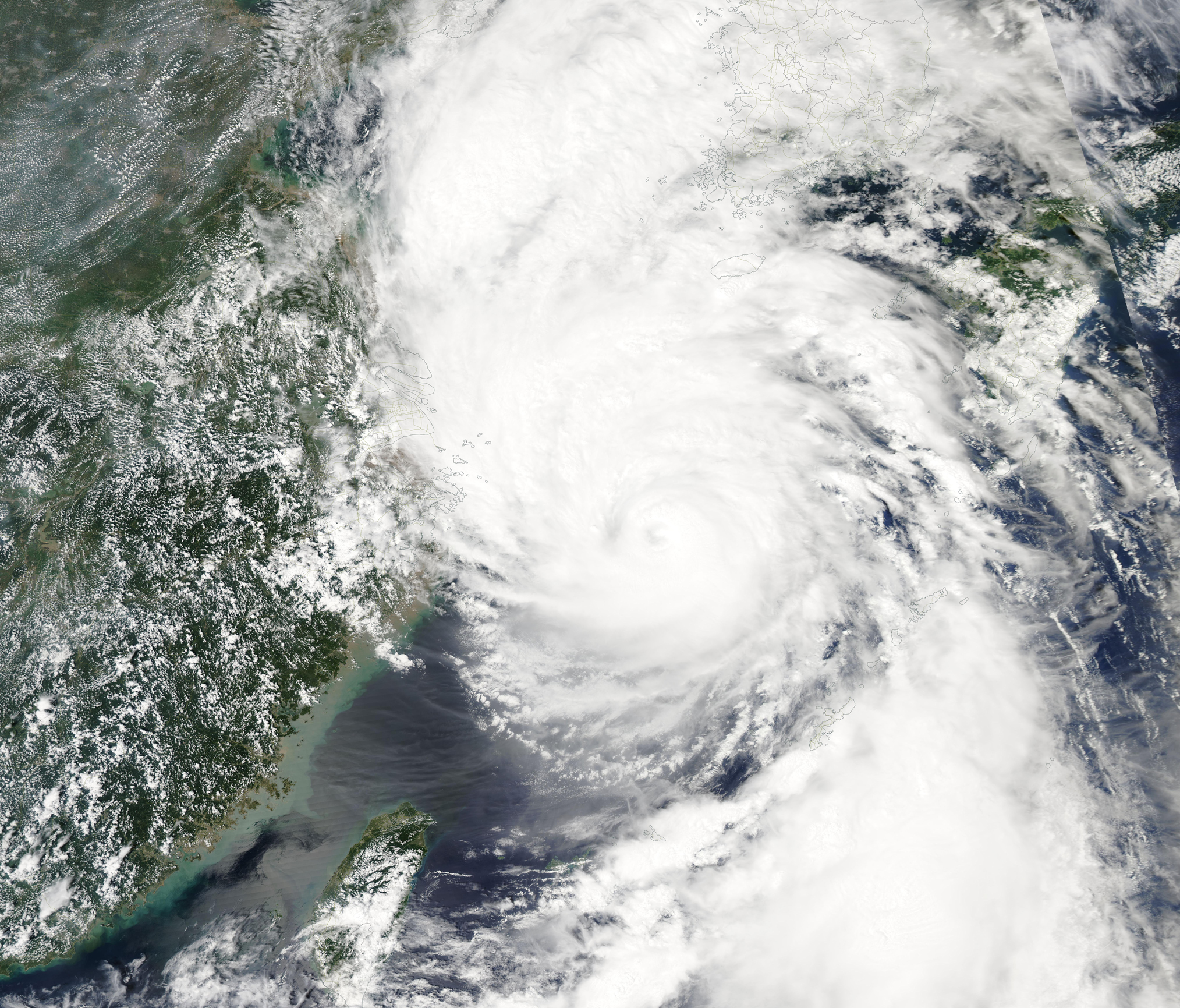
