
Images


September 9, 2019 - Southern Patagonia
 Tweet
Tweet
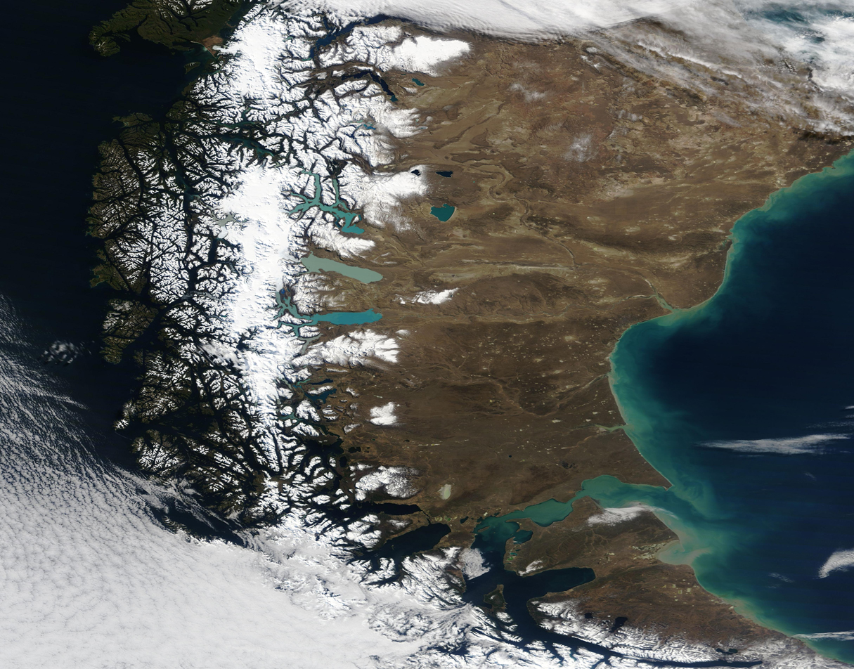
On September 9, 2019, NASA’s Terra satellite passed over southern Patagonia, allowing the Moderate Resolution Imaging Spectroradiometer (MODIS) on board to acquire a stunning true-color, clear-sky image the verdant green forests, tall ice-capped mountains, glacial lakes, and broad arid plains that fill the region.
In the west, Chile’s forest are capped with winter’s snow while, in the east, Argentina’s high plains remain precipitation-free, except for the areas closest to the Andes Mountains. Dense white areas atop the Andes mark the glaciated Southern Patagonian Ice Field. The glaciers feed a number of large lakes, each one a slightly different color. The shades of the lakes are influenced by multiple factors, including depth and sediment content.
Wrapped in an L-shaped valley in the north, Lago Cochrane (west) and Lago Pueyrredon (east) are the deepest blue of all the lakes in this image, while the shallower and round Lago Cardiel appears slightly lighter. Lake Viedma appears milky-blue, thanks to thick glacial flour floating in the waters. Lago San Martin, to Viedma’s north, is the brightest of the lakes while Lago Argentino is similar color. Glacial flour—fine-grained, silt-sized particles created by the grinding of glaciers over rock—are also responsible for the colors of these two electric-blue lakes.
Image Facts
Satellite:
Terra
Date Acquired: 9/5/2019
Resolutions:
1km (958.3 KB), 500m (2.5 MB), 250m (2.1 MB)
Bands Used: 1,4,3
Image Credit:
MODIS Land Rapid Response Team, NASA GSFC
