
Images


November 3, 2019 - Tibetan Plain and the Himalayas
 Tweet
Tweet
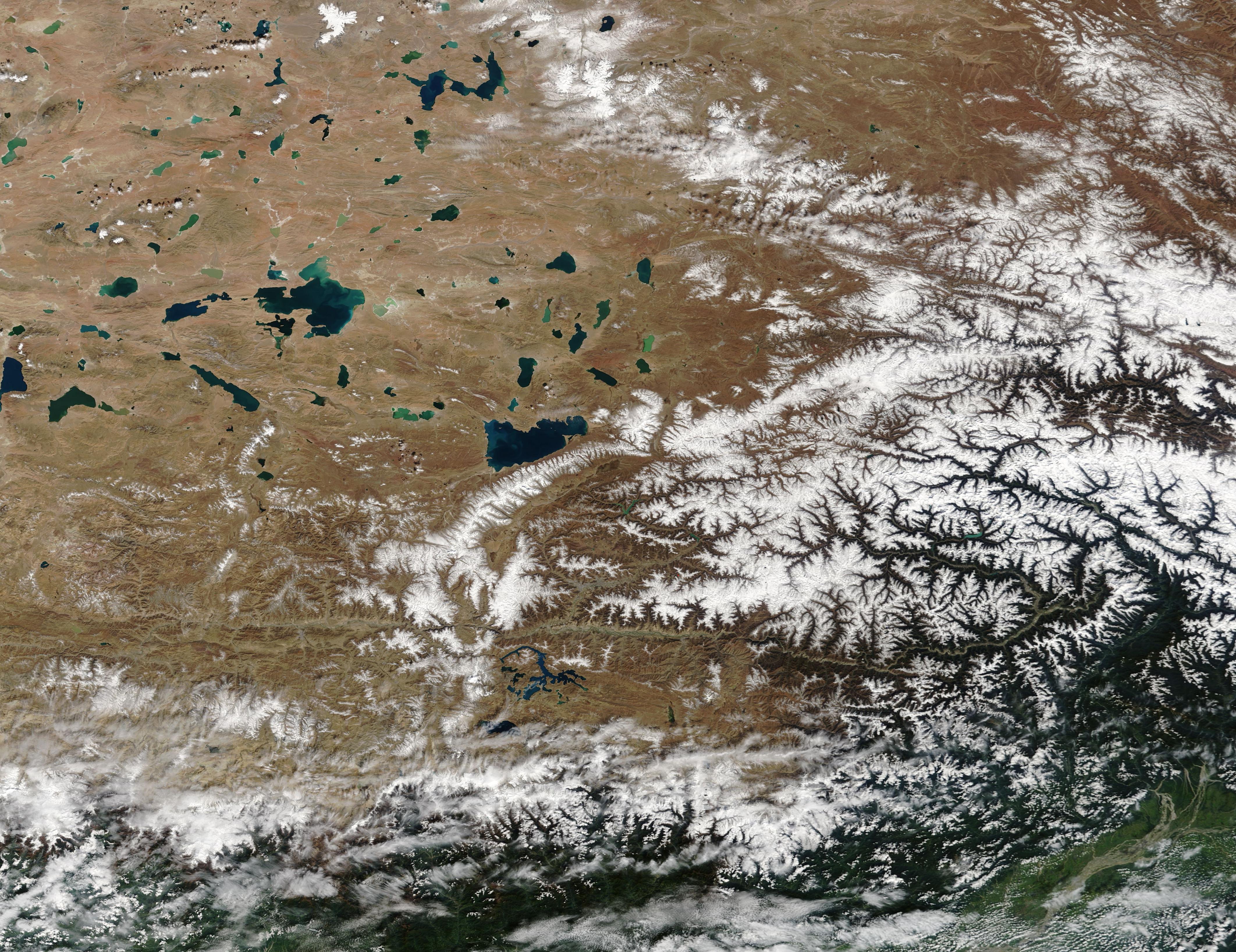
Snow lay across the peaks of the Himalaya Mountains and dusted the autumn landscape of the Tibetan Plateau in late October 2019. The Moderate Resolution Imaging Spectroradiometer (MODIS) on board NASA’s Terra satellite acquired a true-color image of the stunning scene on October 28. The contrast of bright white snow against a stark tan landscape, dotted by the blues and greens of dozens of lakes is a typical of the region where the high plateau pushes up against the Himalayan Mountains.
The expansive Tibetan Plateau, sometimes called the “Roof of the World”, ranks as one of the most extensive are of alpine habitat in the world. With an average elevation of more than 4,500 meters (14,700 feet), the region covers an area of more than 950,000 square miles (2,460,000 sq. km)—a little larger than twice the size of South Africa. The Tibetan Plateau is home to more than 1,500 large and small lakes that cover 24,183 square kilometers (9,337 square miles). The area is also the source of many of Asia’s major rivers, including the Brahmaputra, Indus, Ganges, Salween (Nu Jiang), Mekong (Lancang Jiang), Yangtze (Chang Jiang), and Yellow (Huang He) Rivers.
Image Facts
Satellite:
Terra
Date Acquired: 10/28/2019
Resolutions:
1km (954.6 KB), 500m (2.6 MB), 250m (2.4 MB)
Bands Used: 1,4,3
Image Credit:
MODIS Land Rapid Response Team, NASA GSFC
