
Images


November 19, 2019 - Typhoon Kalmaegi off the Philippines
 Tweet
Tweet
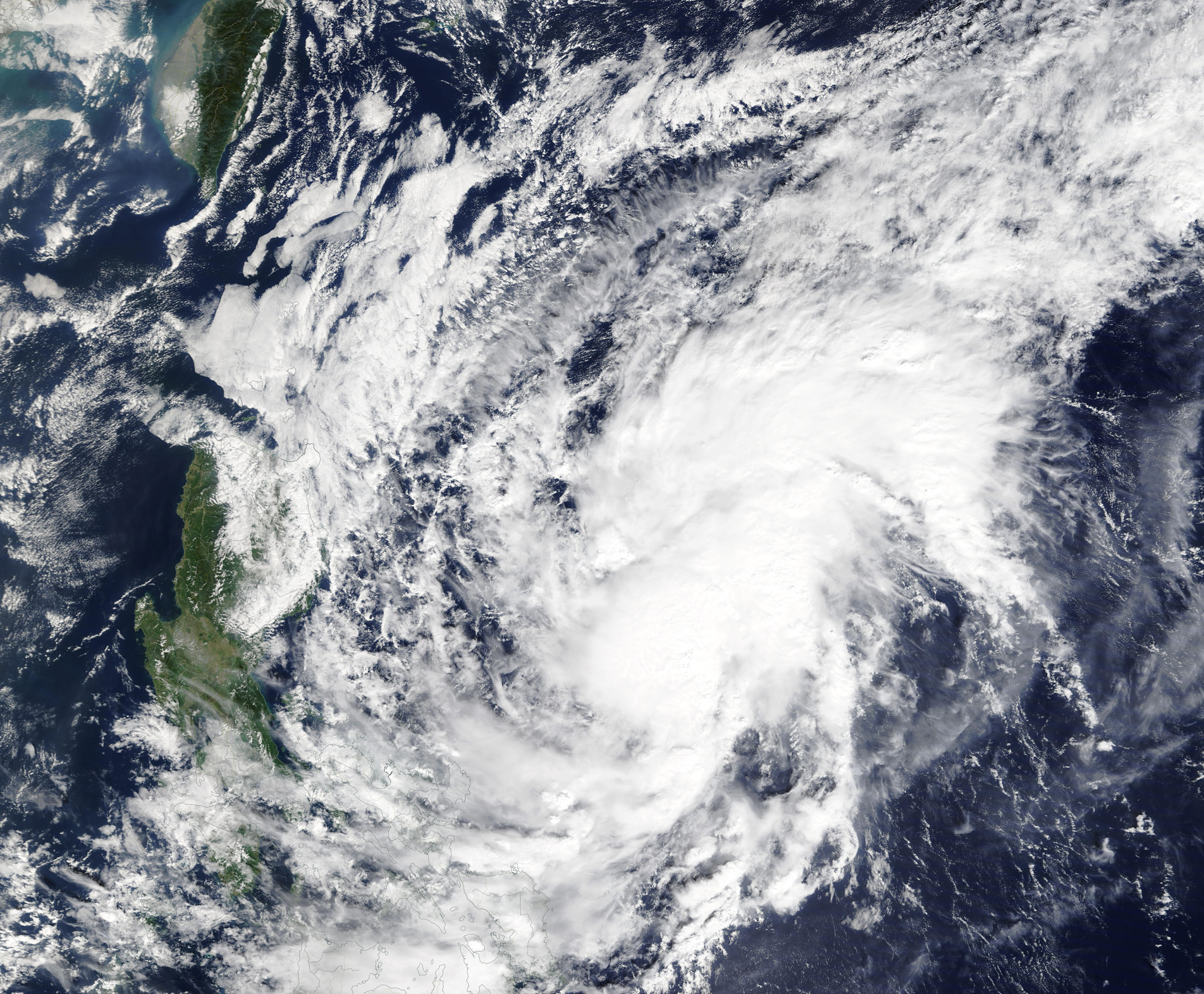
Typhoon Kalmaegi was spinning over the Philippine Sea and approaching the northern tip of the island of Luzon, Philippines, on November 18, 2019, triggering warnings for tropical-cyclone strength wind and heavy rain. At 2100 UTC (4:00 p.m. EST) on November 18, the Joint Typhoon Warning Center (JTWC) reported that Kalmaegi (known as Typhoon Ramon locally) was carrying maximum sustained winds of about 86 mph (138 km/h). The storm was located about 333 miles (536 km) north-northeast of Manilla, Philippines.
Typhoon Kalmaegi is expected to turn towards the west-southwest and clip the northwestern tip of the island of Luzon late on November 18 carrying maximum sustained winds of up to 75 mph (120 km/h). Category 1 on the Saffir-Simpson Hurricane Wind Scale begins at 75 mph (120 km/h). According to the Global Disaster Alert and Coordination System (GDACS), Kalmaegi has already brought heavy rain, flooding and landslides to parts of the Philippines, with several houses destroyed. Moderate to locally heavy rain is forecast for northern Luzon from November 18-19 before the storm dissipates to the west of Luzon in the next several days.
The Moderate Resolution Imaging Spectroradiometer (MODIS) on board NASA’s Terra satellite acquired a true-color image of Typhoon Kalmaegi over the Philippine Sea as it intensified on November 16, 2019. At that time, the system appeared elongated with rain bands curving into a cloud-filled center.
Image Facts
Satellite:
Terra
Date Acquired: 10/16/2019
Resolutions:
1km (2.3 MB), 500m (6.4 MB), 250m (12.2 MB)
Bands Used: 1,4,3
Image Credit:
MODIS Land Rapid Response Team, NASA GSFC
