
Images


November 27, 2019 - Fires and burn scars in Burkina Faso, Niger and Benin
 Tweet
Tweet
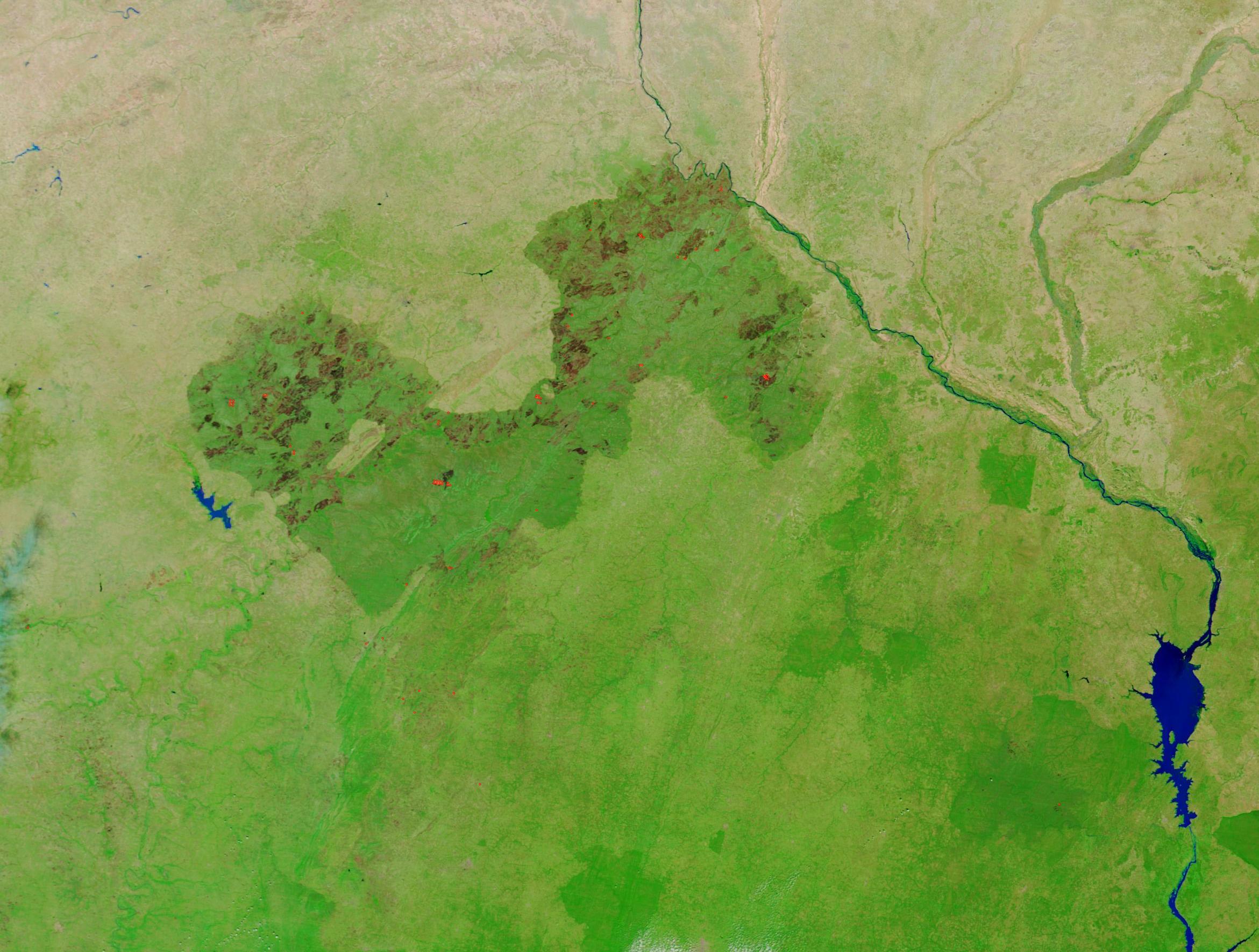
In the grasslands and savannas of West Africa, the agricultural burning season takes place in Northern Hemisphere late fall and winter. Fires are widespread at this time, as people burn crop stubble, brush, and old pasture grasses. While fire has been used to manage agricultural lands in Africa for thousands of years, fires that get out of control can and do cause considerable destruction to the landscape, especially when the fires reoccur over time.
On November 25, 2019, the Moderate Resolution Imaging Spectroradiometer (MODIS) on board NASA’s Terra satellite acquired a false-color image of fires and dense fire scars stretching along an area encompassing parts of Burkina Faso (west), Benin (east) and southern Niger (north).
MODIS imagery, especially the 7,2,1 (false color) band combination, is an excellent tool for assessing the presence and impact of fires. Vegetation appears a bright green, contrasting nicely with the fire scar. Recent fires scars may appear black, very dark brown or brick red where vegetation has burned away leaving open land visible. As vegetation begins to regrow, fire scars begin to fade. Early regrowth—from fires that burned in the last few years— looks slightly paler than new burn. In areas where several years have passed since the fire, the scar may appear only slightly darkened. Bright red “hot spots” mark areas where the thermal sensors on the instrument detected high temperatures, generally indicating actively burning fire.
In this image, several active fires can be seen as well as many, many fire scars of various ages. Almost all of the fires and scars lie within a complex of protected areas that include the W-Arly-Pendjari Complex (west) and W Benin-Niger National Park (east). These protected areas created the largest and most important continuum of terrestrial, semi-aquatic and aquatic ecosystems in the West Africa savanna belt.
According to the United Nations Educational, Scientific, Cultural Organization (UNESCO), the long-term effects of fire linked to human occupation of the W-Arly-Pendjari Complex, perhaps dating back some 50,000 years, have shaped the vegetation of this property. The traditional use of fire maintains the diversity of vegetation types, which in turn provide habitat for the characteristic wildlife of the property. While fire helps maintain the habitat, the encroachment of agricultural land and illegal grazing are listed as primary threats to the protected areas – and that includes over-use of fire as an agricultural tool.
Image Facts
Satellite:
Terra
Date Acquired: 11/25/2019
Resolutions:
1km (282.1 KB), 500m (753 KB), 250m (486 KB)
Bands Used: 7,2,1
Image Credit:
MODIS Land Rapid Response Team, NASA GSFC
