
Images


January 14, 2020 - Burn Scars in Australia
 Tweet
Tweet
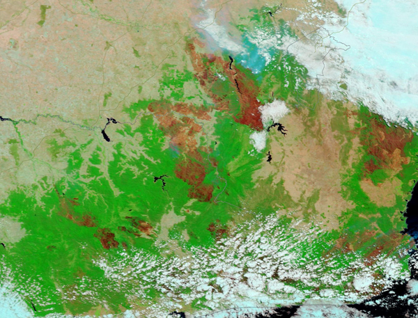
As Australia suffered under one of its worst droughts in decades and sweltered under a record-setting heatwave in December 2019, vegetation turned tinder-dry, setting the stage for the expansion of the annual bushfire season into a furnace-like inferno. Strong winds added to the spread of almost any spark and carried burning embers from growing fires into tinder-dry areas. The combination has proven to be one of the more horrific fire seasons on record, especially in southeastern Australia.
According to media reports, as of January 13, 2020, more than 17.9 million acres (7.3 million hectares) have been consumed by flame—an area larger than Denmark and Belgium combined. New South Wales has taken the brunt of the damage, with more than 12.1 million acres (4.9 million hectares) burned. At least 1,588 homes have been destroyed in that state.
On January 12, 2020, the Moderate Resolution Imaging Spectroradiometer (MODIS) on board NASA’s Terra satellite acquired a false-color image of large burn scars over just a portion of southeastern Australia. Most of the land in this image belongs to the state of Victoria, with just a small amount of New South Wales visible in the north.
In false-color images that use visible and near infrared light (bands 7,2,1 on the instrument), vegetation appears bright green, open land appears tan and fire scars appear may appear black, brown, or brick-red. The color variation in burn scars depends on type of vegetation burned, the completeness of the burn, the amount of residue remaining after the burn, and the age of the burn. In this image, vast burn scars are visible across most of the vegetated area, evidence of several very large fires. To give a sense of size of each fire, the U-shaped Lake Hume, which sits on the Murray River just to the west of the edge of vegetated area, has a surface area of 49,900 acres (10,190 hectares). The lake is dwarfed by the size of most of the fire scars.
A stunning roll-over comparison between the same area on January 4, 2019 and January 12, 2020 is available HERE,thanks to the Worldview application.
NASA's Earth Observing System Data and Information System (EOSDIS) Worldview application provides the capability to interactively browse over 700 global, full-resolution satellite imagery layers and then download the underlying data. Many of the available imagery layers are updated within three hours of observation, essentially showing the entire Earth as it looks "right now.”
Image Facts
Satellite:
Terra
Date Acquired: 1/12/2020
Resolutions:
1km (273.7 KB), 500m (683.6 KB), 250m (486.1 KB)
Bands Used: 7,2,1
Image Credit:
MODIS Land Rapid Response Team, NASA GSFC
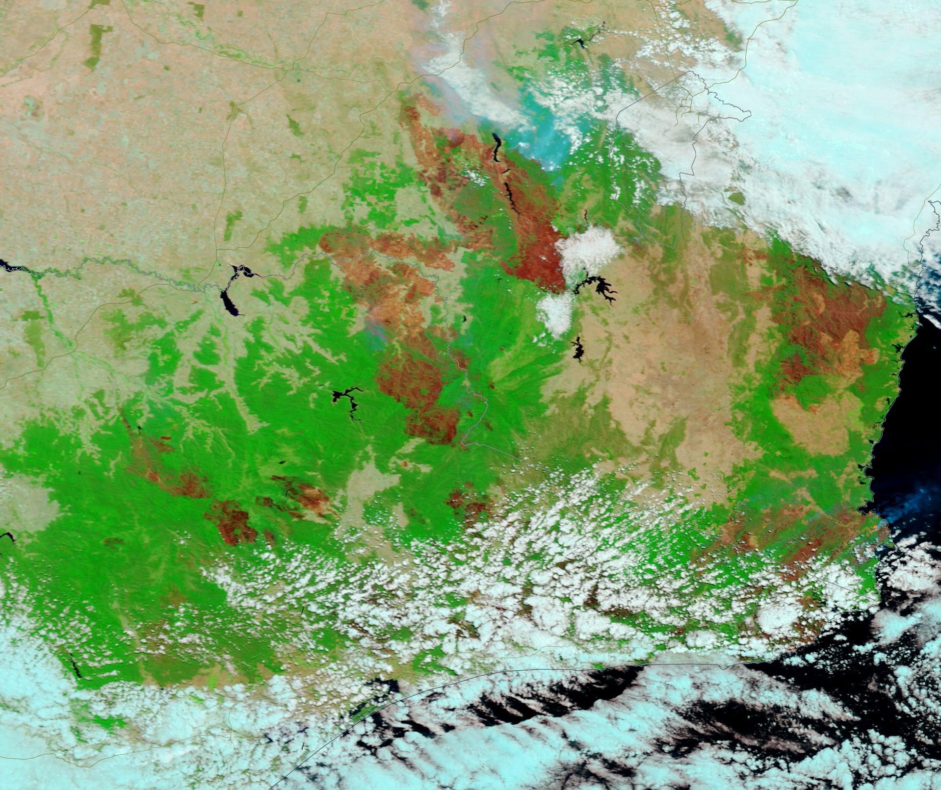
