
Images


February 10, 2020 - Europe
 Tweet
Tweet
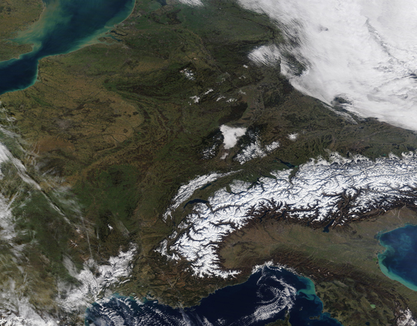
Studying the satellite record of images acquired of Europe reveals one obvious fact: Europe spends a lot of days under cloud cover. Except for relatively sunny Spain and Portugal, clouds regularly darken skies over the rest of Europe, particularly in winter when the jet stream often steers storm systems directly toward western Europe.
On February 2, 2020, the Moderate Resolution Imaging Spectroradiometer (MODIS) on board NASA’s Terra satellite acquired a nearly cloud-free image of much of Europe as it passed overhead.
Although a large bank of cloud in the northeast shrouds part of Germany and cloud also lays over western France, the sky between these areas was mostly clear. Starting in the southeast, a number of European countries can be seen: Italy, Switzerland, Liechtenstein, Austria, France, Germany, Luxembourg, Belgium, The Netherlands, and, across the English Channel, England. A slight haze hangs over Italy’s Po River Valley while the highlands of the Alps wear a blanket of thick snow. Low cloud (fog) hangs over Strasbourg, France as well as the Rhine River, which forms the border between France and Germany in this location.
Image Facts
Satellite:
Terra
Date Acquired: 2/7/2020
Resolutions:
1km (1.5 MB), 500m (4.6 MB), 250m (4 MB)
Bands Used: 2/7/2020
Image Credit:
MODIS Land Rapid Response Team, NASA GSFC
