
Images


February 17, 2020 - Tropical Cyclone Francisco over Madagascar
 Tweet
Tweet
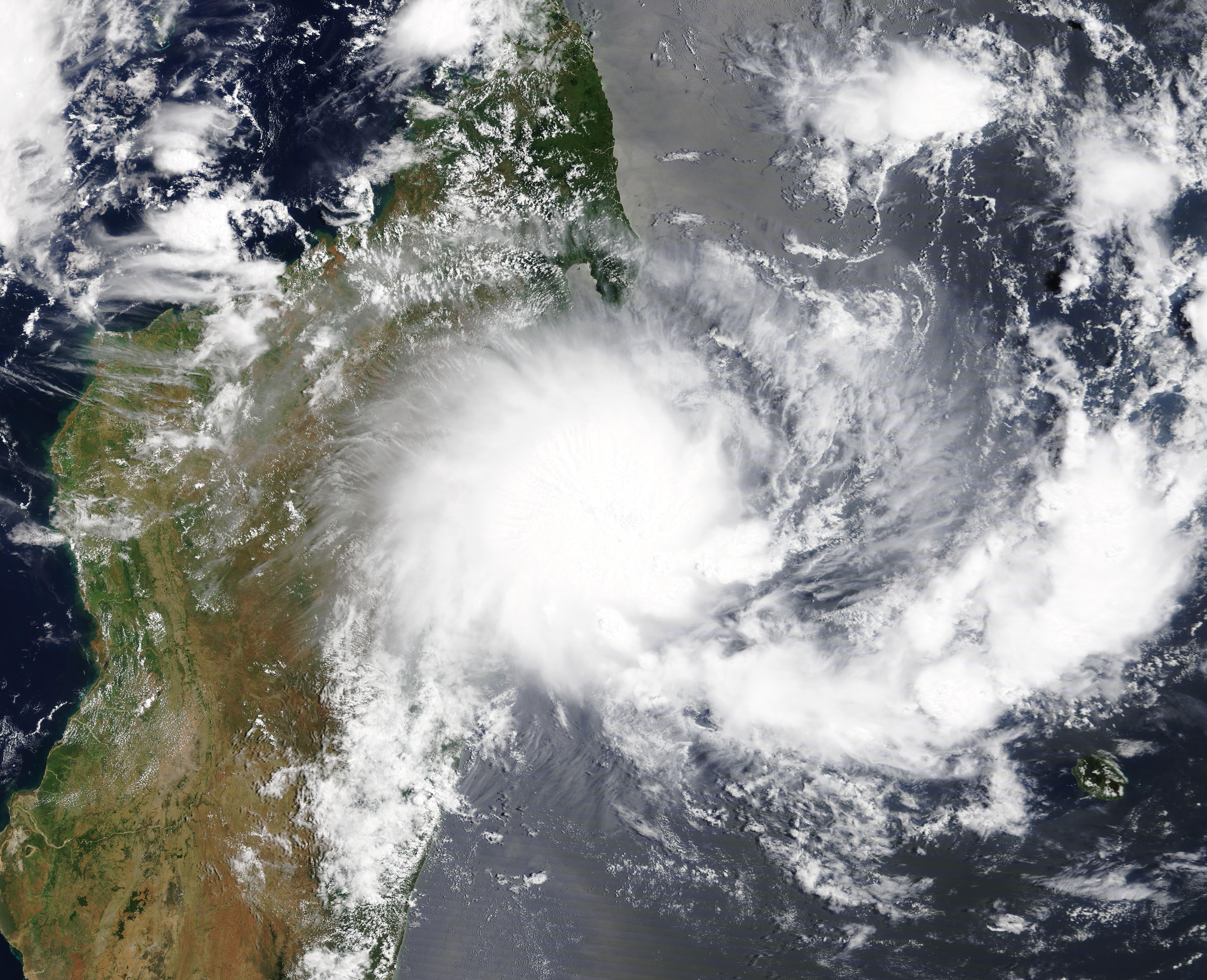
Tropical Cyclone Francisco was approaching landfall on Madagascar on February 13, 2020, when the Moderate Resolution Imaging Spectroradiometer (MODIS) on board NASA’s Terra satellite acquired a true-color image of the strengthening storm.
Francisco first became a Tropical Storm on February 5 but, after facing significant vertical wind shear, the storm was downgraded to a Zone of Disturbed Weather. Météo-France issued a final bulletin on February 7.
The storm reformed on February 13, and Relief Web reported that at 1 p.m. EST (18:00 UTC) its center was located approximately 53 km (33 mi) east of Toamasina City (Atsinanana Region) with maximum sustained winds of 74 km/h (119 mph). Twenty-four hours later, at 1 p.m. EST (18:00 UTC) on February 14, Tropical Cyclone Francisco made landfall over the southeast coast of the Atsinanana Region, close to Vatomandry City. Once making landfall, the storm weakened and dissipated the next day.
Image Facts
Satellite:
Terra
Date Acquired: 2/13/20202
Resolutions:
1km (1.4 MB), 500m (4 MB), 250m (3.3 MB)
Bands Used: 1,4,3
Image Credit:
MODIS Land Rapid Response Team, NASA GSFC
