
Images


February 18, 2020 - Cloud Streets over Lake Superior
 Tweet
Tweet
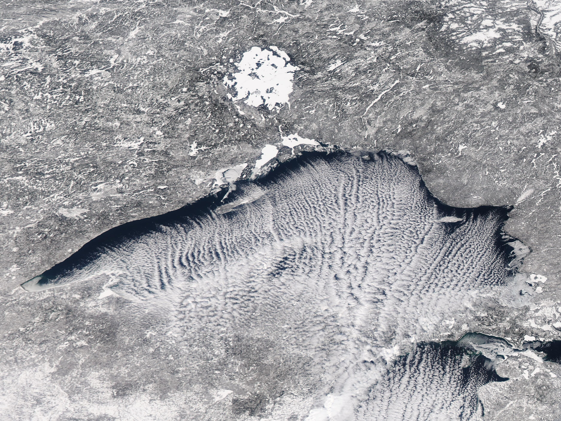
Long streaks of cloud were perfectly aligned with and parallel to a frigid north wind blowing over Lake Superior in mid-February 2020. The Moderate Resolution Imaging Spectroradiometer (MODIS) on board NASA’s Aqua satellite acquired a true-color image of the scene on February 13.
The line of cloud, known as “cloud streets", illustrate an Arctic blast as it sweeps over the region. Temperatures at Thunder Bay, Ontario, dropped to a high of 2°F (-16.7°C) on February 13 and a low of -28°F (-33.3°C) on February 14. Thunder Bay sits on the northern shore of Lake Superior.
Cloud streets are formed when thermals - or columns of warmer air - rise up through the atmosphere and lift the heat away from the surface of a sea - or a Great Lake. The moist air rises from the warmer body of water until it hits a warmer air layer. This air layer acts like a lid, causing the rising thermals to roll over on themselves, forming parallel cylinders of rotating air. On the upward side of the cylinders (rising air), water vapor condenses and forms clouds. Along the downward side (descending air), skies remain clear.
Image Facts
Satellite:
Aqua
Date Acquired: 2/13/2020
Resolutions:
1km (738 KB), 500m (2 MB), 250m (2 MB)
Bands Used: 1,4,3
Image Credit:
MODIS Land Rapid Response Team, NASA GSFC
