
Images


March 16, 2020 - Fires on Mainland Southeast Asia
 Tweet
Tweet
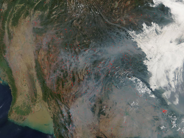
Smoke hung over much of Southeast Asia as fires burned across the region in mid-March 2020. The Moderate Resolution Imaging Spectroradiometer (MODIS) on board NASA’s Terra satellite acquired this true-color image on March 12.
This image captures many dozens of fires burning across Myanmar, Thailand, Laos, and Vietnam. Each red “hot spot” marks an area where the thermal bands on the instrument detected hot temperatures. When combined with typical smoke, as in this image, such hot spots are diagnostic for actively burning fire. There are many reasons that fires start, including weather-related causes such as lightning which can ignite dry trees and grasses. However, given the time of year, number of fires, and location, these are most likely fires that have been deliberately set to manage fields or for other agricultural reasons. At this time of year farmers in Southeast Asia light their fields on fire in order to clear them of detritus and to prepare them for the next growing season.
Image Facts
Satellite:
Terra
Date Acquired: 3/12/2020
Resolutions:
1km (260.8 KB), 500m (914.6 KB), 250m (3 MB)
Bands Used: 1,4,3
Image Credit:
MODIS Land Rapid Response Team, NASA GSFC
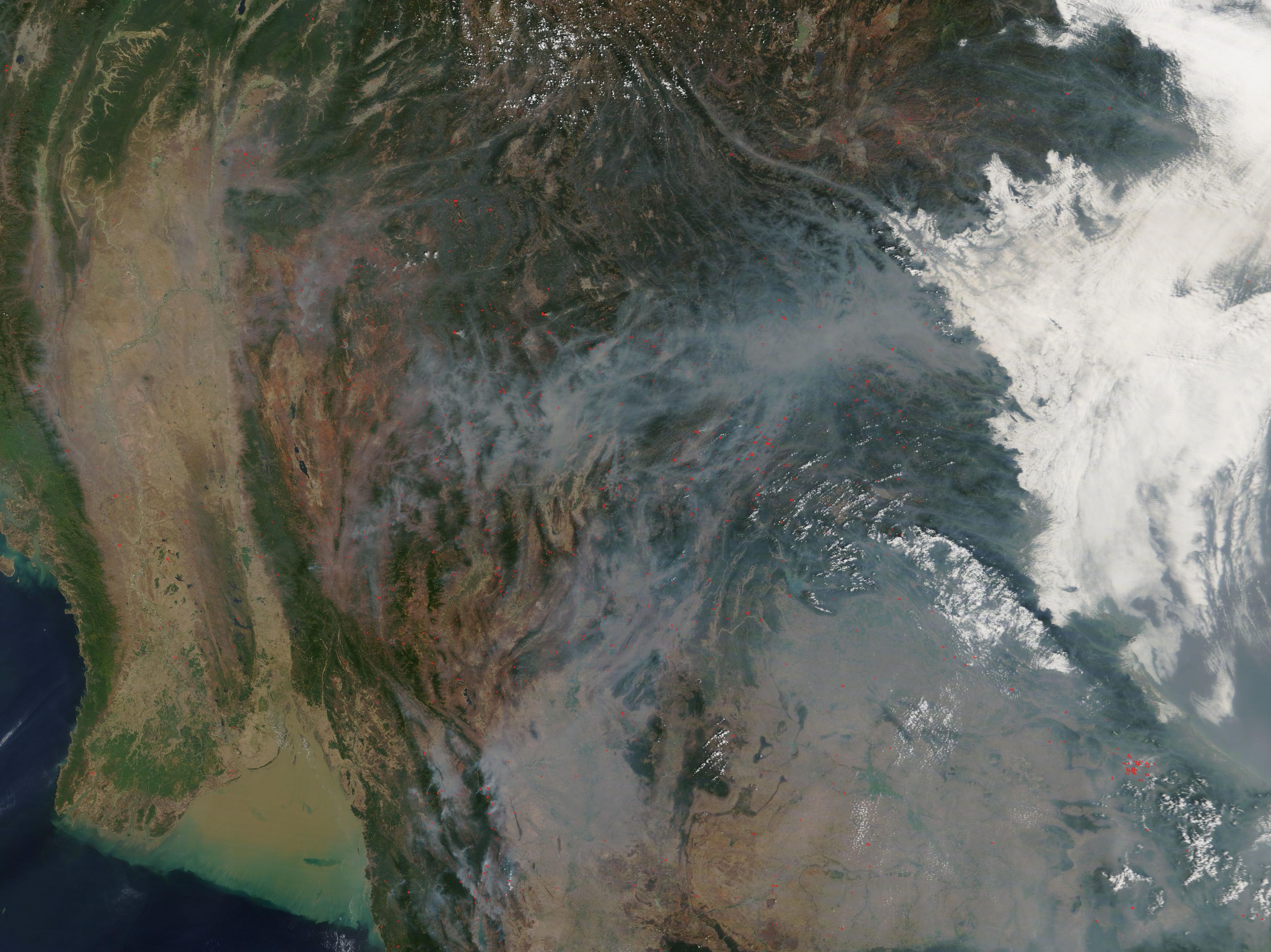
