
Images


April 7, 2020 - Tropical Cyclone Harold over Vanuatu
 Tweet
Tweet
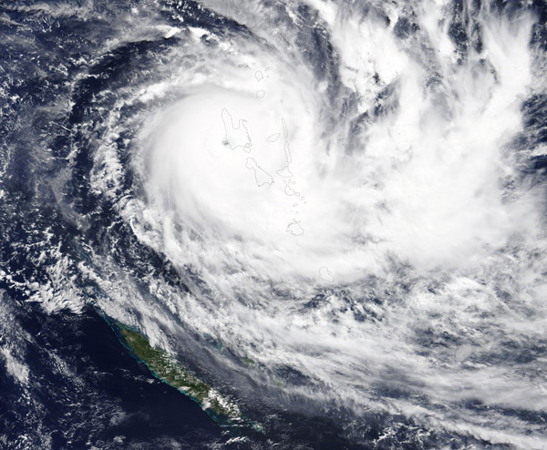
Powerful Tropical Cyclone Harold, the strongest yet recorded in 2020, made landfall on the southwestern coast of Espiritu Santo Island, Vanuatu on April 6 at about 0:00 UTC (April 5, 8:00 p.m. EST). By midday, the devastating storm carried maximum sustained wind of about 215 km/h (134 mph) making it a Category 4 storm based on the Saffir-Simpson Hurricane Wind Scale. Harold ripped roofs off of buildings, caused heavy flooding, and cut communication lines on the country’s largest two islands.
In the days before reaching Vanuatu, the cyclone caused several deaths as it passed south of the Solomon Islands and overthrew a ferry with almost 30 people on board. The storm is expected to reach Fiji by Wednesday.
On April 5, 2020, the Moderate Resolution Imaging Spectroradiometer (MODIS) on board NASA’s Terra satellite acquired a true-color image of Tropical Cyclone Harold’s center preparing to make landfall on Espiritu Santo.
The storm is expected to move east of Vanuatu by April 7. Until then, forecasters at the Vanuatu Meteorology and Geohazards Department warned of destructive storm-force winds with heavy rainfall and flash flooding near river banks and low-lying areas. As of the evening of April 6, widespread power outages on the island were preventing communication of early damage reports from the islands affected by Cyclone Harold.
The country, which was already under a state of emergency due to the COVID-19 pandemic, has lifted its social-distancing practices and removed restrictions on public gatherings to help people move to safe shelters and evacuation centers. However, humanitarian aid efforts have been slowed down by restrictions on international travel.
The last category 5 storm to hit Vanuatu was Cyclone Pam in 2015. The storm caused widespread damages and losses equivalent to nearly two-thirds of the country’s gross domestic product.
Image Facts
Satellite:
Terra
Date Acquired: 4/6/2020
Resolutions:
1km (519.3 KB), 500m (1.6 MB), 250m (3.2 MB)
Bands Used: 1,4,3
Image Credit:
MODIS Land Rapid Response Team, NASA GSFC
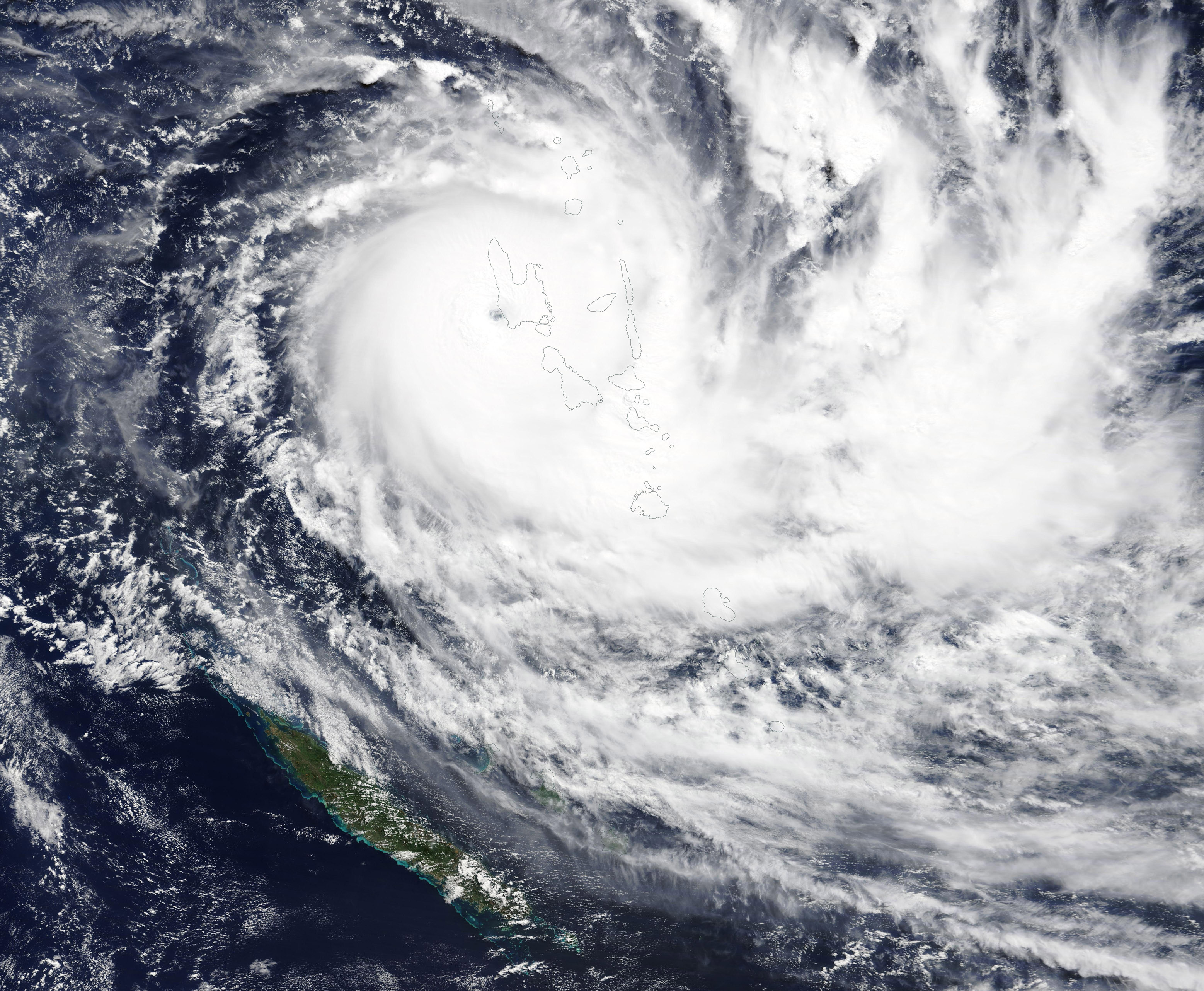
