Images
May 1, 2020 - Río de la Plata
Tweet
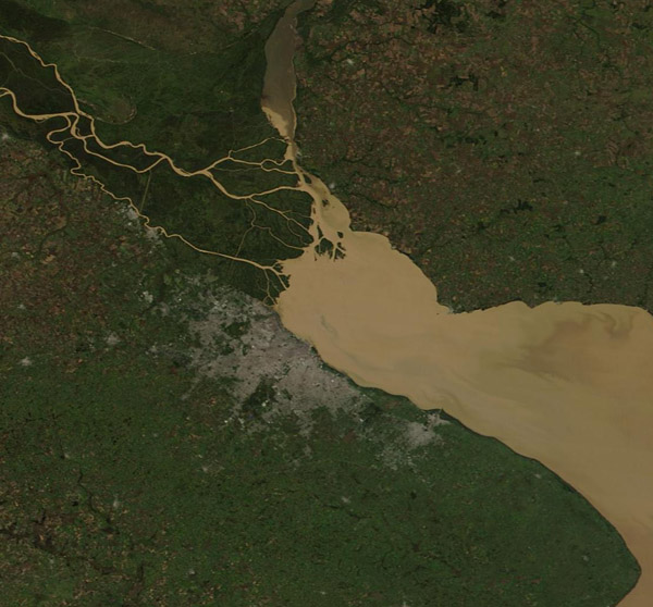
On April 29, 2020, the Moderate Resolution Imaging Spectroradiometer (MODIS) on NASA’s Terra satellite acquired a stunning true-color image of the sediment-laden waters of the Rio de la Plata.
Situated on South America’s eastern coast, the funnel-shaped Rio de la Plata receives water from a drainage area that covers roughly one-fifth of the continent. This occurs primarily through two major rivers: The Parana and the Uruguay. The Parana, seen in the west of this image, supplies about three-quarters of the fresh water to the Rio de la Plata. Near its terminus the Parana stretches across a fertile delta filled with plants and bird life to reach the Uruguay River as waters from both pour into the estuary. Both rivers gather sediment and they flow across agricultural fields on their courses across the continent.
Image Facts
Satellite:
Terra
Date Acquired: 4/29/2020
Resolutions:
1km (69.8 KB), 500m (223.4 KB), 250m (1013.3 KB)
Bands Used: 1,4,3
Image Credit:
MODIS Land Rapid Response Team, NASA GSFC


