
Images


May 20, 2020 - Hudson Bay
 Tweet
Tweet
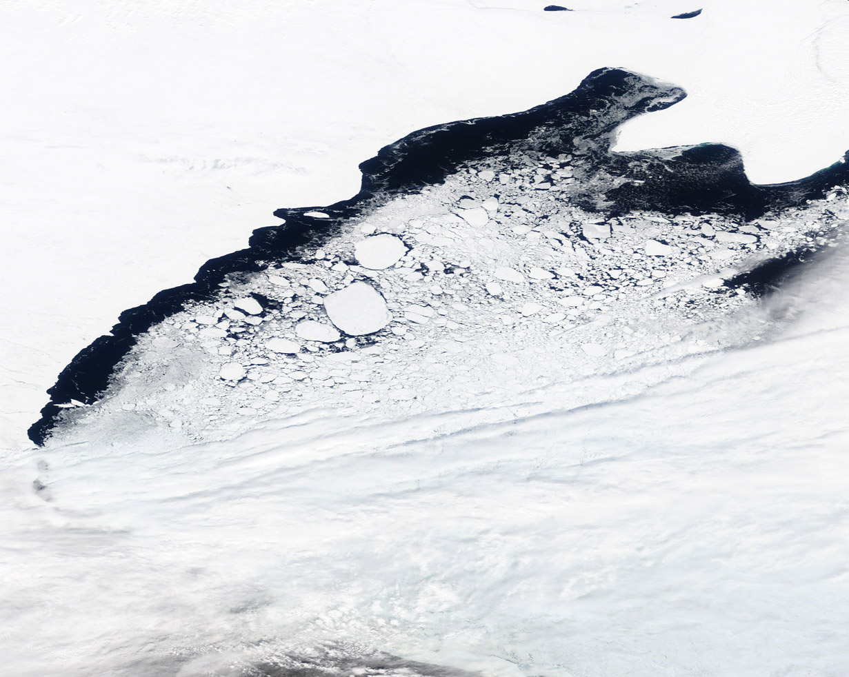
Each winter the waters of Hudson Bay carry a thick cap of ice, which typically begins to melt in late May to early June. The first signs of melting ice begin in the coastal regions to the northwest and northeast, and in James Bay, at the southern tip of Hudson Bay. Because of currents and the flow of wind, ice lingers longest along the southwestern coast.
On May 18, 2020 the Moderate Resolution Imaging Spectroradiometer (MODIS) on board NASA’s Terra satellite acquired a true-color image of spring ice melt in Hudson Bay. The image centers on the ice in northwestern Hudson Bay. Bright white snow covers the territory of Nunavut, Canada in the northwest. Fast ice clings to the coast, creating a stark contrast to the dark-colored open water. As sea ice melts, fissures form and then rupture, creating blocks of free-floating ice. As these are stirred by currents and blown by wind, the waters are soon covered in a slurry of various sizes of floating ice. A blanket of cloud covers the southwestern (lower right) of this image.
Image Facts
Satellite:
Terra
Date Acquired: 5/18/2020
Resolutions:
1km (290.8 KB), 500m (752.2 KB), 250m (1.5 MB)
Bands Used: 1,4,3
Image Credit:
MODIS Land Rapid Response Team, NASA GSFC
