
Images


July 25, 2020 - James Bay
 Tweet
Tweet
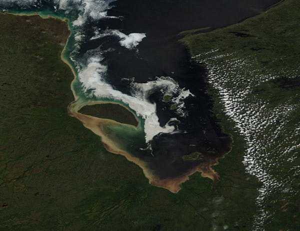
A thin layer of winter’s sea ice lingered near the western shore of James Bay in mid-July, 2020. The Moderate Resolution Imaging Spectroradiometer (MODIS) on board NASA’s Terra satellite acquired this true-color image on July 13.
James Bay sits at the southern end of Hudson Bay, with the Quebec-Ontario border touching the bottom of the bay. The islands, including the large Akimiski Island, within the Bay are administered by the territory of Nunavut, Canada. The shallow bay has an average depth of less than 200 feet (60 meters) and stretches 275 miles (443 km) southward and 135 miles (217 km) across. Each year, these waters cycle through periods of ice followed by open water. By August the thick sea ice of winter has usually melted completely, only to begin to freeze again as temperatures drop in October and November.
Image Facts
Satellite:
Terra
Date Acquired: 7/13/2020
Resolutions:
1km (150.4 KB), 500m (381.2 KB), 250m (773.2 KB)
Bands Used: 1,4,3
Image Credit:
MODIS Land Rapid Response Team, NASA GSFC
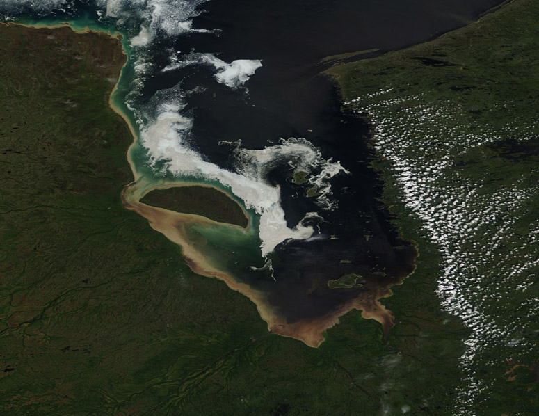
