
Images


July 27, 2020 - Lincoln Sea
 Tweet
Tweet
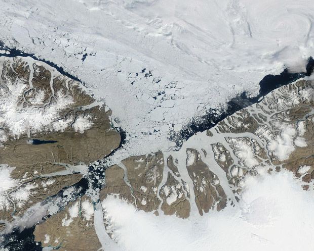
Areas of ice-free blue water peeked through a layer of melting sea ice and edged the coasts of Greenland and Canada in mid-July, 2020. The Moderate Resolution Imaging Spectroradiometer (MODIS) on board NASA’s Aqua satellite acquired a true-color image of summer sea ice melt over the Lincoln Sea on July 16.
A part of the Arctic Ocean, the Lincoln Sea stretches between Cape Columbia, Canada (west) to Cape Morris Jesup, Greenland in the east. During the frigid winter, thick sea ice forms over the entire Lincoln Sea. Some of the thickest ice in the Arctic Ocean, measuring up to 49 feet (15 meters) thick, floats atop these waters in mid-winter. While ice breaks up, especially in the south, during summer, some sea ice remains over the Lincoln Sea year-round. The passage in the south, the Robeson Channel, leads to the Nares Strait and provides a channel for movement of ice and chilly Arctic Ocean currents southward.
Image Facts
Satellite:
Aqua
Date Acquired: 7/16/2020
Resolutions:
1km (134.8 KB), 500m (425 KB), 250m (741.6 KB)
Bands Used: 1,4,3
Image Credit:
MODIS Land Rapid Response Team, NASA GSFC
