
Images


August 8, 2020 - Spectacular clouds off of Madagascar
 Tweet
Tweet
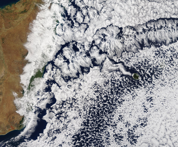
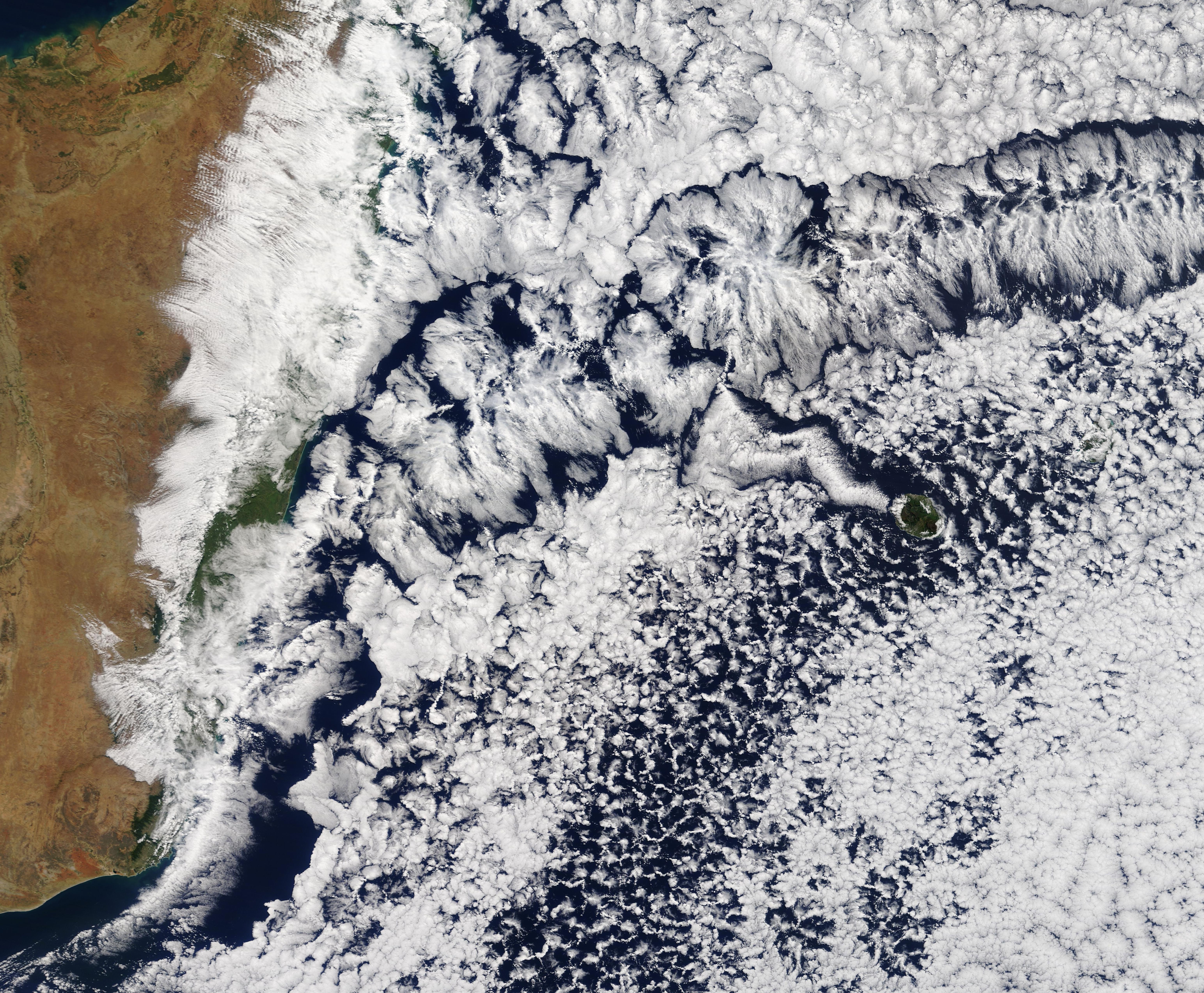
The skies off the coast of Madagascar sported a richly-textured coating of cloud in early August 2020. The Moderate Resolution Imaging Spectroradiometer (MODIS) on board NASA’s Terra satellite acquired a true-color image of the stunning scene on August 4.
The beautifully complex patterns are drawn in a layer of marine stratocumulus cloud – one of the most common types of cloud to stretch across offshore oceans.
There are both “open-cell” and “closed-cell” stratocumulus clouds filling the sky. The cloud “cells” are formed in a hexagonal pattern much like a honeycomb. Open-cell clouds look like empty compartments, where one can see the white honeycomb-like structure with blue ocean underneath. Closed-cell cloud appears fluffier, as if they are stuffed with white.
In "closed" cells, warm air is rising in the center, and sinking around the edges, so clouds appear in cell centers, but evaporate around cell edges. This produces cloud formations like those that dominate in the upper and lower right sections of this image. The reverse flow can also occur - air can sink in the center of the cell and rise at the edge. This process is called "open cell" convection, and clouds form at cell edges around open centers, which creates a lacy, hollow-looking pattern like the clouds that dominate across most of the lower section of the image.
Closed- and open- cell convection represent two stable atmospheric configurations — two sides of the convection coin. But what determines which path the "boiling" atmosphere will take? Apparently, the process is highly chaotic, and there appears to be no way to predict whether convection will result in open or closed cells. Indeed, the atmosphere may sometimes flip between one mode and another in no predictable pattern.
Banks of open- or closed- cell clouds usually occur where the wind is fairly calm and stable. Where air moves more rapidly or turbulently, the clouds can take on even more complex patterns. The streak filled with gorgeous lace-like patterns may be created by turbulent air, as it stretches hundreds of miles across the Indian Ocean to an area that appears to be a system forming well away from Madagascar. A snake-like curving streak of cloud has formed on the leeward side of Reunion Island, cutting across open-cell stratocumulus cloud, thanks to the motion of the wind as it is deflected by, and travels past, the tall face of the island.
Image Facts
Satellite:
Terra
Date Acquired: 8/4/2020
Resolutions:
1km (768.1 KB), 500m (2.3 MB), 250m (4.6 MB)
Bands Used: 8/4/2020
Image Credit:
MODIS Land Rapid Response Team, NASA GSFC
