
Images


August 9, 2020 - Lake Winnepeg
 Tweet
Tweet
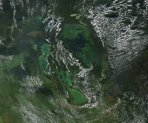
Sitting in northeastern Manitoba, Canada, Lake Winnipeg stretches 271 mi (436 km) from north to south and covers an area of about 9,170 square miles (23,750 sq km), making it the 11th-largest freshwater lake on Earth. This is hardly the only lake in Manitoba – according to the World Atlas, Manitoba lays claim to 110,000 lakes – but it certainly is the heartbeat of the province. Permanent home to about 23,000 people who live in 30 communities along its shoreline, the lake’s waters and beaches are an essential heartbeat for Manitoba, providing recreation, tourism dollars, and hydroelectric power generation.
On August 3, 2020, the Moderate Resolution Imaging Spectroradiometer (MODIS) on board NASA’s Aqua satellite acquired a true-color image centered on Lake Winnipeg, showing swirls of green within the waters of the lake. These swirls are likely caused by algae, which frequently blooms in the lake, especially in the heat of summer. While algae occur naturally in the lake, heavy growth is spurred by high levels of phosphorus and nitrogen that pour into the lake each year, primarily from human activity within the drainage basin. These serve as fertilizers and can fuel substantial blooms, including harmful algae blooms (HAB) which can be toxic to life in the lake and for people who wish to use or drink the waters.
Near the northeast end of the lake, brown sediment sits in several small lakes near Lake Winnipeg. To the southeast, the long, thin Lake Winnipegosis hosts a heavy algae bloom, as does Lake Manitoba, which begins near the south end of Lake Winnipegosis.
Image Facts
Satellite:
Aqua
Date Acquired: 8/3/2020
Resolutions:
1km (237.1 KB), 500m (575.1 KB), 250m (1 MB)
Bands Used: 1,4,3
Image Credit:
MODIS Land Rapid Response Team, NASA GSFC
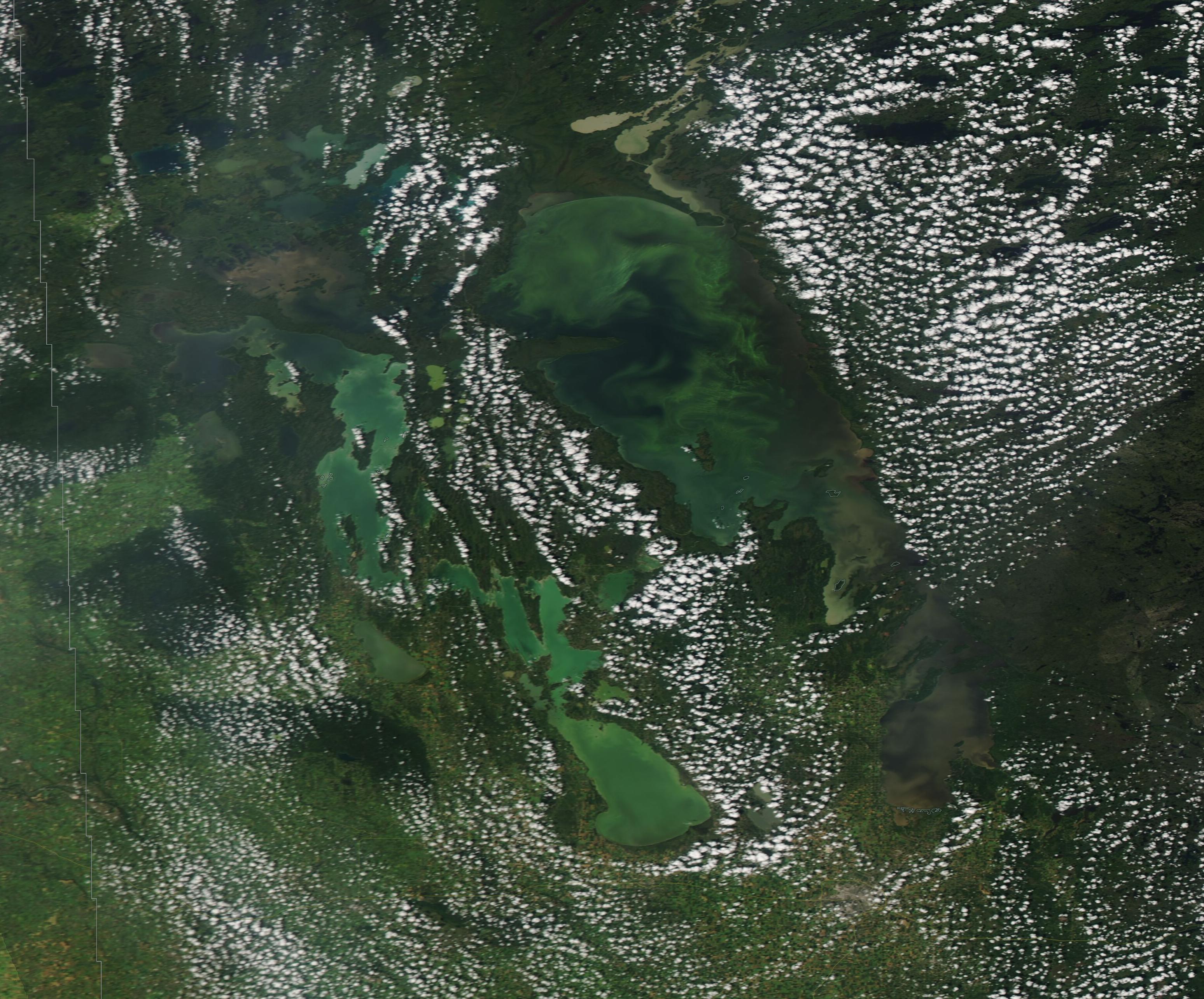
