
Images


September 21, 2020 - Clouds surround the Galapagos Islands
 Tweet
Tweet
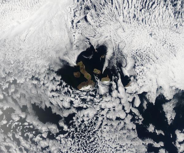
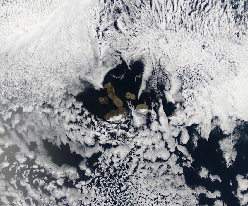
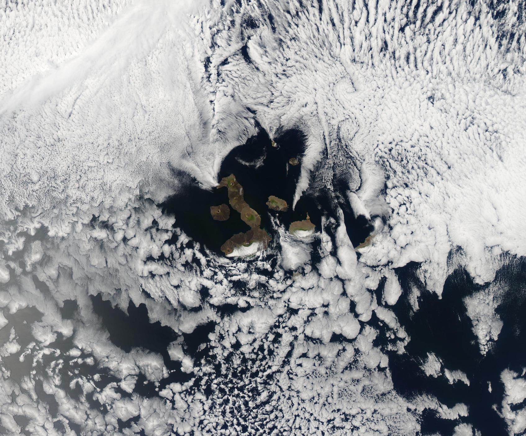
Often called the “Enchanted Islands”, the 19 volcanic islands that make up Ecuador’s Galapagos Islands sit about 1,000 km (621 mi) from the South American Continent and at the confluence of three ocean currents. The extreme isolation of the islands helped create unique species, many of which are found nowhere else on Earth, including the wide variety of finch that inspired Charles Darwin’s theory of evolution by natural selection.
The islands are often cloud-shrouded, especially in the dry season (garúa) which typically runs from June to November. This is when the trade winds blow more strongly and the Humboldt and Cromwell Undercurrent are the predominant currents. These cooler currents are accompanied by cooler air, which frequently results in the formation of an inversion layer – a layer of warmer air that traps cooler air underneath. The moisture that evaporates from the ocean is trapped within this inversion layer (300 to 600 meters (984-1968 feet) above sea level, creating low cloud. The higher mountain elevations sit within the cloud layer and receive rain, often in the form of mist (garúa means mist), while the lower elevations remain dry.
On September 17, 2020, the Moderate Resolution Imaging Spectroradiometer (MODIS) on board NASA’s Terra satellite acquired a true-color image of clouds around the Galapagos Islands. While most of the islands remain in sunny skies, the eastern slopes of Isla Isabella (west) and Isla Santa Cruz (east) lie under the mist-filled clouds. Isla San Cristobal, in the southeast, is completely covered in cloud.
Image Facts
Satellite:
Terra
Date Acquired: 9/17/2020
Resolutions:
1km (140.7 KB), 500m (462.6 KB), 250m (1.3 MB)
Bands Used: 1,4,3
Image Credit:
MODIS Land Rapid Response Team, NASA GSFC
