
Images


October 16, 2020 - California Burn Scars
 Tweet
Tweet
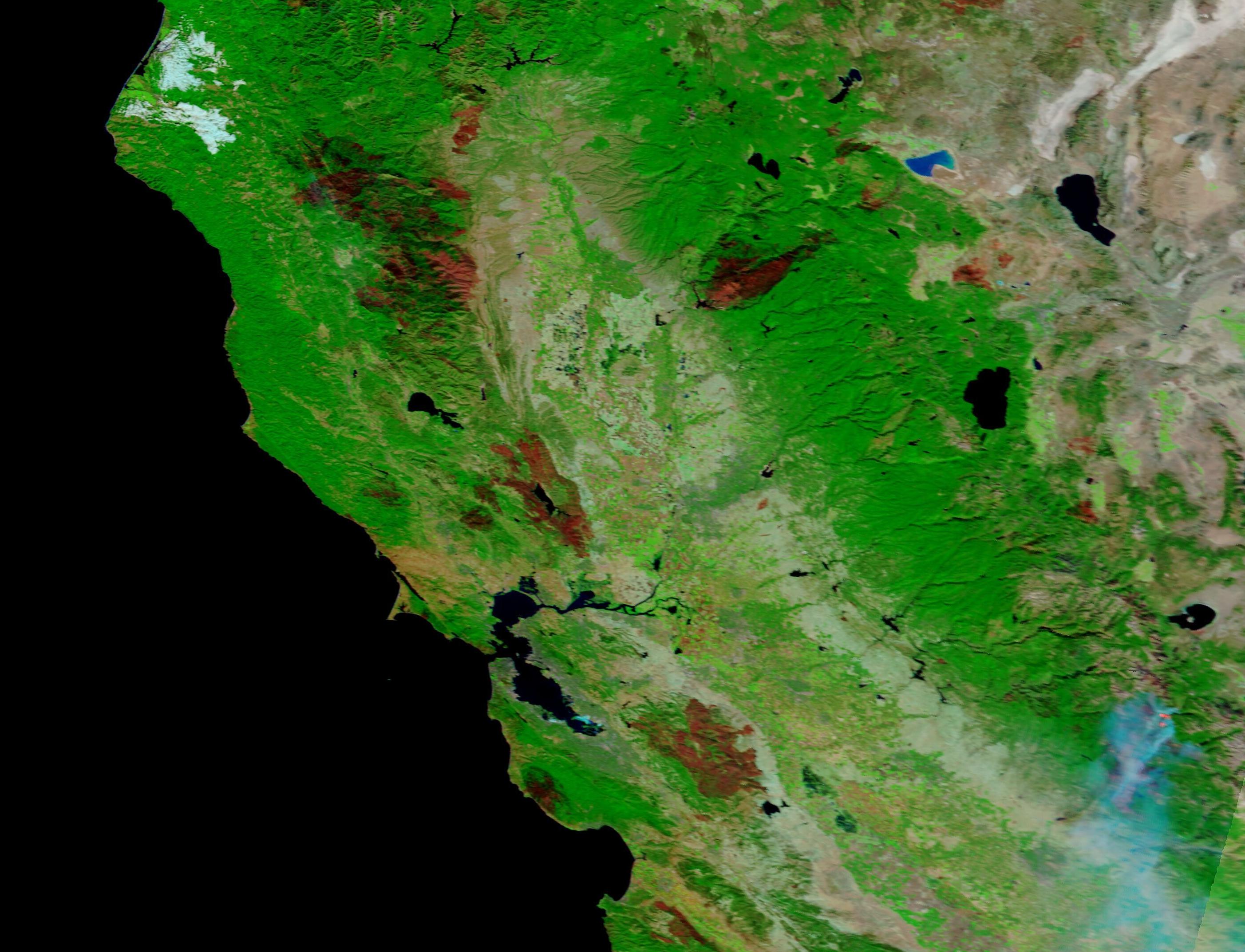
California’s wildfire season had left extensive scars across the land by October 2020. On October 8, the Moderate Resolution Imaging Spectroradiometer (MODIS) on board NASA’s Terra satellite acquired a false-color image of two large scars near San Francisco Bay.
The blazes that left these scars ignited in what is known as the “August Lightning Siege of 2020”. The LNU Lightning Complex sits in the north, near Santa Rosa. It ignited on August 17 and had consumed 363,220 acres before it had been extinguished on October 2. To the south, the SCU Lightning Complex burned 396,624 acres between August 18, when it began, and containment on October 1.
The false-color image uses a combination of visible and infrared light to better visualize the burn scars by making them easier to see against the vegetation. Burned areas appear brown, black, and brick red while and unburned vegetation appears bright green.
Image Facts
Satellite:
Terra
Date Acquired: 10/14/2020
Resolutions:
1km (194.3 KB), 500m (194.3 KB), 250m (558 KB)
Bands Used: 7,2,1
Image Credit:
MODIS Land Rapid Response Team, NASA GSFC
