
Images


October 20, 2020 - Sediment in the northern Persian Gulf
 Tweet
Tweet
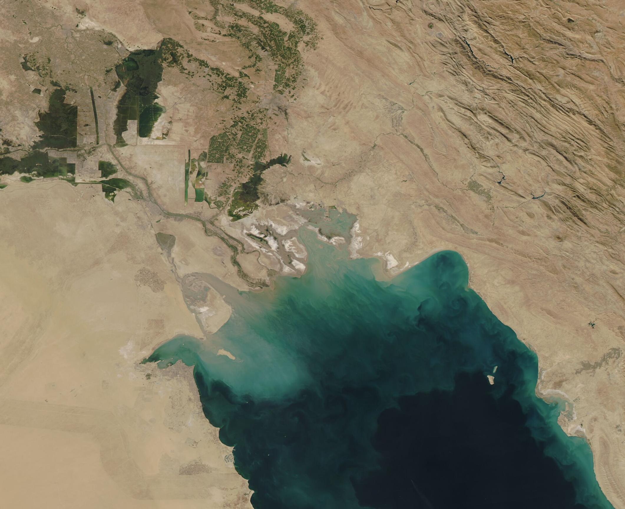
On October 19, 2020, the Moderate Resolution Imaging Spectroradiometer (MODIS) on board NASA’s Aqua satellite acquired a true-color image of sediment flowing into the northern Persian Gulf. As sediment pours into the Gulf, it lays near the surface of the water and appears muddy tan. As the sediment sinks, the reflectivity changes and it then appears green or turquoise when seen from space.
Much of the sediment clouding the blue waters of the Gulf comes from the Shatt al-Arab River, which is visible as a muddy curving line along the border between Iran (east) and Iraq (west). The Shatt al-Arab is formed by the confluence of the Euphrates and Tigris Rivers of Iraq and the Karun River of Iran. It is the main source of freshwater to the northern Persian Gulf and, along with the associated marshes (seen as dark green areas) provide nutrients, sediment, and pollutants, making the river profoundly important to the northern Gulf ecosystem.
Image Facts
Satellite:
Aqua
Date Acquired: 10/19/2020
Resolutions:
1km (33.1 KB), 500m (115.3 KB), 250m (355.1 KB)
Bands Used: 1,4,3
Image Credit:
MODIS Land Rapid Response Team, NASA GSFC
