
Images


November 2, 2020 - Cold and Clouds over Canada
 Tweet
Tweet
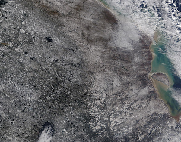
In late October 2020, frigid wind swept across northern Ontario, Canada, painting the landscape with a splash of seasonal snow. The first accumulating snow of the season began on October 18 across parts of northern and western Ontario, according to the Weather Network. High temperatures tumbled from a high of 61˚F (20˚C) early in the month to the low 20’s by month’s end as passing cold fronts brought gusting winds and snow.
The Moderate Resolution Imaging Spectroradiometer (MODIS) acquired a true-color image of the winter-like scene on October 29. Highly reflective white snow can be seen dusted across the green landscape of northern Ontario while streaks of cloud brush across far northern section of the image and across the sediment-laden waters of Hudson Bay, in the east. Streaks of cloud also can be seen over Lake Nipigon, in the south. This area had been covered in cloud nearly continuously since October 20.
Image Facts
Satellite:
Terra
Date Acquired: 10/29/2020
Resolutions:
1km (320.7 KB), 500m (1.2 MB), 250m (3 MB)
Bands Used: 1,4,3
Image Credit:
MODIS Land Rapid Response Team, NASA GSFC
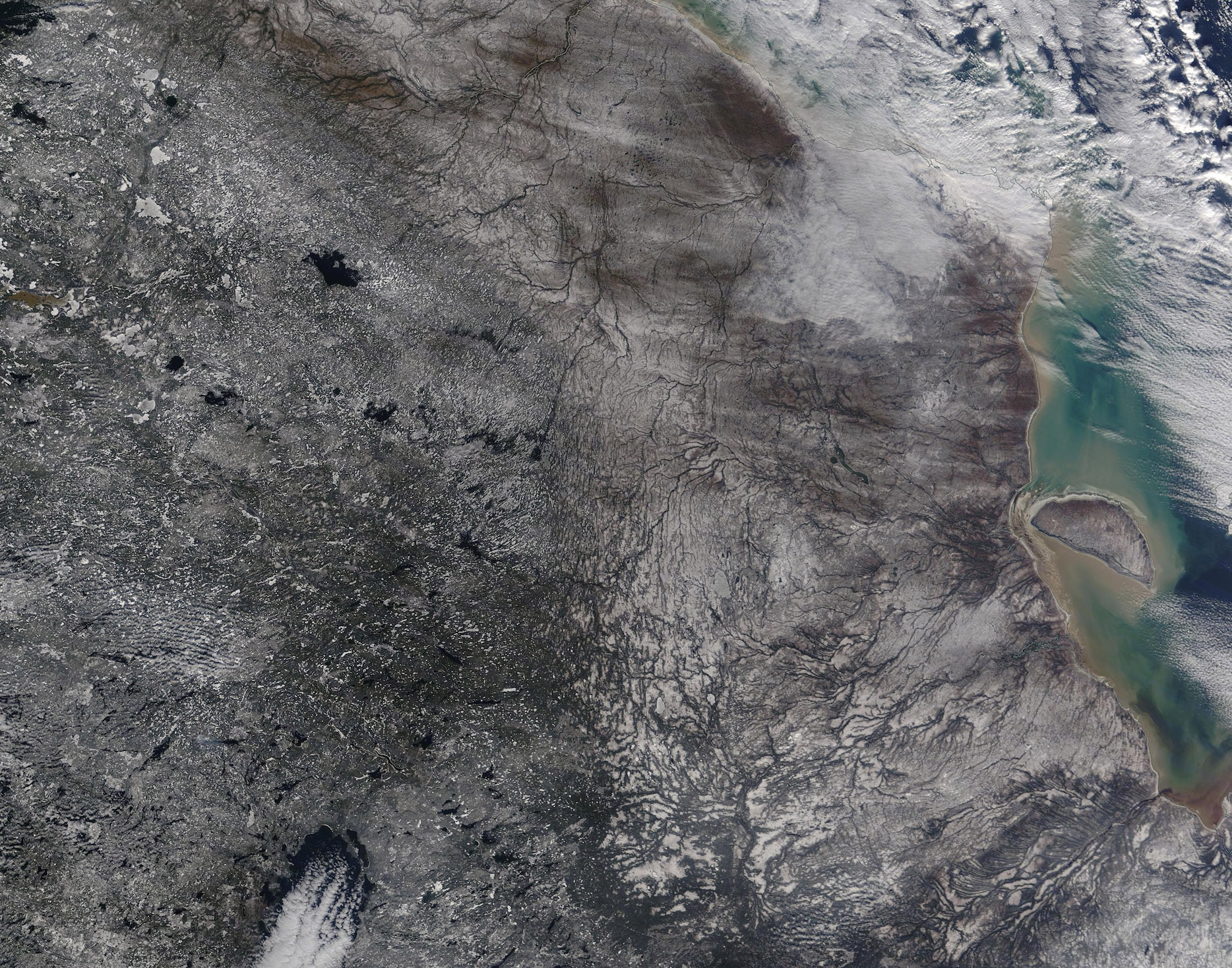
