
Images


November 10, 2020 - Brahmaputra River
 Tweet
Tweet
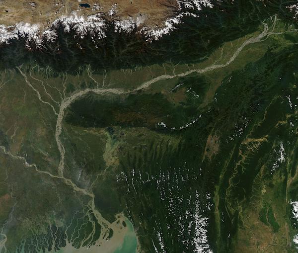
One of the major rivers of Asia, the Brahmaputra begins in the snowpack and glaciers high on the Tibetan Plateau and Himalaya Mountains before winding about 2,880 km (1,800 miles) to reach the Bay of Bengal. About 1,625 km (1,009 mi) of the river’s course lies in China (Tibet), 918 km (570 mi) in India, and about 337 km (209 mi) flows through Bangladesh.
The large river, sometimes called a “moving ocean” due to the large amount of water it carries, is made up of many small channels that meander and change over time. The river builds up bars as sediment from the mountains spill onto slow-moving sections, while new channels are cut by seasonal high flow from spring snowmelt or monsoonal rains. The resulting river is beautifully braided, with many small channels weaving back and forth along the length of the Brahmaputra.
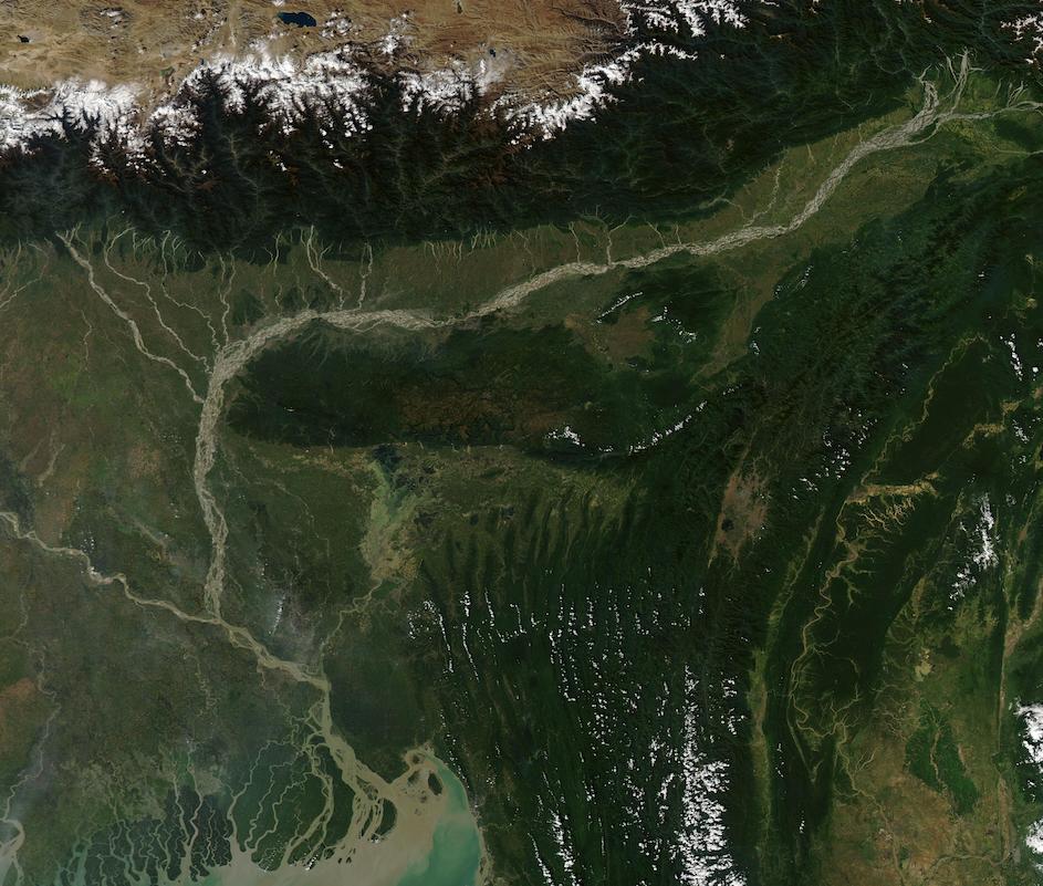
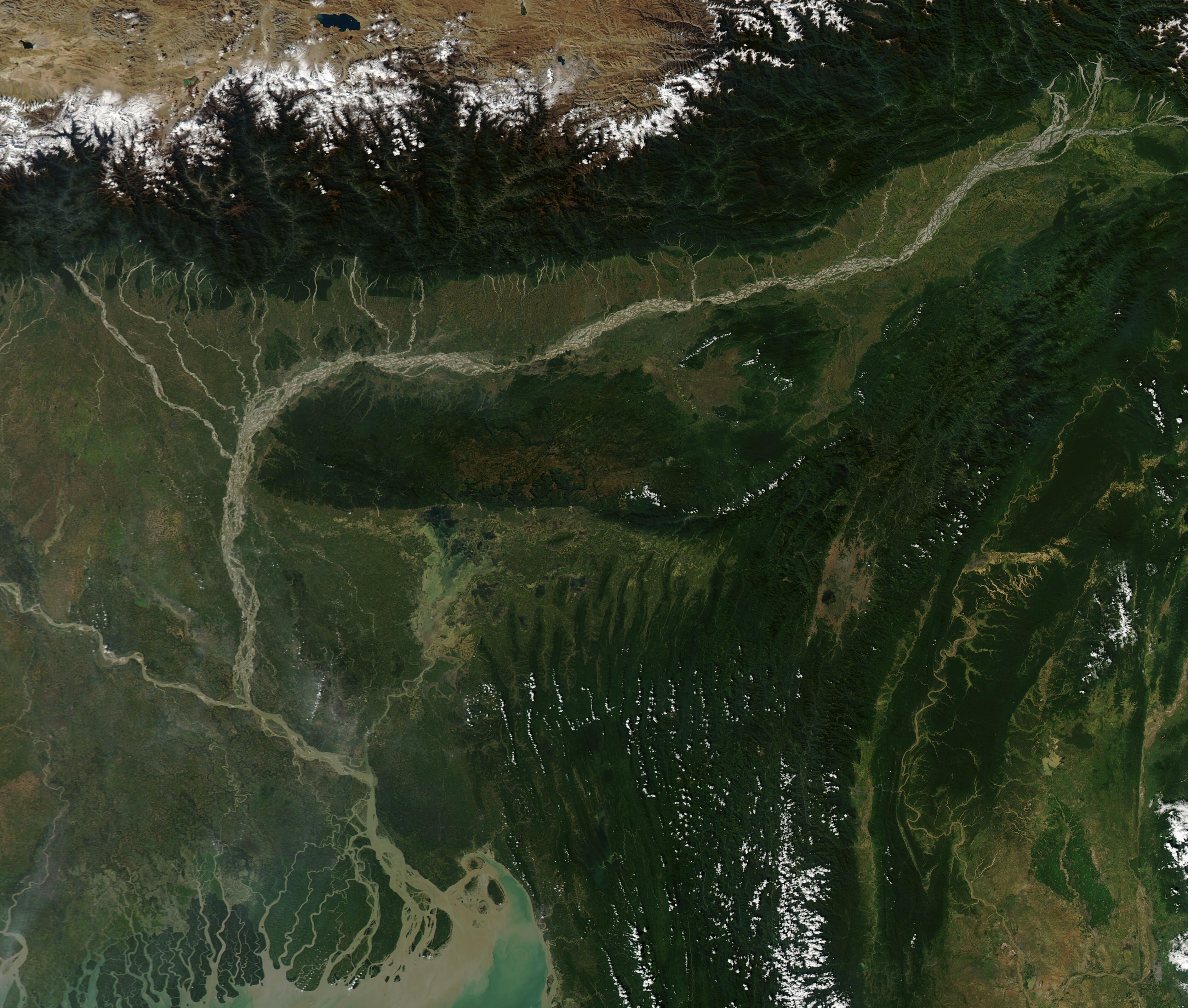
On November 9, 2020, the Moderate Resolution Imaging Spectroradiometer (MODIS) on board NASA’s Aqua satellite acquired a gorgeous true-color image of the Brahmaputra River. The semi-arid Tibetan Plateau (northwest) butts up to the Himalayas, which are snow-capped on the northern slopes and lushly green with vegetation in the south. As the Brahmaputra winds along the valley at the foot of the Himalayas, many sediment-filled rivers join the braided river.
As the Brahmaputra approaches the border between India and Bangladesh, it turns southward. The Ganges River, flowing from the west, joins the Brahmaputra shortly before it splits into many large channels before spilling into the Bay of Bengal.
Image Facts
Satellite:
Aqua
Date Acquired: 11/9/2020
Resolutions:
1km (140.6 KB), 500m (510.1 KB), 250m (1.6 MB)
Bands Used: 1,4,3
Image Credit:
MODIS Land Rapid Response Team, NASA GSFC
One of the major rivers of Asia, the Brahmaputra begins in the snowpack and glaciers high on the Tibetan Plateau and Himalaya Mountains before winding about 2,880 km (1,800 miles) to reach the Bay of Bengal. About 1,625 km (1,009 mi) of the river’s course lies in China (Tibet), 918 km (570 mi) in India, and about 337 km (209 mi) flows through Bangladesh.
The large river, sometimes called a “moving ocean” due to the large amount of water it carries, is made up of many small channels that meander and change over time. The river builds up bars as sediment from the mountains spill onto slow-moving sections, while new channels are cut by seasonal high flow from spring snowmelt or monsoonal rains. The resulting river is beautifully braided, with many small channels weaving back and forth along the length of the Brahmaputra.
On November 9, 2020, the Moderate Resolution Imaging Spectroradiometer (MODIS) on board NASA’s Aqua satellite acquired a gorgeous true-color image of the Brahmaputra River. The semi-arid Tibetan Plateau (northwest) butts up to the Himalayas, which are snow-capped on the northern slopes and lushly green with vegetation in the south. As the Brahmaputra winds along the valley at the foot of the Himalayas, many sediment-filled rivers join the braided river.
As the Brahmaputra approaches the border between India and Bangladesh, it turns southward. The Ganges River, flowing from the west, joins the Brahmaputra shortly before it splits into many large channels before spilling into the Bay of Bengal.
Image Facts
Satellite:
Aqua
Date Acquired: 11/9/2020
Resolutions:
1km (140.6 KB), 500m (510.1 KB), 250m (1.6 MB)
Bands Used: 1,4,3
Image Credit:
MODIS Land Rapid Response Team, NASA GSFC
