
Images


November 16, 2020 - The Orange River
 Tweet
Tweet
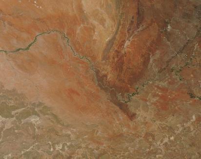
The Orange River twists through more than 1,367 miles (2,200 km) of South Africa’s stunning landscape, carrying life-giving water to the veld and the southern limits of the Kalahari and Namib Deserts. Rising from the Drakensberg Mountains in Lesotho, the Orange flows westward to spill into the Atlantic Ocean. The waters are vital to support agriculture, industry, recreation, tourism, energy production, and drinking water across South Africa.
On November 13, 2020, the Moderate Resolution Imaging Spectroradiometer (MODIS) on board NASA’s Terra satellite acquired a true-color image of the Orange River as it transverses the stunning ochres, reds, and tans of Northern Cape Province in South Africa. The blue waters are outlined in green, marking areas where the water feeds vegetative growth. Dark green areas that line the river east of the Korannaberg and Asbesberge Mountains marks irrigated agriculture, where crops such as table grapes, cotton, groundnuts, wheat, and maize are grown.
Near the eastern edge of the image, the Vaal River flows southwestward to join the Orange River, which flows northwestward to meet it. It is in this general area, between the Orange and the Vaal, that the discovery of diamonds triggered the rapid growth of an industry that made South Africa famous—and a few people extremely rich. The first diamond was found along the banks of the Orange near Hopetown (east of this image) in 1866. In 1869, the 83.5 carat Star of South Africa was unearthed near the confluence of the Orange and Vaal. Not far to the north, a rich trove of diamonds on lands owned by the DeBeers family encouraged thousands to dug in an area that became known as the Kimberly Mine. Also called the “Big Hole” after deep excavation, the mine was closed in 1914.
Image Facts
Satellite:
Terra
Date Acquired: 11/13/2020
Resolutions:
1km (19.3 KB), 500m (69.4 KB), 250m (214.2 KB)
Bands Used: 1,4,3
Image Credit:
MODIS Land Rapid Response Team, NASA GSFC
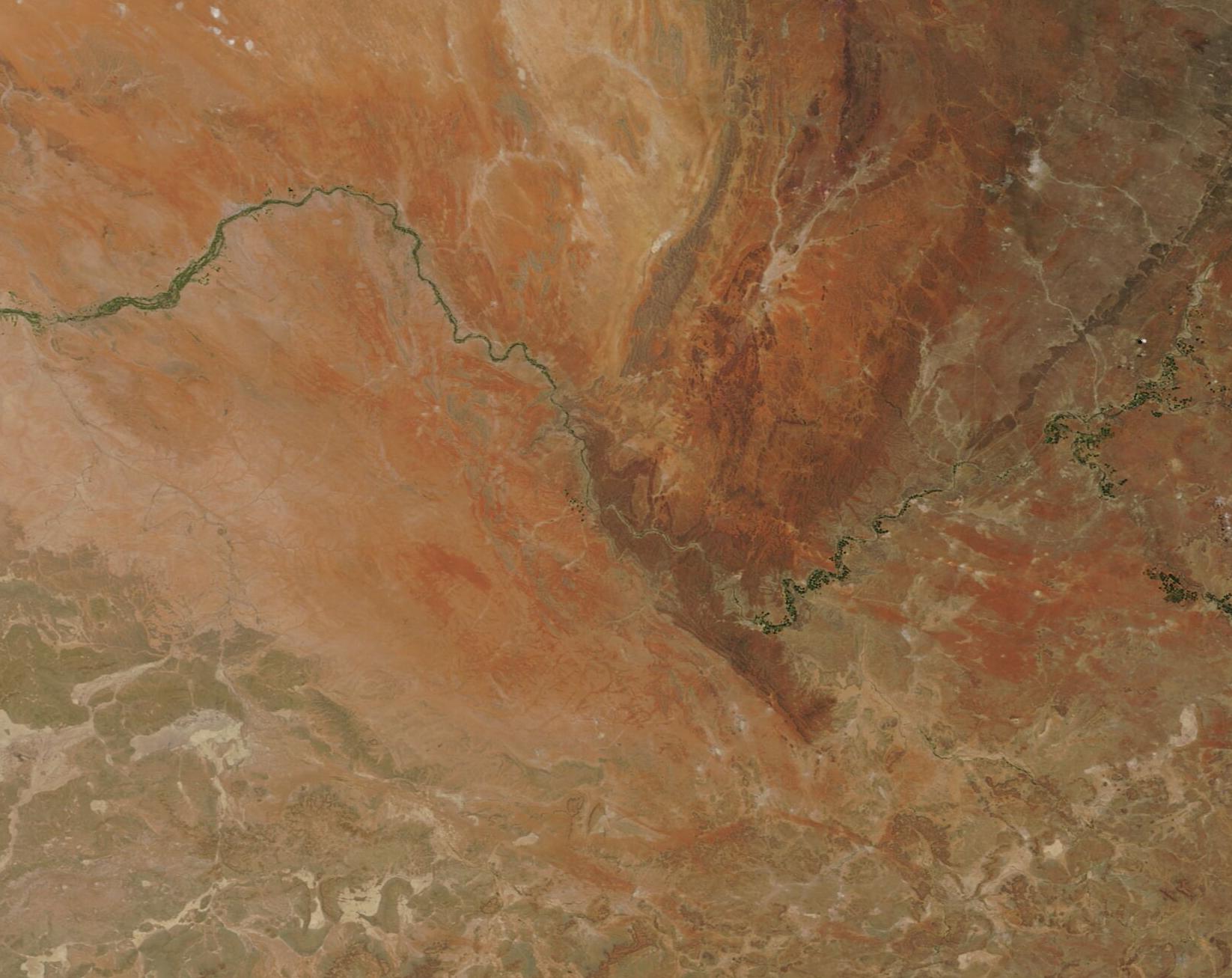
