
Images


January 5, 2021 - Eastern Russia
 Tweet
Tweet
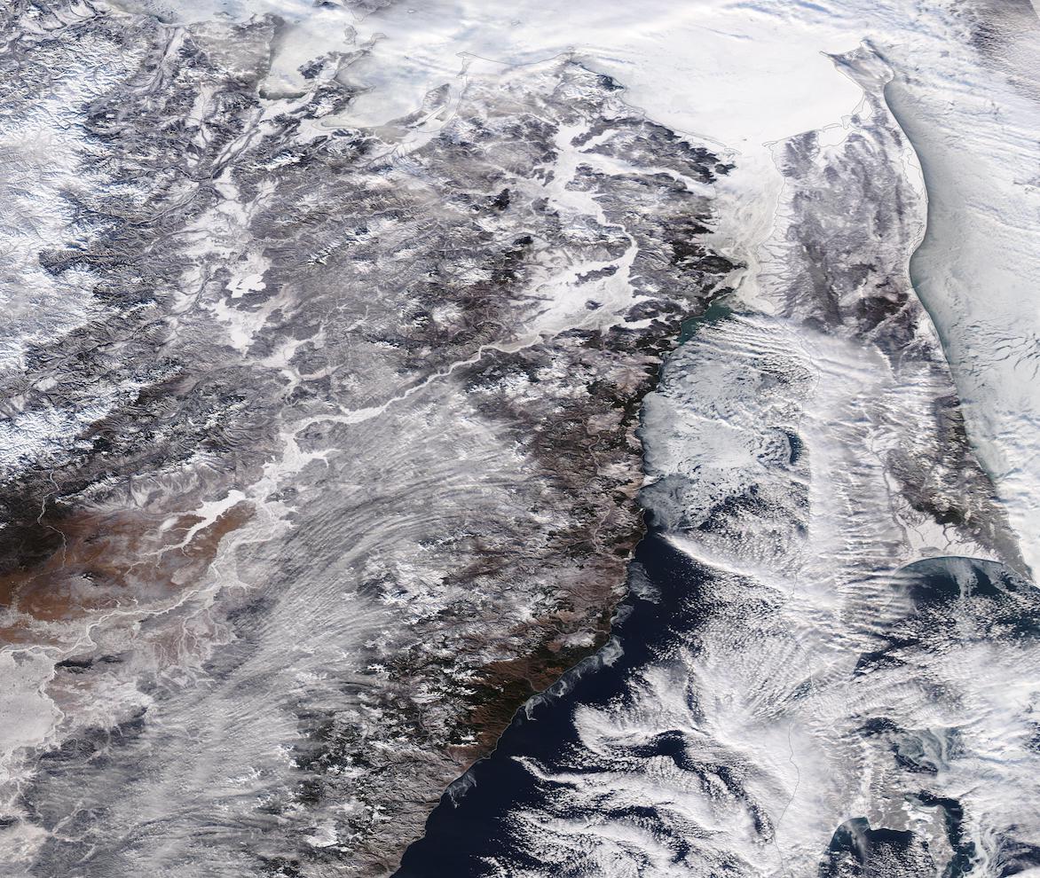
On January 3, 2021, the Moderate Resolution Imaging Spectroradiometer (MODIS) on board NASA’s Aqua satellite acquired a true-color image of a frigid winter day in Eastern Russia.
Clouds partially obscure the sea ice floating on the Strait of Tartary—the narrow waterway that separates mainland Russia from Sakhalin Island. The shallow Strait, which connects the Sea of Okhotsk (north) with the Sea of Japan in the South, constricts to only 4.5 miles (7.3 km) wide at the narrowest point. It freezes early and thaws late, making shipping through the strait nearly impossible for nearly half of each year. Most commercial ships travel longer routes to avoid the strait, because the very shallow depth (13-66 feet/4-20 meters) only allows lightly loaded or small vessels to pass.
Image Facts
Satellite:
Aqua
Date Acquired: 1/3/2021
Resolutions:
1km (319 KB), 500m (1.1 MB), 250m (3.2 MB)
Bands Used: 1,4,3
Image Credit:
MODIS Land Rapid Response Team, NASA GSFC
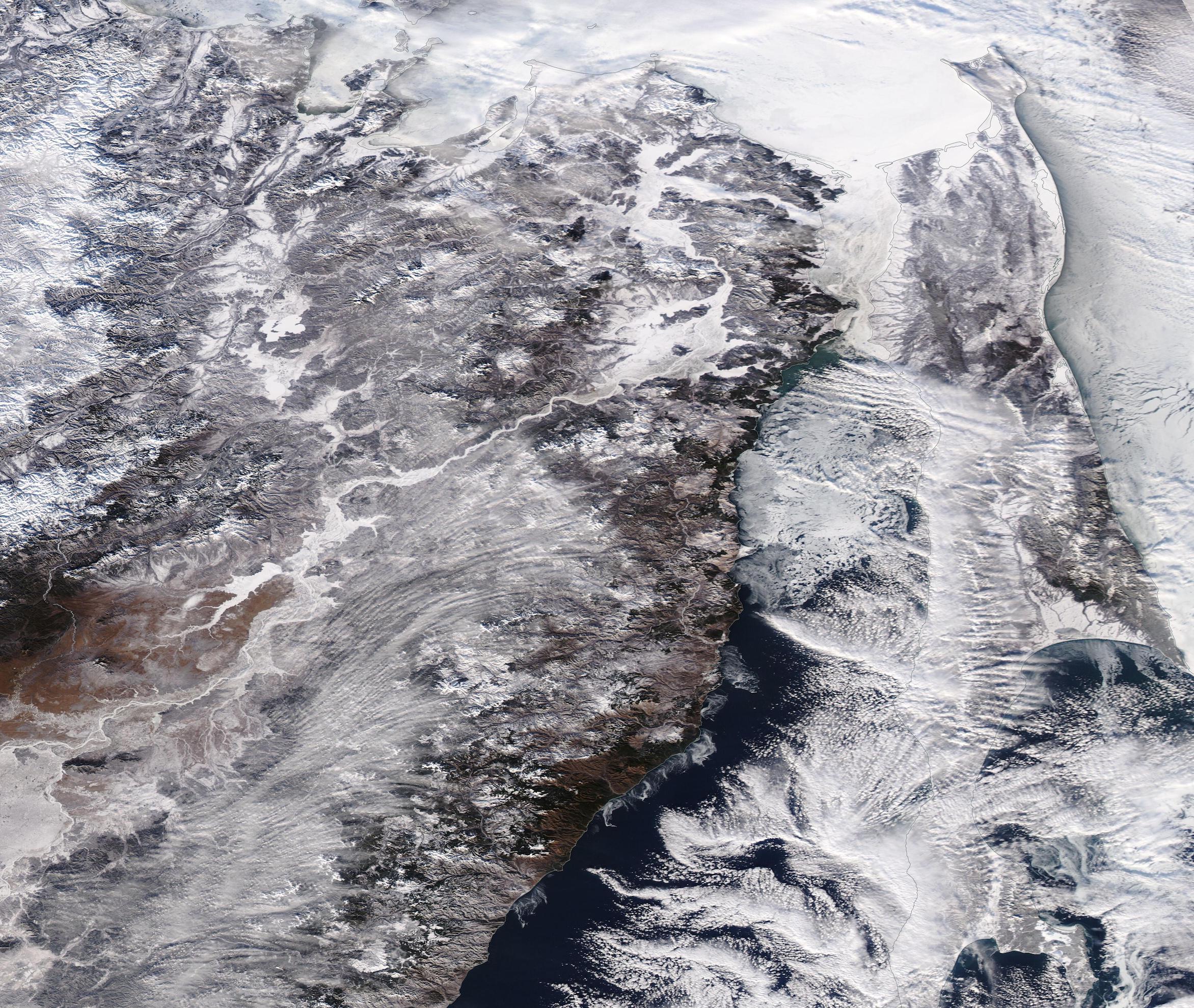
