
Images


February 24, 2021 - Dust over Europe
 Tweet
Tweet
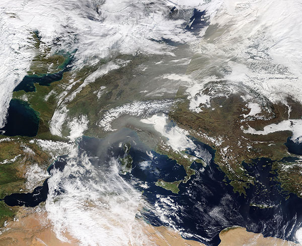
A sand-colored river of Saharan dust stretched from northern Africa to Scandinavia—a distance of more than 1,800 miles (2,900 km) in late February 2021. The Moderate Resolution Imaging Spectroradiometer (MODIS) on board NASA’s Terra satellite acquired a true-color image of the dust on February 23. At that time, the dust was so thick over a long stretch (from Germany to Latvia) that it obscured the land from view.
The dust was riding a strong southerly jet—a river of northward-blowing air. The jet was formed as a European ridge, initiated by a deep low near Ireland, formed in the west and, at the same time, a high-pressure system formed further east. As the European ridge and the North Atlantic deep trough pushed towards each other, the air between the two was pushed northward, creating a vacuum-like effect, sucking up dust from North Africa’s Sahara Desert and carrying it far to the north. Satellite imagery shows a massive funnel of dust rising from Algeria, Morocco, Tunisia, and Libya and crossing the Alboran Sea to reach Spain on February 21. By the next day, the dust-laden jet had reached Belgium and western Norway. The European ridge pushed eastward on February 23 and so did the dust, which now flowed from Africa and over the Baltics to reach Norway.
Each year more than 180 million tons of dust blow out from North Africa, lofted out of the Sahara Desert by strong seasonal winds.
Image Facts
Satellite:
Terra
Date Acquired: 2/23/2021
Resolutions:
1km (2.9 MB), 500m (7.3 MB),
Bands Used:
Image Credit:
MODIS Land Rapid Response Team, NASA GSFC
