
Images


March 11, 2021 - Silver Rivers in the Democratic Republic of the Congo
 Tweet
Tweet
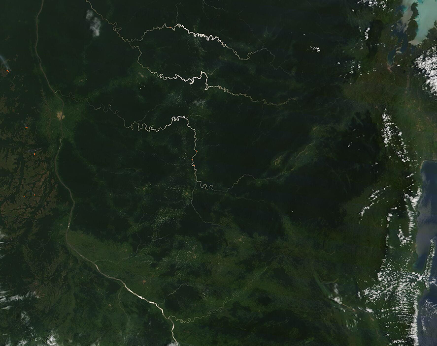
Several rivers wind through the dense forests of the eastern Democratic Republic of the Congo. Most of these rivers wind towards the Lualaba River. In turn, the Lualaba flows into the Congo River—the second longest river in Africa. On March 10, 2021, when the Moderate Resolution Imaging Spectroradiometer (MODIS) on board NASA’s Terra satellite acquired a true-color image of the region, parts of several rivers glowed like liquid silver, dramatically contrasting against the deep green of the forest.
The glowing silver is created by an optical phenomenon called “sunglint”. When sun reflects off a smooth surface—an ocean, lake, or river—at the same angle that a satellite sensor views it, the result is a mirror-like shine. An image captured at this moment will show a silver glow wherever the reflectance angle is exactly right. The “sweet spot” for sunglint is relatively narrow in the east-to-west direction but as the satellite is moving, it is longer along the track of the satellite. The sunglint is quite bright in the center and quickly becomes duller and disappears moving away from that central bright spot. Yet rivers several hundred miles away from each other are each affected by sunglint. The Lualaba River, running roughly south to north is seen in the western (left) section of the image. It is not in sunglint so appears dark.
Image Facts
Satellite:
Terra
Date Acquired: 3/10/2021
Resolutions:
1km (133.3 KB), 500m (351.3 KB), 250m (197.1 KB)
Bands Used: 1,4,3
Image Credit:
MODIS Land Rapid Response Team, NASA GSFC
