
Images


March 13, 2021 - Tropical Cyclone Habana
 Tweet
Tweet
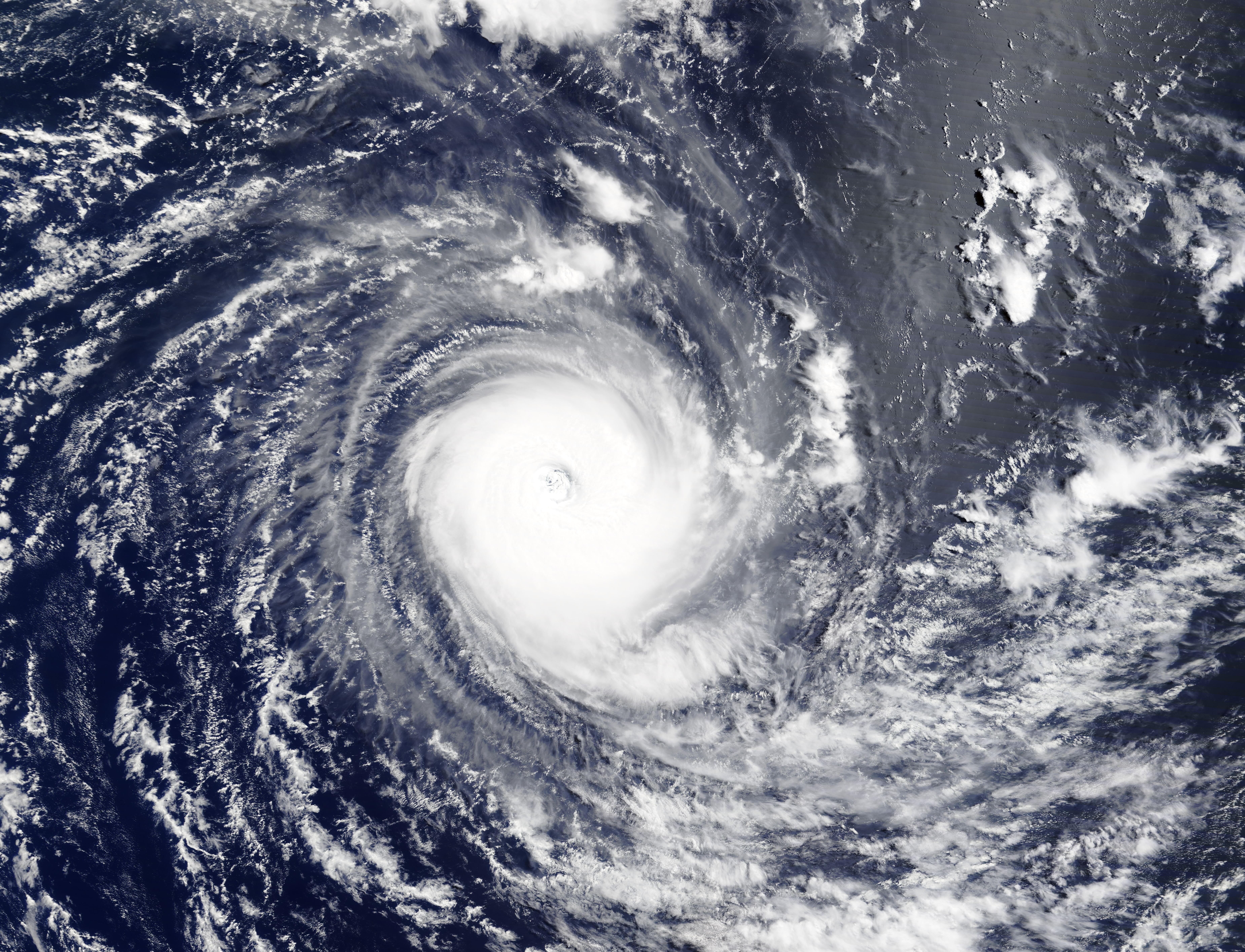
On March 12, 2021, the Moderate Resolution Imaging Spectroradiometer (MODIS) on board NASA’s Aqua satellite acquired a striking true-color image of Tropical Cyclone Habana as it spun over the Indian Ocean.
The storm was named on March 4, after an area of disturbed weather strengthened enough to reach tropical storm status. It rapidly intensified, reaching maximum sustained winds of about 145 mph (233 km/h) on March 5. After weakening and turning, Habana once again intensified reaching peak strength on March 10, with one-minute sustained winds of 155 mph (250 km/h), placing it as a strong Category 4 storm on the Saffir-Simpson Hurricane Wind Scale.
At 1800 UTC on March 12 (1:00 p.m. EST), the Joint Typhoon Warning Center (JTWC) reported that Tropical Cyclone Habana was located about 883 miles (1,421 km) east of Port Louis, Mauritius and was tracking south-southwestward over open water. The storm’s winds had dropped to 115 mph (185 km/h). The JTWC stated that satellite imagery indicates the system has peaked and is on the decline, with convection becoming more ragged. Tropical Cyclone Habana is expected to slowly weaken over the next several days, with no hazards to land.
Image Facts
Satellite:
Terra
Date Acquired: 3/12/2021
Resolutions:
1km (2.5 MB), 500m (6.7 MB), 250m (4.9 MB)
Bands Used: 1,4,3
Image Credit:
MODIS Land Rapid Response Team, NASA GSFC
