
Images


March 20, 2021 - Sunny Summer Day in South Island, New Zealand
 Tweet
Tweet
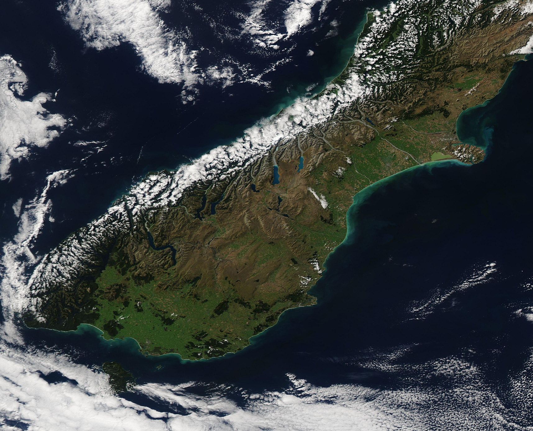
The stunning colors of New Zealand’s South Island shone on March 18, 2021, when the Moderate Resolution Imaging Spectroradiometer (MODIS) on board NASA’s Aqua satellite acquired a true-color image of a rare cloud-free late summer day.
The Southern Alps stretch down the length of South Island, capped with snow and glaciers year-round. On this day, clouds also covered much of the western slopes and the western coast—not unusual at any time of the year as the West Coast of South Island is the wettest region anywhere in New Zealand. Thanks to the tall mountains and the resultant rain shadow, the area just east of the mountains is one of the driest areas in New Zealand.
While most of South Island experiences copious sunshine, capturing satellite images of the island can be difficult due to frequent and shifting cloud patterns brought by the island’s position in the “Roaring 40s”. This is a wide belt of gale-force westerly winds that circle the Southern Hemisphere, bringing storms and copious clouds. Clouds are so frequent—and so appreciated—that they are frequently used in common names. For example, the highest peak in the Southern Alps (and in New Zealand) is Aoraki/Mount Cook at 3,754 meters (12,316 ft). The native name is said to translate to “The Cloud Piercer”, a nod to the dramatic clouds that so frequently sit around the mountaintop.
Image Facts
Satellite:
Aqua
Date Acquired: 3/18/2021
Resolutions:
1km (589.5 KB), 500m (1.5 MB), 250m (1.1 MB)
Bands Used: 1,4,3
Image Credit:
MODIS Land Rapid Response Team, NASA GSFC
