
Images


April 4, 2021 - Snow in Oregon
 Tweet
Tweet
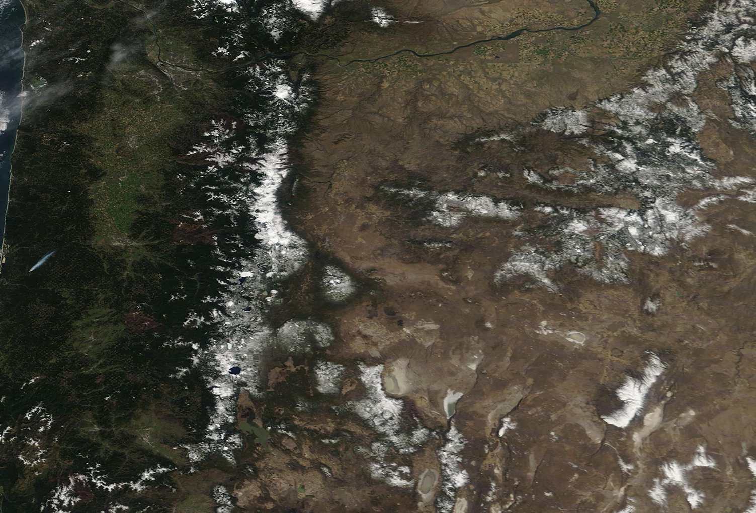
A pair of late-March snowstorms rolled across Oregon, increasing the snow cap in the higher elevations. According to local news media, on Monday, March 22, 2021 roughly a foot of snow was reported in the northern Cascades and a second storm on March 25 added another foot to some areas in the higher elevations. On March 24, the base at Mt. Hood Meadows was reported at 153 inches (12.75 feet; 388.6 cm)—before the incoming storm.
While the fresh snow excited skiers at many resorts across Oregon’s mountains, precipitation at lower elevations fell as rain, adding to the spring greening. The contrast between the snow and rain line was obvious from space.
On April 1, the Moderate Resolution Imaging Spectroradiometer (MODIS) on board NASA’s Terra satellite acquired a true-color image of springtime in Oregon. Snow coats the Cascades, which run north to south in the west and the Rockies in the east. Mt. Hood Meadows sits at the northern end of the Cascades in this image while the Columbia River (north) forms the border between Oregon and Washington. Oregon’s forests appear deep green and drier land, especially in the rain shadow just east of the Cascades are tan tinted with green.
Image Facts
Satellite:
Terra
Date Acquired: 4/1/2021
Resolutions:
1km (401 KB), 500m (1 MB), 250m (750.4 KB)
Bands Used: 1,4,3
Image Credit:
MODIS Land Rapid Response Team, NASA GSFC
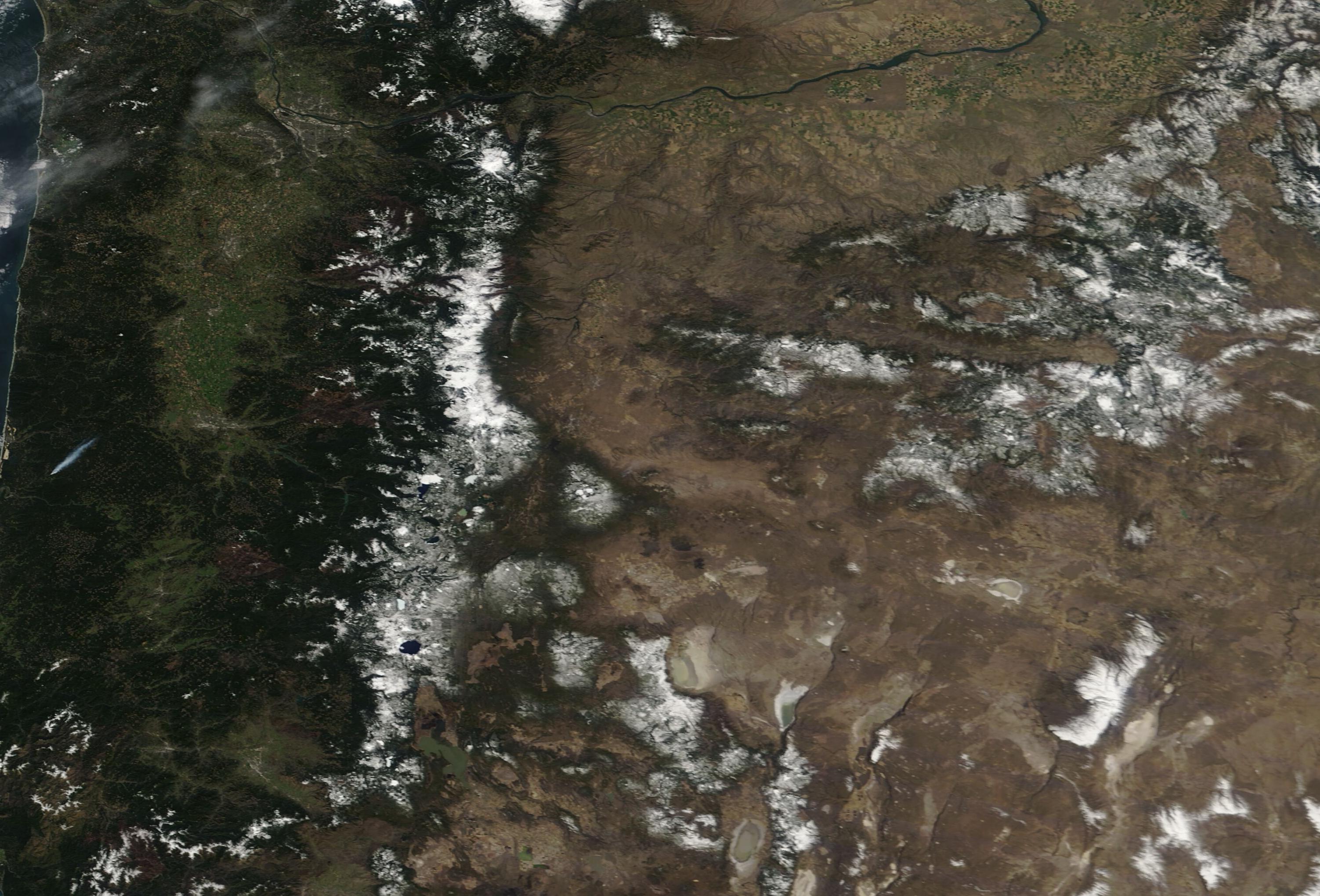
