
Images


April 6, 2021 - Ephemeral Lake Mackay
 Tweet
Tweet
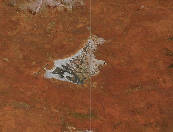
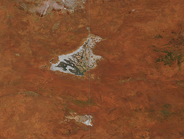
Straddling the border between Australia’s Northern Territory and Western Australia and surrounded by the red soils of the Central Desert region, ephemeral Lake Mackay owns the title of the fourth-largest lake in Australia. As a highly saline lake, the surface is encrusted with salt during frequent dry spells and supports little vegetation except on a few islands and surrounding clay pans. Lake Mackay is dotted with numerous islands, while the surrounding sandy plains hold freshwater swamps and pans, all of which create a complex and intricate ecosystem.
Like many of the ephemeral lakes sprinkled across the landscape of northern and western Australia, Lake Mackay infrequently fills through seasonal rainfall that runs off nearby lands and seeps into the lake through small drainage channels. When water comes to Lake Mackay, so do a variety of shorebirds and water birds such as Banded Stilts, Red-necked Avocet, and Australian Bustard. The lake is listed as an Important Bird Area (IBA) by Birdlife International.
On April 1, 2021, the Moderate Resolution Imaging Spectroradiometer (MODIS) on board NASA’s Terra satellite acquired a stunning true-color image of Lake Mackay surrounded by red soils. White salt encrusts the edges of the lake while green-tinted water fills much of the basin, especially in the Western Australia portion.
Parts of Queensland and New South Wales experienced extremely heavy rains and flooding in the late March. While those torrential rains did not directly affect Lake Mackay or the desert, smaller amounts fell locally and have accumulated in the ephemeral lake. Once flooded, Lake Mackay tends to dry slowly—seasonal rainwater may linger for as long as six months.
Image Facts
Satellite:
Terra
Date Acquired: 4/1/2021
Resolutions:
1km (113 KB), 500m (284.2 KB), 250m (165.5 KB)
Bands Used: 1,4,3
Image Credit:
MODIS Land Rapid Response Team, NASA GSFC
