
Images


April 23, 2021 - Prescribed Burn in Oregon
 Tweet
Tweet
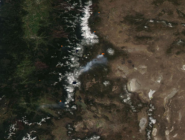
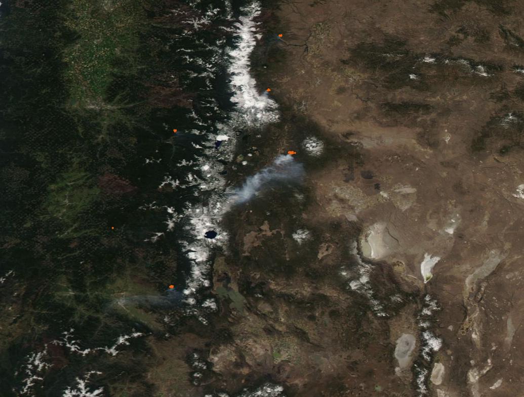
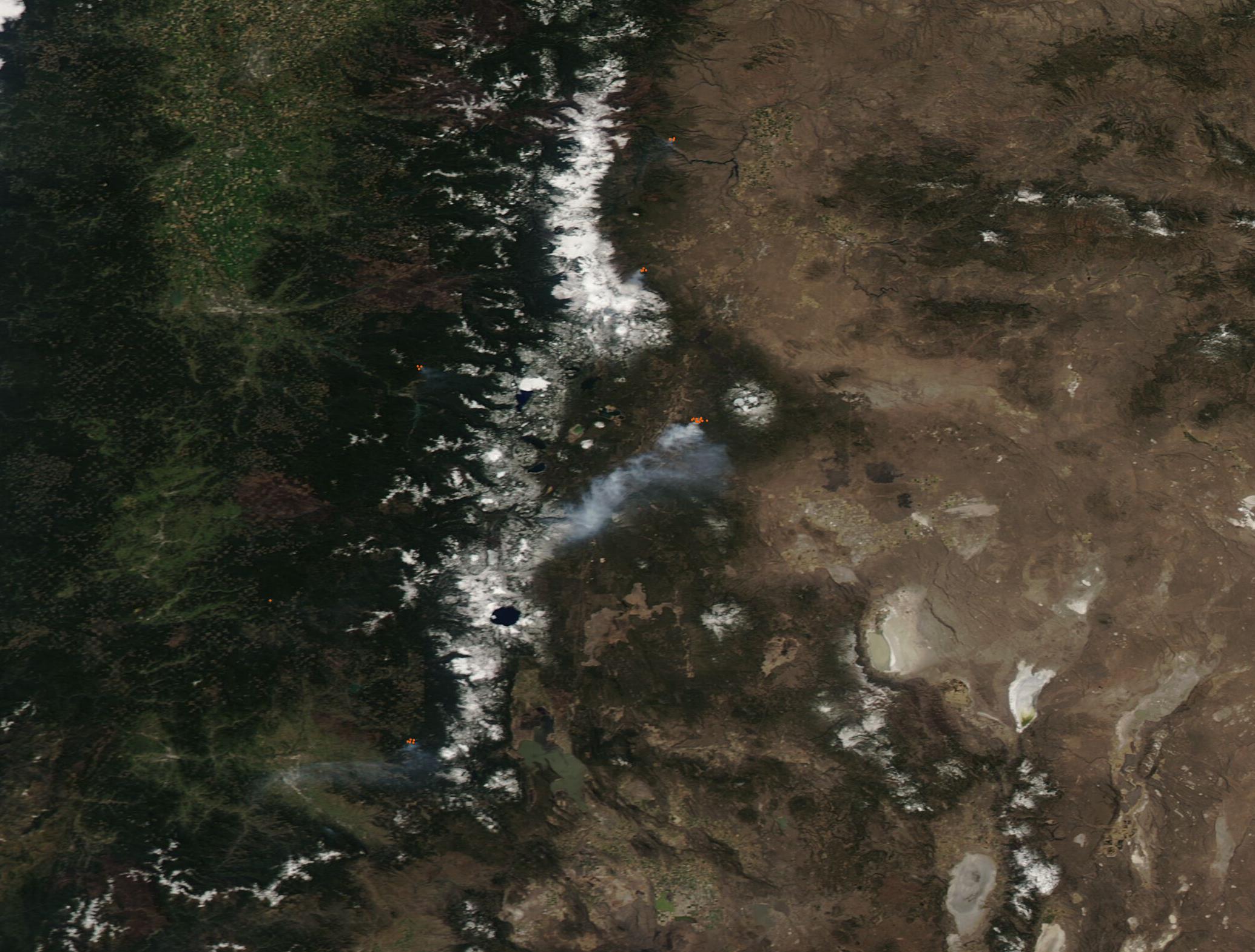
On April 21, 2021, a large plume of smoke rose from a fire in Deschutes National Forest, Oregon. The Moderate Resolution Imaging Spectroradiometer (MODIS) on board NASA’s Aqua satellite captured this true-color image of the scene on that same day.
The thick gray ribbon of smoke stretched southwest from the National Forest almost to Crater Lake, a distance of roughly 55 miles (90 km). Several smaller fires also burned in the forested lands both east and west of the snow-capped Cascades Mountains and can be seen as bright red “hot spots”. Each hot spot marks an area where the thermal bands on the MODIS instrument detected high temperatures. When combined with smoke, such hotspots mark actively burning fire.
While it is not possible to determine the cause of a fire by satellite imagery alone, the time of year, location, and public notifications confirm that these fires are prescribed burns. Each spring forest managers in the Pacific Northwest carefully plan, ignite, and control fires designed to reduce fuel loads and improve wildlands.
According to the USDA Forest Service, burning was taking place in Deschutes National Forest on April 21 and 22 approximately five miles east of La Pine. Their notification states, “Fuels specialists will underburn approximately 600 acres along the north side of Forest Service Road (FSR) 22 (Finley Butte Road), between FSR 9750 and FSR 2215. The objective of this prescribed burn is to reduce fuel loadings in ponderosa pine stands that have been treated as part of the Ogden Landscape Vegetation Management Project. This will allow fires to burn with less intensity and reduce potential impacts of wildfire coming into the La Pine community.”
Image Facts
Satellite:
Aqua
Date Acquired: 4/21/2021
Resolutions:
1km (33.4 KB), 500m (117.6 KB), 250m (376.2 KB)
Bands Used: 1,4,3
Image Credit:
MODIS Land Rapid Response Team, NASA GSFC
